MyTopo
Zaleski Ohio US Topo Map
Couldn't load pickup availability
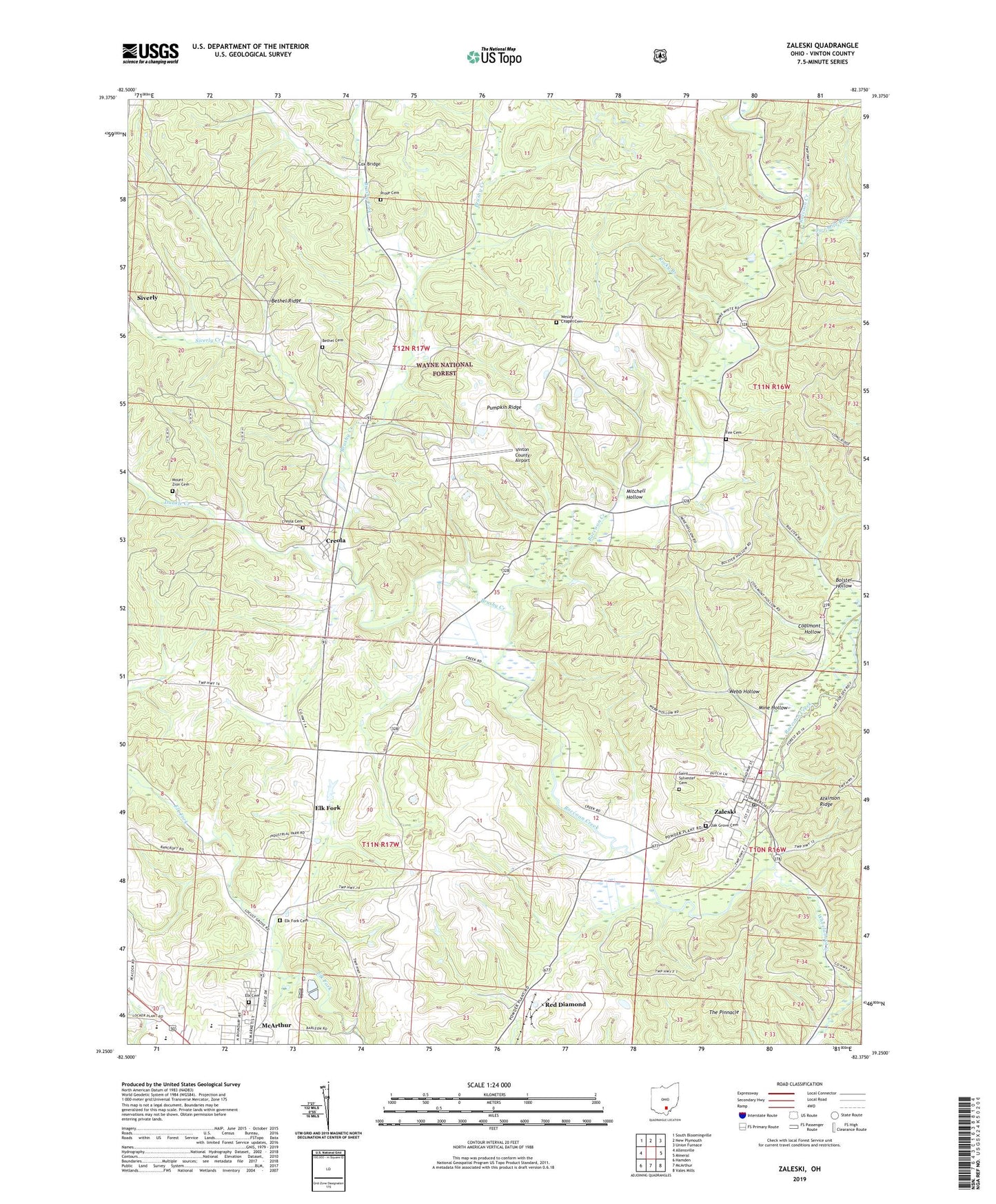
2019 topographic map quadrangle Zaleski in the state of Ohio. Scale: 1:24000. Based on the newly updated USGS 7.5' US Topo map series, this map is in the following counties: Vinton. The map contains contour data, water features, and other items you are used to seeing on USGS maps, but also has updated roads and other features. This is the next generation of topographic maps. Printed on high-quality waterproof paper with UV fade-resistant inks.
Quads adjacent to this one:
West: Allensville
Northwest: South Bloomingville
North: New Plymouth
Northeast: Union Furnace
East: Mineral
Southeast: Vales Mills
South: McArthur
Southwest: Hamden
Contains the following named places: Bethel Cemetery, Bethel Church, Bethel Ridge, Bolster Hollow, Brushy Creek, Brushy Fork, Church of the Nazarene, Coalmont Hollow, Cox Bridge, Coyote Creek, Creola, Creola Cemetery, Dunkle Creek, Elk Cemetery, Elk Fork, Elk Fork Cemetery, Fee Cemetery, McArthur Chapel, Mine Hollow, Mitchell Hollow, Mount Zion Cemetery, Oak Grove Cemetery, Pleasant Valley Church, Prose Cemetery, Pumpkin Ridge, Red Diamond, Rocky Branch, Saint Sylvester Cemetery, Siverly, Siverly Creek, Swan School, The Pinnacle, Township of Elk, Township of Madison, Township of Swan, Twomile Run, Ural, Village of Zaleski, Vinton County, Vinton County Airport, Vinton County Childrens Home, Vinton County Emergency Medical Services, Webb Hollow, Wesley Chapel Cemetery, Wheelabout Creek, Zaleski, Zaleski Elementary School, Zaleski Post Office, Zaleski State Forest, Zaleski State Forest Landing Strip, Zaleski Volunteer Fire Department, ZIP Codes: 45651, 45654, 45698