MyTopo
Glencoe Oklahoma US Topo Map
Couldn't load pickup availability
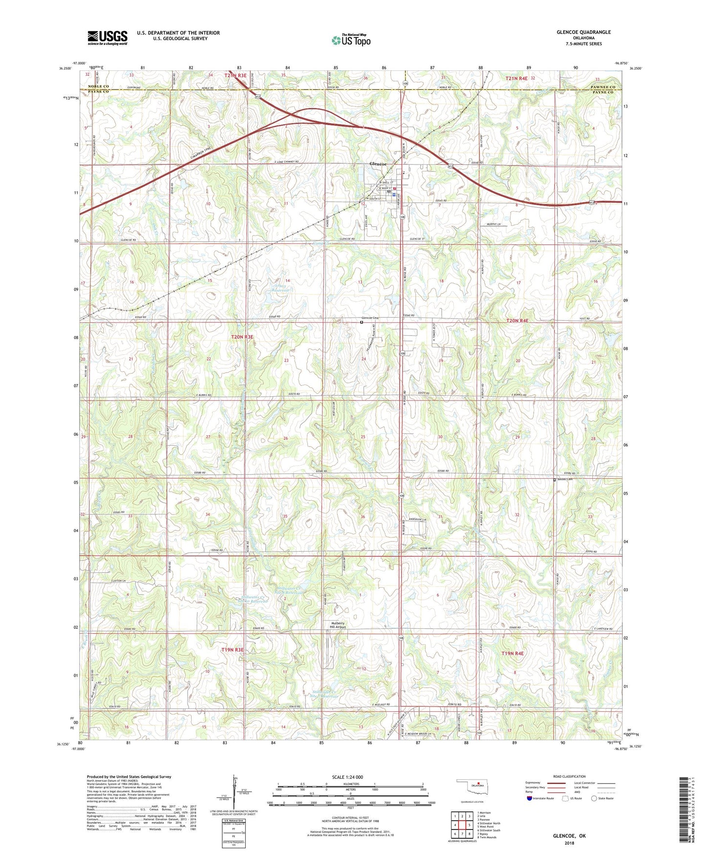
2018 topographic map quadrangle Glencoe in the state of Oklahoma. Scale: 1:24000. Based on the newly updated USGS 7.5' US Topo map series, this map is in the following counties: Payne, Noble, Pawnee. The map contains contour data, water features, and other items you are used to seeing on USGS maps, but also has updated roads and other features. This is the next generation of topographic maps. Printed on high-quality waterproof paper with UV fade-resistant inks.
Quads adjacent to this one:
West: Stillwater North
Northwest: Morrison
North: Lela
Northeast: Pawnee
East: West Point
Southeast: Twin Mounds
South: Ripley
Southwest: Stillwater South
Contains the following named places: Bethel Cemetery, Eberle Cemetery, Feather Creek, Glencoe, Glencoe Cemetery, Glencoe Elementary School, Glencoe High School, Glencoe Police Department, Glencoe Post Office, Glencoe Volunteer Fire Department, Longbranch Site 1 Dam, Longbranch Site 1 Reservoir, Mulberry Hill Airport, Oknoname 11903 Dam, Oknoname 11903 Reservoir, Stillwater Creek Site 10 Dam, Stillwater Creek Site 10 Reservoir, Stillwater Creek Site 7 Dam, Stillwater Creek Site 7 Reservoir, Stillwater Creek Site 8 Dam, Stillwater Creek Site 8 Reservoir, Town of Glencoe, Township of Glencoe, Union Home Church, ZIP Code: 74032