MyTopo
Hodgen Oklahoma US Topo Map
Couldn't load pickup availability
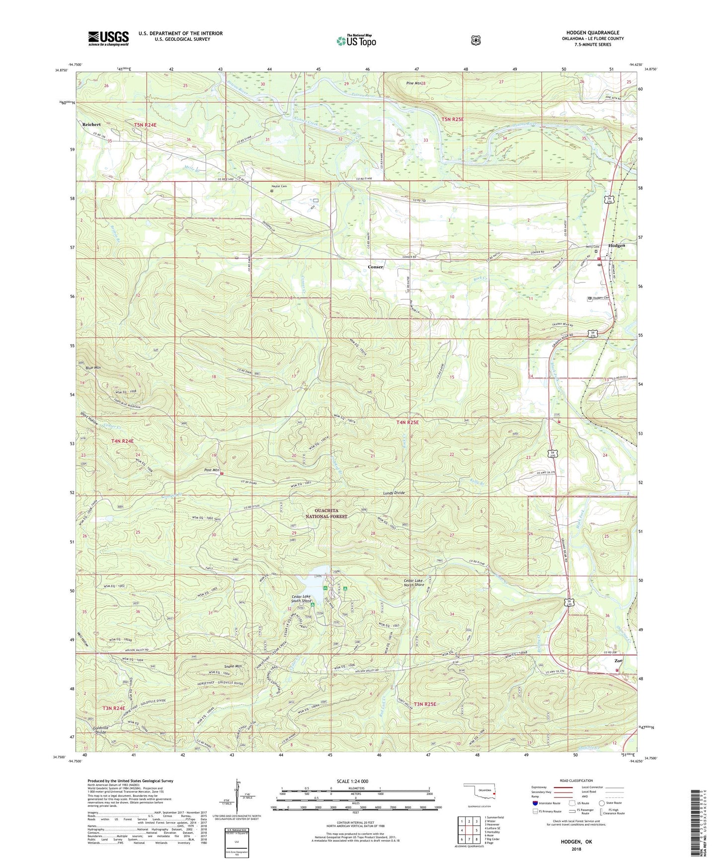
2018 topographic map quadrangle Hodgen in the state of Oklahoma. Scale: 1:24000. Based on the newly updated USGS 7.5' US Topo map series, this map is in the following counties: Le Flore. The map contains contour data, water features, and other items you are used to seeing on USGS maps, but also has updated roads and other features. This is the next generation of topographic maps. Printed on high-quality waterproof paper with UV fade-resistant inks.
Quads adjacent to this one:
West: Leflore SE
Northwest: Summerfield
North: Wister
Northeast: Heavener
East: Hontubby
Southeast: Page
South: Big Cedar
Southwest: Muse
Contains the following named places: Brushy Creek, Cedar Lake, Cedar Lake Dam, Cedar Lake North Shore, Cedar Lake Recreation Site, Cedar Lake South Shore, Choctaw District Ranger Office, Choctaw Work Center, Conser, Conser Creek, Crooked Branch, Goldville Divide, Heavener Division, Hodgen, Hodgen Cemetery, Hodgen Census Designated Place, Hodgen Elementary School, Hodgen Post Office, Hodgen Volunteer Fire Department, Hodgens Station, Holson Valley State Game Management Area, Kelly Branch, Lundy Divide, Merle Branch, Naylor Cemetery, Perry Cemetery, Perry Chapel, Pine Mountain, Post Mountain, Post Mountain Fire Department, Red Lick Creek, Reichert, Rock Creek, Shawnee Creek, Short Hollow, Snake Mountain, Stapp Zoe Volunteer Fire Department, Township of Houston, United States Forest Service Choctaw Work Center, Zoe