MyTopo
Jet Oklahoma US Topo Map
Couldn't load pickup availability
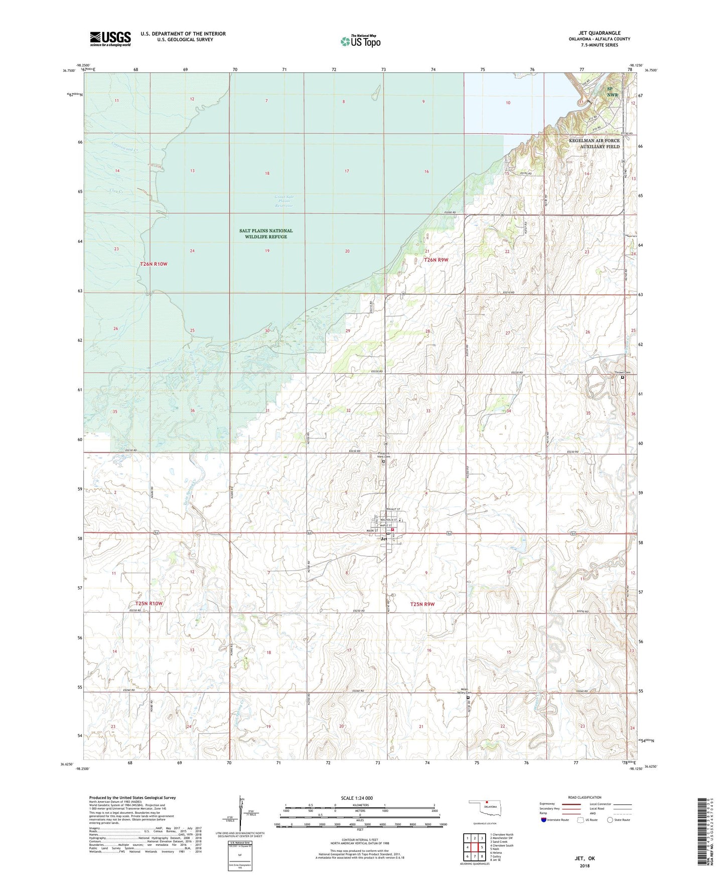
2018 topographic map quadrangle Jet in the state of Oklahoma. Scale: 1:24000. Based on the newly updated USGS 7.5' US Topo map series, this map is in the following counties: Alfalfa. The map contains contour data, water features, and other items you are used to seeing on USGS maps, but also has updated roads and other features. This is the next generation of topographic maps. Printed on high-quality waterproof paper with UV fade-resistant inks.
Quads adjacent to this one:
West: Cherokee South
Northwest: Cherokee North
North: Manchester SW
Northeast: Sand Creek
East: Nash
Southeast: Jet SE
South: Goltry
Southwest: Helena
Contains the following named places: Clay Creek, Cottonwood Creek, Great Salt Plains Dam, Great Salt Plains Lake, Great Salt Plains Reservoir, Great Salt Plains State Park, Jet, Jet Post Office, Jet Volunteer Fire Department, Kegelman Air Force Auxiliary Field, Milan Valley Cemetery, Pleasant View Cemetery, Spring Creek, Thrawl Cemetery, Timberlake Elementary School, Town of Jet, Township of Saline, Twin Spring Creek, ZIP Code: 73749