MyTopo
Lake Sahoma Oklahoma US Topo Map
Couldn't load pickup availability
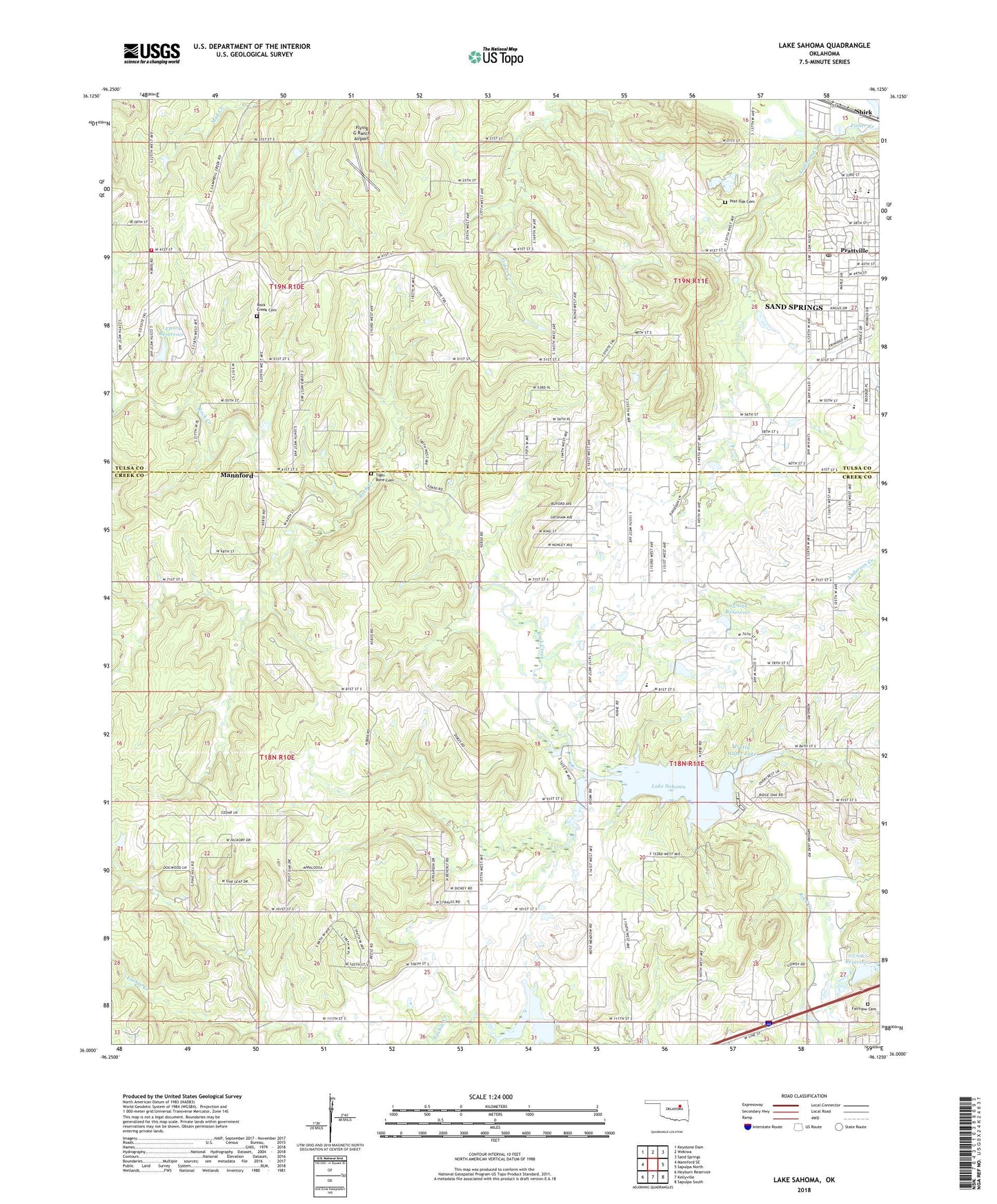
2018 topographic map quadrangle Lake Sahoma in the state of Oklahoma. Scale: 1:24000. Based on the newly updated USGS 7.5' US Topo map series, this map is in the following counties: Creek, Tulsa. The map contains contour data, water features, and other items you are used to seeing on USGS maps, but also has updated roads and other features. This is the next generation of topographic maps. Printed on high-quality waterproof paper with UV fade-resistant inks.
Quads adjacent to this one:
West: Mannford SE
Northwest: Keystone Dam
North: Wekiwa
Northeast: Sand Springs
East: Sapulpa North
Southeast: Sapulpa South
South: Kellyville
Southwest: Heyburn Reservoir
Contains the following named places: Anderson Creek, Angus Valley Elementary School, Cedar Grove Church, Clyde Boyd Middle School, Fairview Cemetery, Flying G Ranch Airport, Keystone Fire Department Station 3, Lake Sahoma, Limestone Church, Oknoname 037065 Dam, Oknoname 037065 Reservoir, Oknoname 037067 Dam, Oknoname 037067 Reservoir, Oknoname 143003 Dam, Oknoname 143003 Reservoir, Oknoname 143004 Dam, Oknoname 143004 Reservoir, Open Door Fellowship Church, Post Oak Cemetery, Pratt Elementary School, Prattville Post Office, Prattwood Assembly of God, Pretty Water Church, Pretty Water Dam, Pretty Water Lake, Pretty Water School, Rock Creek Cemetery, Rock Creek Church, Sahoma Dam, Sahoma Lake Airport, Sapulpa Dam, Sapulpa Lake, Sapulpa Reservoir, Shirk, Tiger Bone Cemetery, Township of Red Fork