
MyTopo
Leflore SE Oklahoma US Topo Map
Couldn't load pickup availability
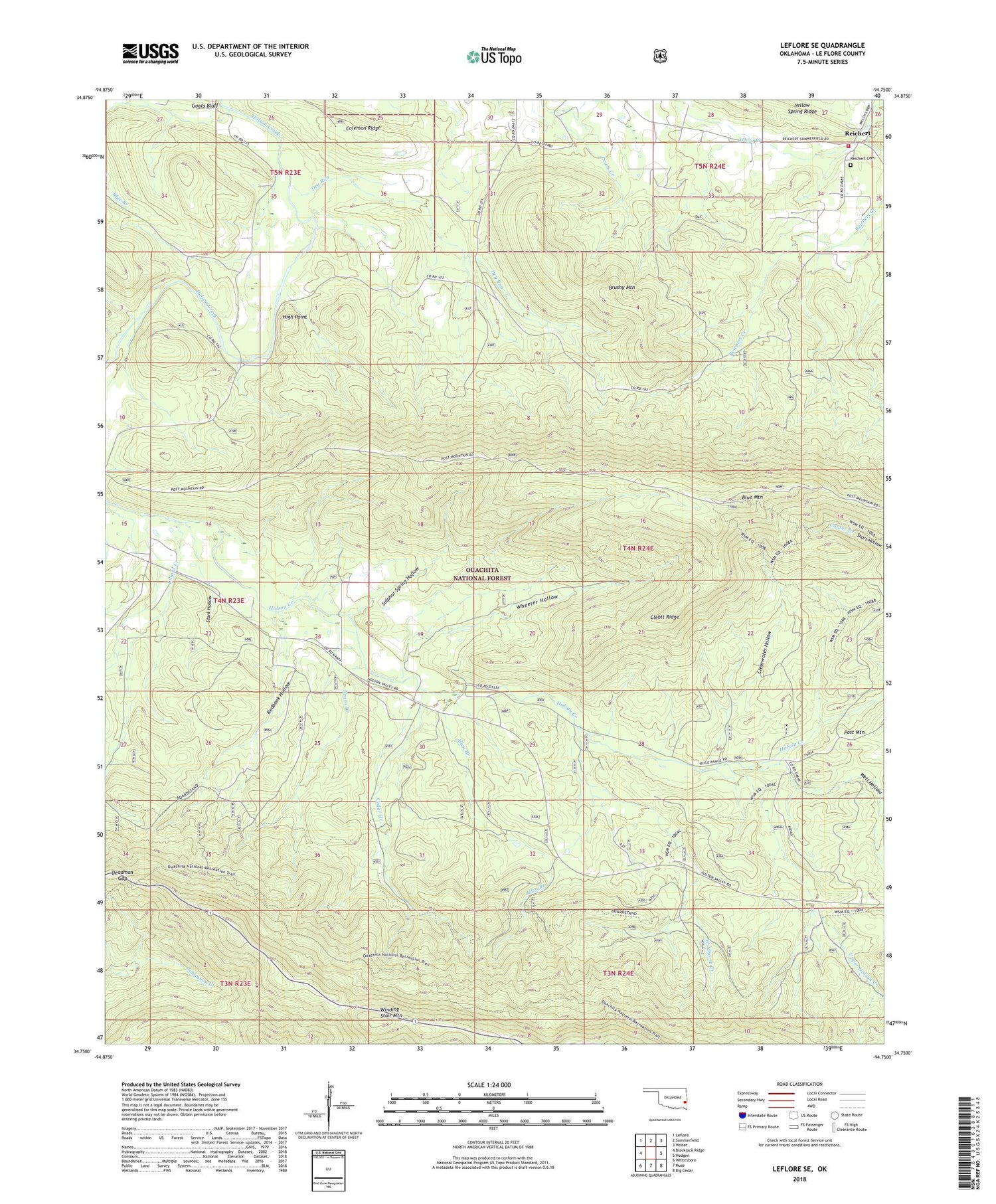
2018 topographic map quadrangle Leflore SE in the state of Oklahoma. Scale: 1:24000. Based on the newly updated USGS 7.5' US Topo map series, this map is in the following counties: Le Flore. The map contains contour data, water features, and other items you are used to seeing on USGS maps, but also has updated roads and other features. This is the next generation of topographic maps. Printed on high-quality waterproof paper with UV fade-resistant inks.
Quads adjacent to this one:
West: Blackjack Ridge
Northwest: Leflore
North: Summerfield
Northeast: Wister
East: Hodgen
Southeast: Big Cedar
South: Muse
Southwest: Whitesboro
Contains the following named places: Allen Branch, Blue Mountain, Britton Branch, Brushy Mountain, Cedar Branch, Clearwater Hollow, Clebit Ridge, Coleman Ridge, Deadman Gap, Dry Run, High Point, Holson Valley Church, Indian Nations National Scenic and Wildlife Area, Lillard Creek, Negro Branch, Redbank Hollow, Reichert, Reichert Cemetery, Reichert Community Fire Association, Stark Hollow, Sulphur Spring Hollow, Upper Holson Creek, Well Hollow, Wheeler Hollow, White Branch, Wildhorse Creek


