MyTopo
Little City Oklahoma US Topo Map
Couldn't load pickup availability
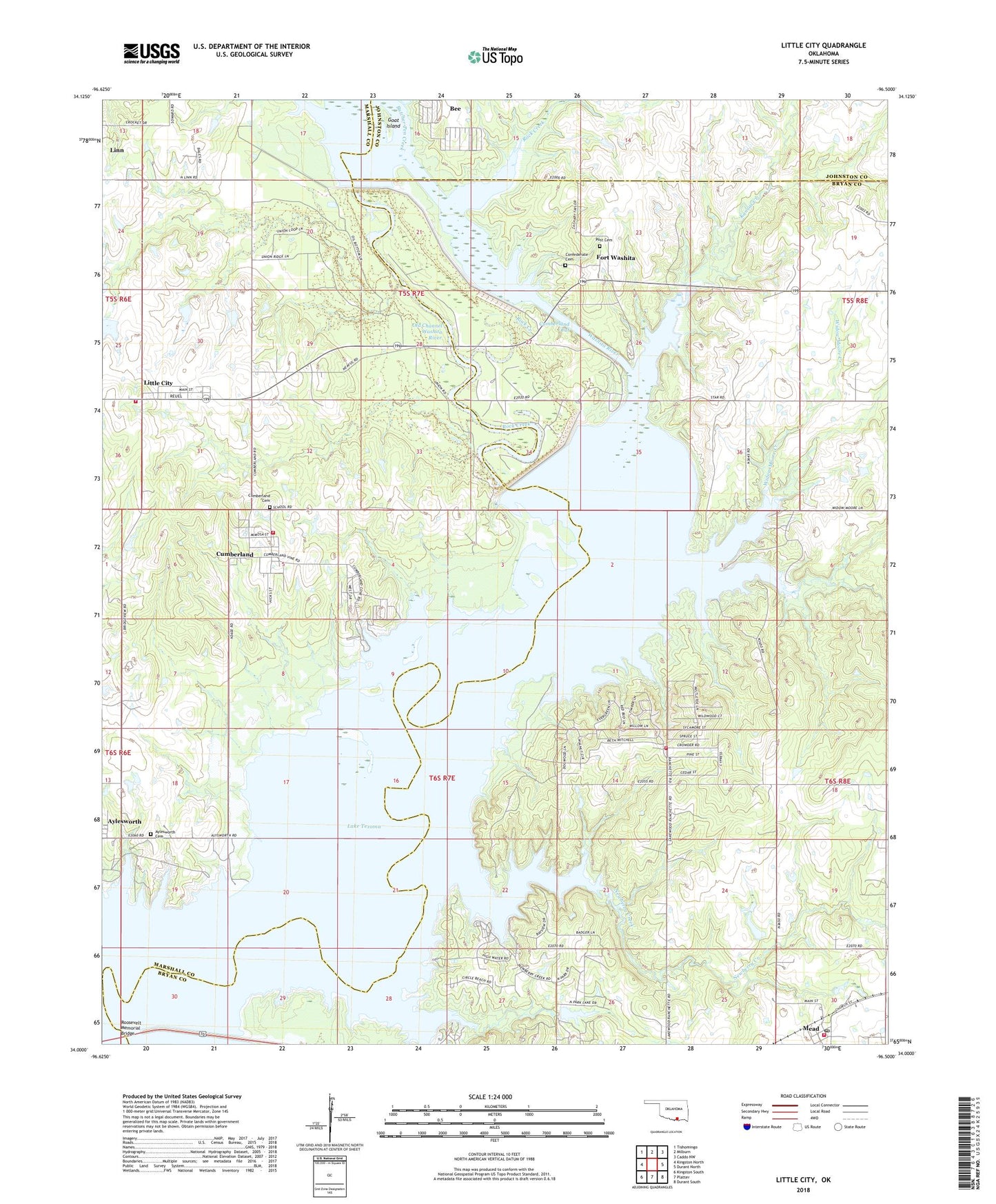
2018 topographic map quadrangle Little City in the state of Oklahoma. Scale: 1:24000. Based on the newly updated USGS 7.5' US Topo map series, this map is in the following counties: Bryan, Marshall, Johnston. The map contains contour data, water features, and other items you are used to seeing on USGS maps, but also has updated roads and other features. This is the next generation of topographic maps. Printed on high-quality waterproof paper with UV fade-resistant inks.
Quads adjacent to this one:
West: Kingston North
Northwest: Tishomingo
North: Milburn
Northeast: Caddo NW
East: Durant North
Southeast: Durant South
South: Platter
Southwest: Kingston South
Contains the following named places: Aylesworth Cemetery, Bee, Confederate Cemetery, Cumberland, Cumberland Cemetery, Cumberland Census Designated Place, Cumberland Cut, Cumberland Levee, Cumberland Oil Field, Denny McCoy 1 Dam, Denny McCoy 1 Reservoir, Fort Washita, Goat Island, Kansas Creek, Lakewood Volunteer Fire Department, Linn, Little City, Little City Census Designated Place, Mead Post Office, Newberry Creek, Oknoname 013018 Dam, Oknoname 013018 Reservoir, Oknoname 023001 Dam, Oknoname 023001 Reservoir, Old Channel Washita River, Post Cemetery, Robinson Corner, Rock Creek, Southeast Aylesworth Oil Field, Texoma Public Hunting Area, Township of Brown, Tri - City Fire Department, Tri - City Fire Department Station 2, Weder Number 1 Dam, Weder Number 1 Reservoir, West Bryan County Fire and Rescue, West Mead Oil Field, Widow Moore Creek, ZIP Code: 73449