MyTopo
Lynn Mountain Oklahoma US Topo Map
Couldn't load pickup availability
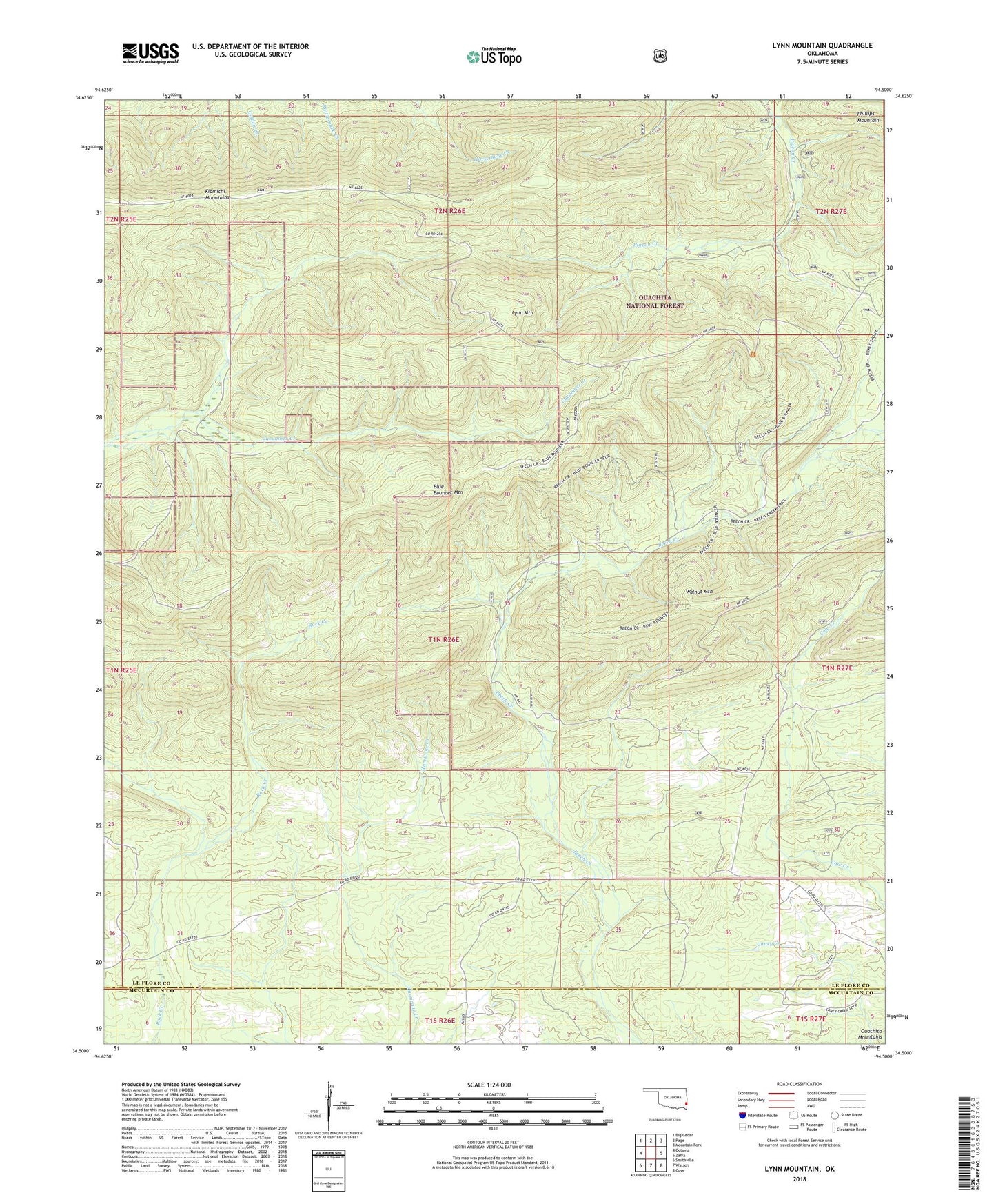
2018 topographic map quadrangle Lynn Mountain in the state of Oklahoma. Scale: 1:24000. Based on the newly updated USGS 7.5' US Topo map series, this map is in the following counties: Le Flore, McCurtain. The map contains contour data, water features, and other items you are used to seeing on USGS maps, but also has updated roads and other features. This is the next generation of topographic maps. Printed on high-quality waterproof paper with UV fade-resistant inks.
Quads adjacent to this one:
West: Octavia
Northwest: Big Cedar
North: Page
Northeast: Mountain Fork
East: Zafra
Southeast: Cove
South: Watson
Southwest: Smithville
Contains the following named places: Beech Creek National Scenic Area, Blue Bouncer Mountain, Lynn Mountain, Phillips Mountain, Zafra Church