MyTopo
Newby Oklahoma US Topo Map
Couldn't load pickup availability
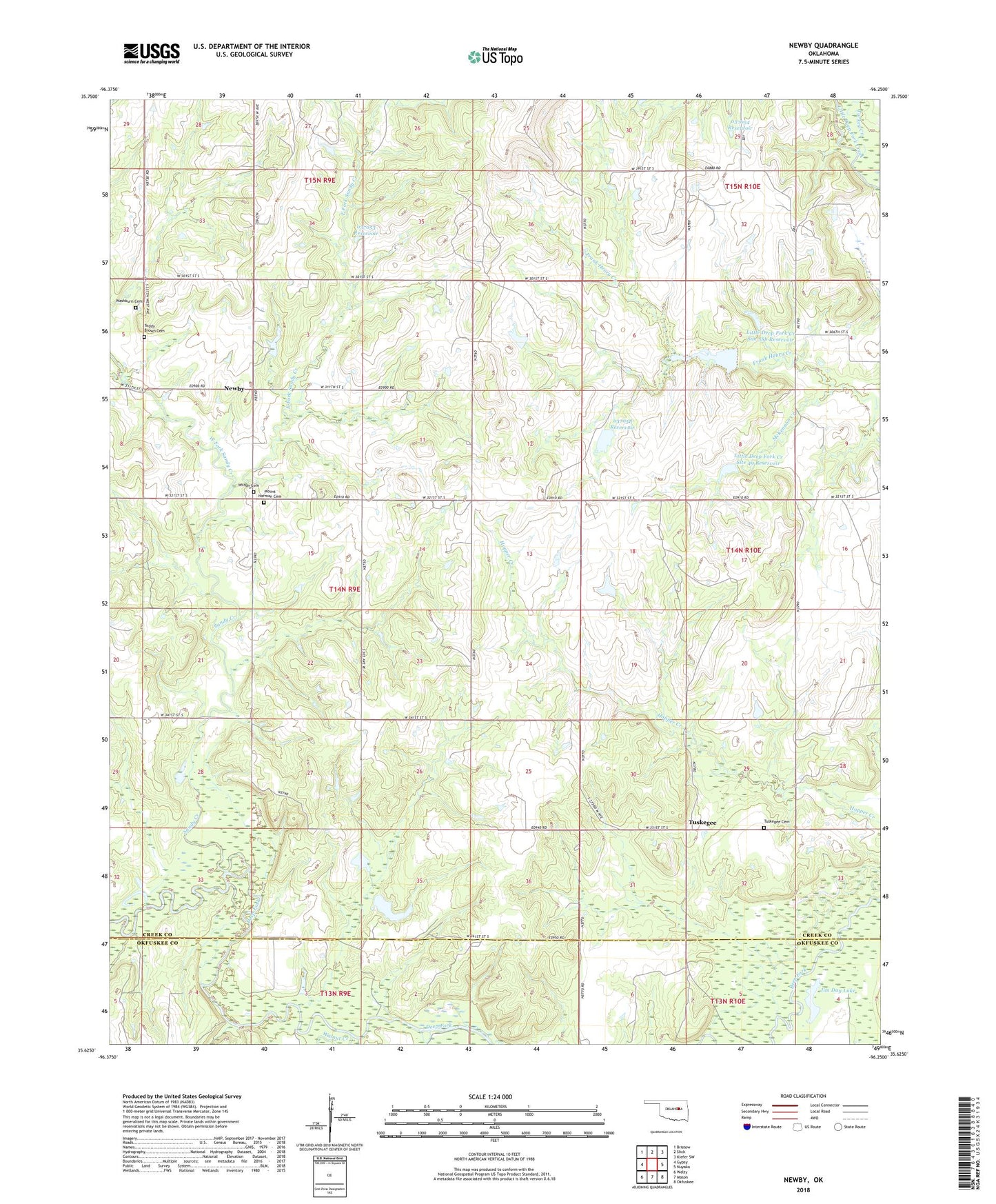
2018 topographic map quadrangle Newby in the state of Oklahoma. Scale: 1:24000. Based on the newly updated USGS 7.5' US Topo map series, this map is in the following counties: Creek, Okfuskee. The map contains contour data, water features, and other items you are used to seeing on USGS maps, but also has updated roads and other features. This is the next generation of topographic maps. Printed on high-quality waterproof paper with UV fade-resistant inks.
Quads adjacent to this one:
West: Gypsy
Northwest: Bristow
North: Slick
Northeast: Kiefer SW
East: Nuyaka
Southeast: Okfuskee
South: Mason
Southwest: Welty
Contains the following named places: Beacon Light Church, East Fork Sandy Creek, Hopper Creek, Jim Day Lake, Little Deep Fork Creek Site 48 Dam, Little Deep Fork Creek Site 48 Reservoir, Little Deep Fork Creek Site 49 Dam, Little Deep Fork Creek Site 49 Reservoir, Little Deep Fork Creek Site 58b Dam, Little Deep Fork Creek Site 58b Reservoir, McKennon Creek, Mount Harman Cemetery, Newby, Okfuskee Tributaries Site W-3 Dam, Oknoname 037053 Dam, Oknoname 037053 Reservoir, Oknoname 037054 Dam, Oknoname 037054 Reservoir, Oknoname 037058 Dam, Oknoname 037058 Reservoir, Sandy Creek, Teddy Brown Cemetery, Township of Newby, Turkey Creek, Tuskegee, Tuskegee Cemetery Number 2, Walnut Creek, Washburn Cemetery, West Fork Sandy Creek, Wilson Cemetery