MyTopo
North Village Oklahoma US Topo Map
Couldn't load pickup availability
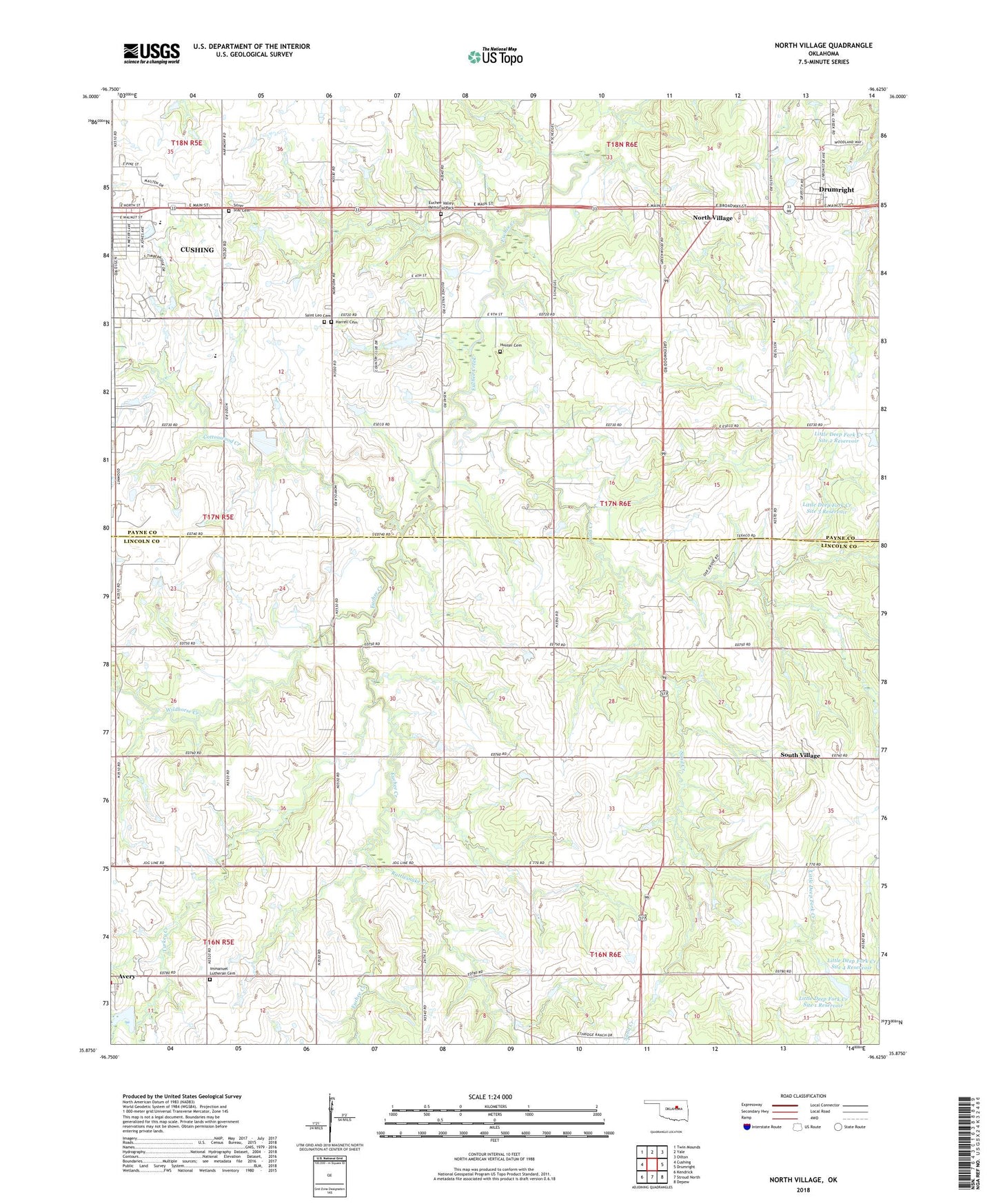
2018 topographic map quadrangle North Village in the state of Oklahoma. Scale: 1:24000. Based on the newly updated USGS 7.5' US Topo map series, this map is in the following counties: Lincoln, Payne. The map contains contour data, water features, and other items you are used to seeing on USGS maps, but also has updated roads and other features. This is the next generation of topographic maps. Printed on high-quality waterproof paper with UV fade-resistant inks.
Quads adjacent to this one:
West: Cushing
Northwest: Twin Mounds
North: Yale
Northeast: Oilton
East: Drumright
Southeast: Depew
South: Stroud North
Southwest: Kendrick
Contains the following named places: Cottonwood Creek, Cushing Christian Church, Cushing Country Club, Cushing High School, Cushing Lower Elementary School, Euchee Valley Memorial Park, Happy Valley School, Harrell Cemetery, Henry Hunter Cemetery, Immanuel Church, Immanuel Lutheran Cemetery, KUSH-AM (Cushing), Little Deep Fork Creek Site 1 Dam, Little Deep Fork Creek Site 1 Reservoir, Little Deep Fork Creek Site 2 Dam, Little Deep Fork Creek Site 2 Reservoir, Little Deep Fork Creek Site 3 Dam, Little Deep Fork Creek Site 3 Reservoir, Living Word Church, North Village, Oak Grove Church, Oak Grove Elementary School, Oak Street Baptist Church, Only Way Church, Rattlesnake Creek, Saint Leo Cemetery, Sand Creek, Silver Star Cemetery, South Village, Summit Ridge, Summit Ridge Shopping Center, The Followers Church, Township of Indian, Township of Ponca, Turkey Creek, United Pentecostal Church, Wildhorse Creek