MyTopo
Perkins Oklahoma US Topo Map
Couldn't load pickup availability
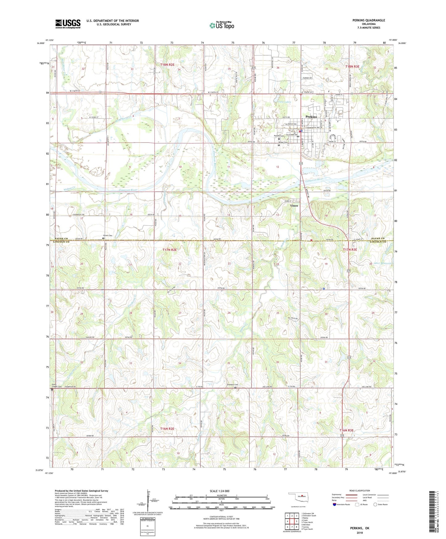
2018 topographic map quadrangle Perkins in the state of Oklahoma. Scale: 1:24000. Based on the newly updated USGS 7.5' US Topo map series, this map is in the following counties: Lincoln, Payne. The map contains contour data, water features, and other items you are used to seeing on USGS maps, but also has updated roads and other features. This is the next generation of topographic maps. Printed on high-quality waterproof paper with UV fade-resistant inks.
Quads adjacent to this one:
West: Coyle
Northwest: Stillwater SW
North: Stillwater South
Northeast: Ripley
East: Tryon North
Southeast: Tryon South
South: Carney
Southwest: Meridian
Contains the following named places: Bible Evanglistic Temple, Brandon Cemetery, City of Perkins, Corduroy Creek, Iowa Chapel Cemetery, Iowa Tribal Volunteer Fire Department, Iowa Tribe Police Department, Knipe Cemetery, Oklahoma State University Experimental Farm, Oknoname 08117 Dam, Olivet Cemetery, Olivet Church, Perkins, Perkins - Tryon Elementary School, Perkins - Tryon High School, Perkins - Tryon Intermediate Elementary School, Perkins - Tryon Junior High School, Perkins Cemetery, Perkins Fire Department, Perkins Police Department, Perkins Post Office, Township of Iowa, Township of Perkins, Twin Lakes, Vinco, Walnut Creek, Wild Horse Creek, ZIP Code: 74059