MyTopo
Reydon Oklahoma US Topo Map
Couldn't load pickup availability
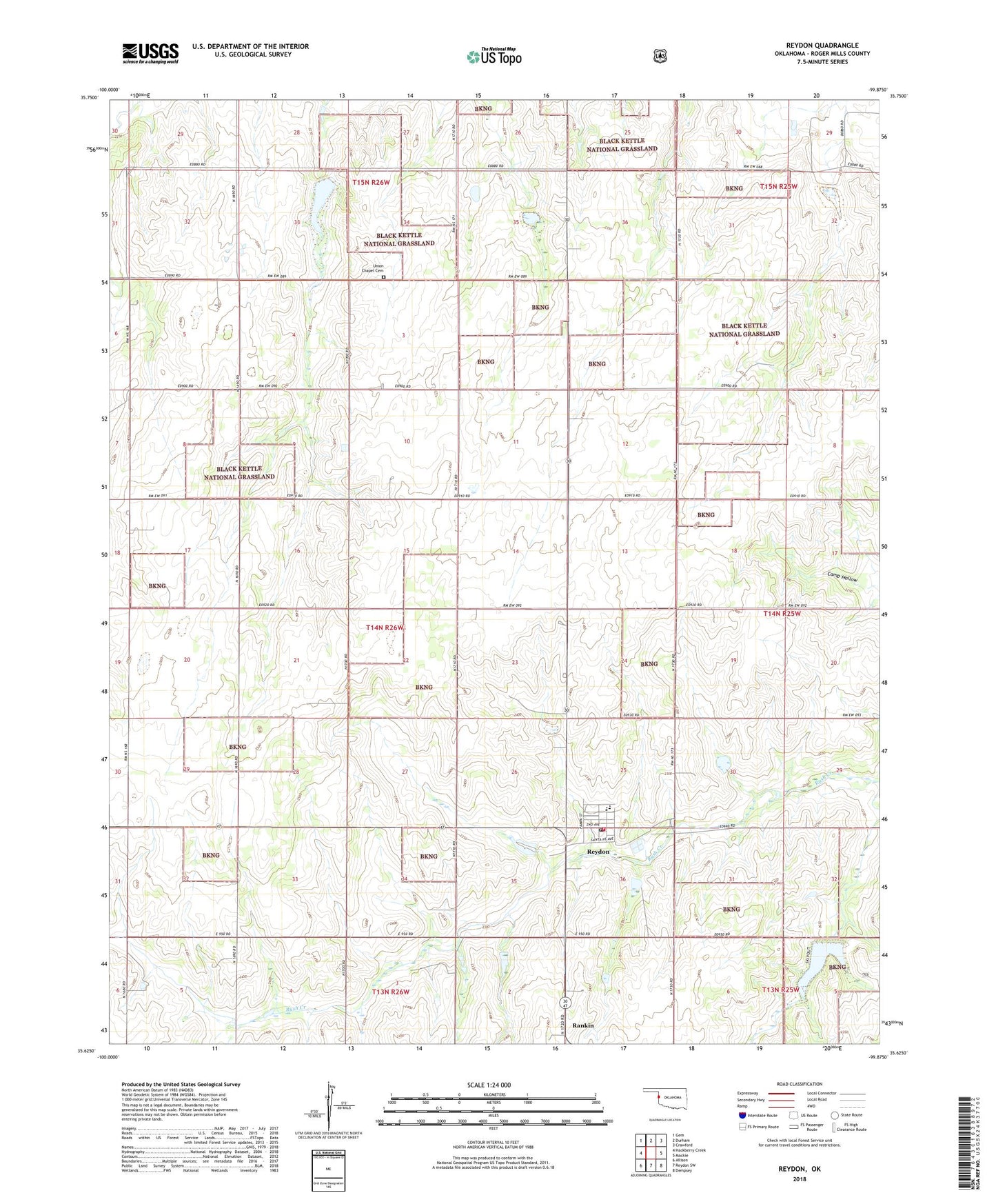
2018 topographic map quadrangle Reydon in the state of Oklahoma. Scale: 1:24000. Based on the newly updated USGS 7.5' US Topo map series, this map is in the following counties: Roger Mills. The map contains contour data, water features, and other items you are used to seeing on USGS maps, but also has updated roads and other features. This is the next generation of topographic maps. Printed on high-quality waterproof paper with UV fade-resistant inks.
Quads adjacent to this one:
West: Hackberry Creek
Northwest: Gem
North: Durham
Northeast: Crawford
East: Mackie
Southeast: Dempsey
South: Reydon SW
Southwest: Allison
Contains the following named places: Cary Ranch Airport, Midway, Reydon, Reydon Elementary School, Reydon High School, Reydon Post Office, Reydon Volunteer Fire Department, Roger Mills County Emergency Medical Service, Skipout Campground, Skipout Lake, Town of Reydon, Township of Bowman, Union Chapel Cemetery, Upper Washita River Site 101 Dam, Upper Washita River Site 49 Dam, Upper Washita River Site 49 Reservoir, Upper Washita River Site 50 Dam, Upper Washita River Site 50 Reservoir, Upper Washita Site 101 Reservoir, Upper Washita Site 35 Dam, Upper Washita Site 35 Reservoir, Upper Washita Site 36 Dam, Upper Washita Site 36 Reservoir, Upper Washita Site 41 Dam, Upper Washita Site 41 Reservoir, Upper Washita Site 48 Dam, Upper Washita Site 48 Reservoir, Upper Washita Site 51 Dam, Upper Washita Site 51 Reservoir, Upper Washita Site 52 Dam, Upper Washita Site 52 Reservoir, Upper Washita Site 53 Dam, Upper Washita Site 56 Dam, Upper Washita Site 56 Reservoir