MyTopo
Yale Oklahoma US Topo Map
Couldn't load pickup availability
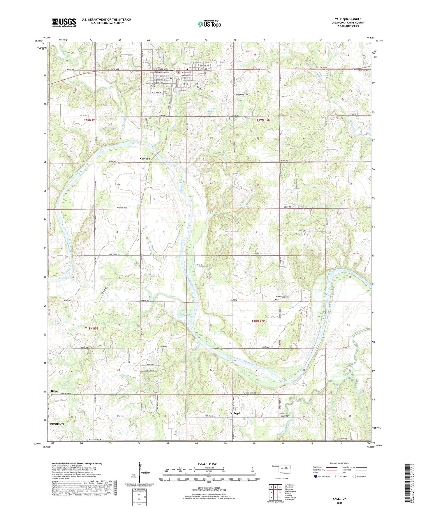
2018 topographic map quadrangle Yale in the state of Oklahoma. Scale: 1:24000. Based on the newly updated USGS 7.5' US Topo map series, this map is in the following counties: Payne. The map contains contour data, water features, and other items you are used to seeing on USGS maps, but also has updated roads and other features. This is the next generation of topographic maps. Printed on high-quality waterproof paper with UV fade-resistant inks.
Quads adjacent to this one:
West: Twin Mounds
Northwest: West Point
North: Maramec
Northeast: Jennings
East: Oilton
Southeast: Drumright
South: North Village
Southwest: Cushing
Contains the following named places: Baptist Church, Cartoco, Church of Christ, City of Yale, Deep Rock Elementary School, Eagle Creek, Greenwood Cemetery, Jim Thorpe Park, Mud Creek, Oknoname 11905 Dam, Oknoname 11905 Reservoir, Salt Creek, Schlegel, Skull Creek, Township of Eagle, Turkey Creek, Underwood Cemetery, Yale, Yale Division, Yale Elementary School, Yale Fire Department, Yale High School, Yale Police Department, Yale Post Office, ZIP Code: 74085