MyTopo
Buck Butte Oregon US Topo Map
Couldn't load pickup availability
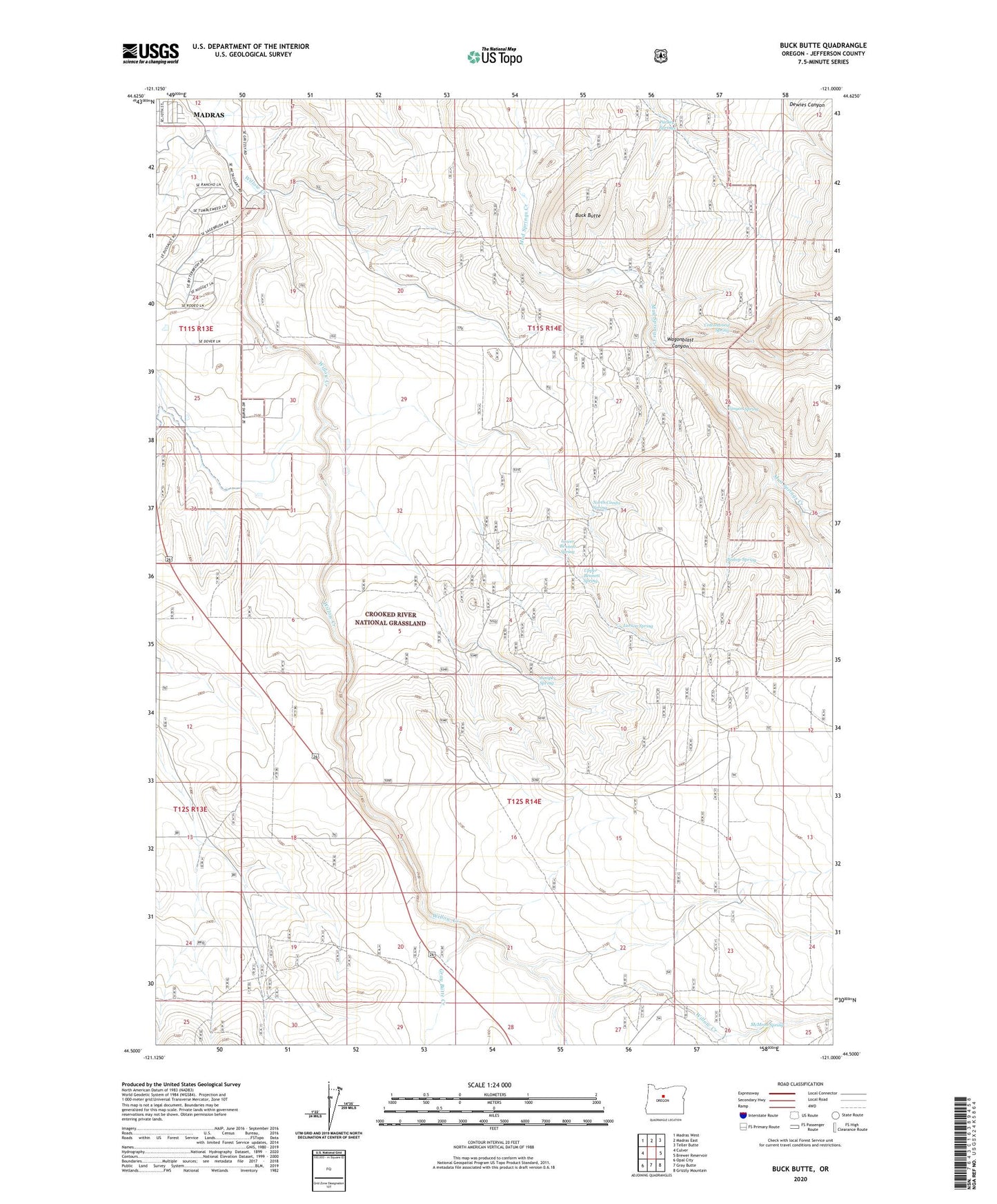
2020 topographic map quadrangle Buck Butte in the state of Oregon. Scale: 1:24000. Based on the newly updated USGS 7.5' US Topo map series, this map is in the following counties: Jefferson. The map contains contour data, water features, and other items you are used to seeing on USGS maps, but also has updated roads and other features. This is the next generation of topographic maps. Printed on high-quality waterproof paper with UV fade-resistant inks.
Quads adjacent to this one:
West: Culver
Northwest: Madras West
North: Madras East
Northeast: Teller Butte
East: Brewer Reservoir
Southeast: Grizzly Mountain
South: Gray Butte
Southwest: Opal City
Contains the following named places: Bennett Well, Bishop Spring, Blanchard Well, Boyce Corral, Boyce Pond Well, Buck Butte, C W A Well, Canyon Spring, Cap Healy Well, Cottonwood Spring, Crooked River National Grassland, Dayton-Grant Well, Degner Well, Devine Well, Gray Butte Creek, Hardwick Well, Juniper Spring, Larson Spring, Lower Bennett Spring, McMeen Creek, McMeen Spring, North Combs Spring, Parkey Springs, Reichen Well, Reuter Well, South Waste Water Treatment Facility, Suicide Well, Upper Bennett Spring, Wagonblast Canyon, Willow Creek Corral