MyTopo
Crater Lake West Oregon US Topo Map
Couldn't load pickup availability
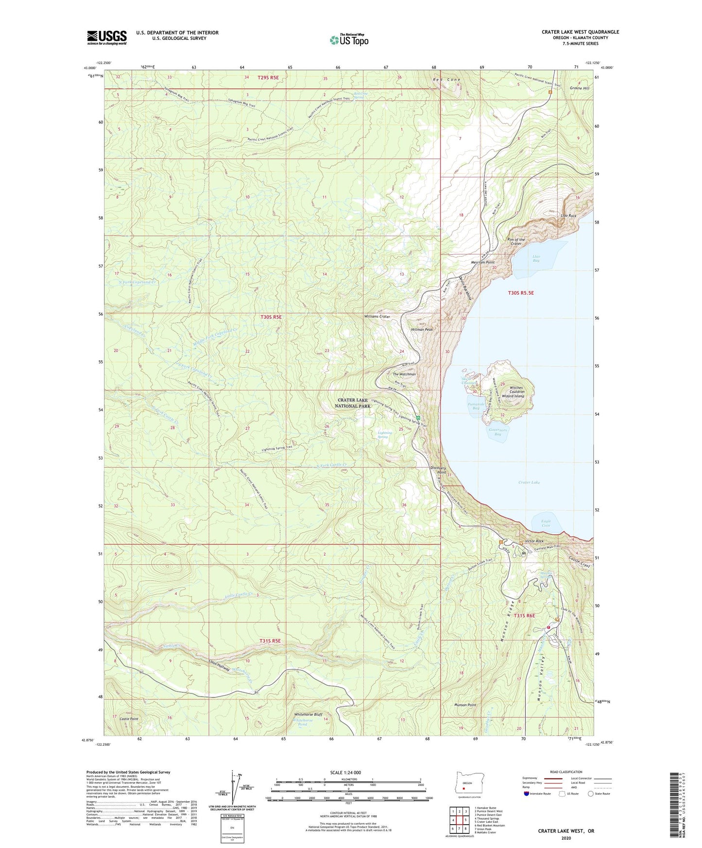
2020 topographic map quadrangle Crater Lake West in the state of Oregon. Scale: 1:24000. Based on the newly updated USGS 7.5' US Topo map series, this map is in the following counties: Klamath. The map contains contour data, water features, and other items you are used to seeing on USGS maps, but also has updated roads and other features. This is the next generation of topographic maps. Printed on high-quality waterproof paper with UV fade-resistant inks.
Quads adjacent to this one:
West: Thousand Springs
Northwest: Hamaker Butte
North: Pumice Desert West
Northeast: Pumice Desert East
East: Crater Lake East
Southeast: Maklaks Crater
South: Union Peak
Southwest: Red Blanket Mountain
Contains the following named places: Bybee Meadow Trail, Cascade Divide Trail, Castle Creek Trail, Castle Crest, Crater Lake Lodge, Crater Lake National Park, Crater Lake National Park Fire Department, Crater Lake National Park Headquarters, Crater Lake Post Office, Devils Backbone, Discovery Point, Dutton Creek, Dutton Creek Trail, Eagle Cove, Elephants Back, Fumarole Bay, Governors Bay, Hillman Peak, Lightening Spring Trail, Lightning Spring, Llao Bay, Llao Rock, Llaos Hallway, Merriam Point, Middle Fork Copeland Creek, Munson Point, Munson Ridge, Munson Springs, National Park Service Crater Lake National Park Ranger Station, Red Cone, Red Cone Spring, Rim of the Crater, Rim Village, Rim Village Picnic Area, Sinnott Memorial, Skell Channel, South Fork Copeland Creek, Summit Cascade Divide, The Watchman, Trapper Creek, Victor Rock, Whitehorse Bluff, Whitehorse Creek, Whitehorse Pond, Williams Crater, Witches Cauldron, Wizard Island, ZIP Code: 97604