MyTopo
Detroit Oregon US Topo Map
Couldn't load pickup availability
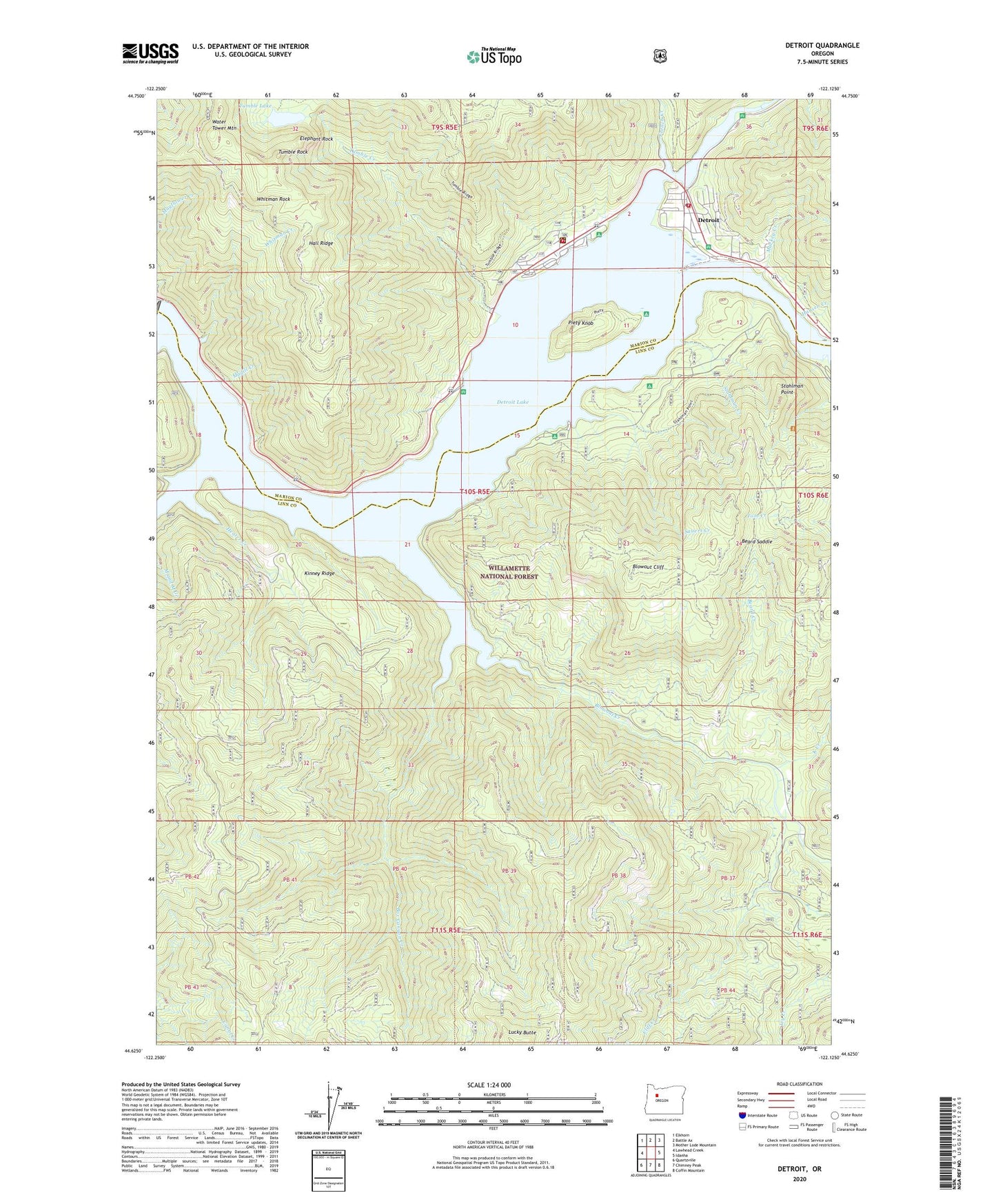
2020 topographic map quadrangle Detroit in the state of Oregon. Scale: 1:24000. Based on the newly updated USGS 7.5' US Topo map series, this map is in the following counties: Linn, Marion. The map contains contour data, water features, and other items you are used to seeing on USGS maps, but also has updated roads and other features. This is the next generation of topographic maps. Printed on high-quality waterproof paper with UV fade-resistant inks.
Quads adjacent to this one:
West: Lawhead Creek
Northwest: Elkhorn
North: Battle Ax
Northeast: Mother Lode Mountain
East: Idanha
Southeast: Coffin Mountain
South: Chimney Peak
Southwest: Quartzville
Contains the following named places: Beard Creek, Beard Saddle, Berry, Berry Post Office, Blowout Cliff, Blowout Creek, Box Canyon Creek, Breitenbush River, Canyon Creek, City of Detroit, Cliff Creek, Cove Creek Campground Boat Ramp, Cove Creek Recreation Site, Detroit, Detroit City Hall, Detroit Dam, Detroit Flats Boat Landing, Detroit Flats Recreation Site, Detroit Lake, Detroit Lake Marina, Detroit Lake State Park, Detroit Lake State Park Boat Ramp D, Detroit Lake State Park Boat Ramp G, Detroit Lake State Park Fishing Dock, Detroit Lake State Park Moorage Boat Dock F, Detroit Lake State Park Moorage Boat Dock H, Detroit Municipal Court, Detroit Post Office, Elephant Rock, Elk River, French Creek, Gravel Spur, Hall Ridge, Halls, Hammond Lumber Company Number 2, Hansen Creek, Heater Creek, Idanha - Detroit Rural Fire Protection District Substation, K Creek, Kanes Marina, Kinney Ridge, Larson, Lucky Butte, Mackey Creek, Madill Creek, Mongold Boat Ramp, Mongold Day Use Area Marina Transient Dock, Mongold Recreation Site, Piety Island Boat - In Campground Boat Landing, Piety Island Recreation Site, Piety Knob, Redne Post Office, Sauers Creek, South Shore Campground Boat Ramp, Southshore Campground, Sportsman Club Private Marina, Stahlman Creek, Stahlman Point, Tumble Creek, Tumble Lake, Tumble Rock, United States Forest Service Detroit Flats Boat Ramp, United States Forest Service Detroit Ranger District, Upper Arm Recreation Site, Volcano Trail, Water Tower Mountain, Whitman Creek, Whitman Rock