MyTopo
Dundee Oregon US Topo Map
Couldn't load pickup availability
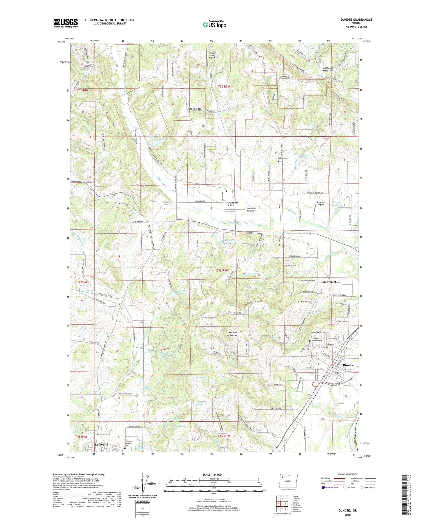
2020 topographic map quadrangle Dundee in the state of Oregon. Scale: 1:24000. Based on the newly updated USGS 7.5' US Topo map series, this map is in the following counties: Yamhill, Marion. The map contains contour data, water features, and other items you are used to seeing on USGS maps, but also has updated roads and other features. This is the next generation of topographic maps. Printed on high-quality waterproof paper with UV fade-resistant inks.
Quads adjacent to this one:
West: Carlton
Northwest: Gaston
North: Laurelwood
Northeast: Scholls
East: Newberg
Southeast: Saint Paul
South: Dayton
Southwest: McMinnville
Contains the following named places: Big Spring, Billick/Dundee School Park, Bronson Creek, Bryan Creek, Chehalem Airpark, City of Dundee, Crabtree Park, Diamond Post Office, Dundee, Dundee City Hall, Dundee Elementary School, Dundee Fire Department Station 3, Dundee Municipal Courthouse, Dundee Pioneer Cemetery, Dundee Police Department, Dundee Post Office, Dundee Publlic Works, Dundee Scenic Overlook, E R Baker Dam, Ewing Young Elementary School, Ewing Young Historical Marker, Falcon Crest Park, Hess Creek, Hickory Hill Farm Dam, Hickory Hill Farm Reservoir, Kuehne Dam, Kuehne Reservoir, Lafayette Pioneer Cemetery, Lafayette Spring, Nelson Spring, Newberg Division, Noble Cemetery, Our Lady of Guadalupe Trappist Abbey Cemetery, Pringle Spring, Red Hills of Dundee, Ribbon Ridge, Ribbon Ridge Airport, Ribbon Ridge School, Saint Josephs Dam, Saint Josephs Reservoir, Stan Jost Airport, Sunnycrest, Tangen Reservoir, Tilikum Lake, Trappist Abbey of Our Lady of Guadalupe, Valley View School, Walker Dam, Walker Reservoir, West Chehalem, West Chehalem Post Office, Zink Reservoir, ZIP Code: 97115