MyTopo
Falls City Oregon US Topo Map
Couldn't load pickup availability
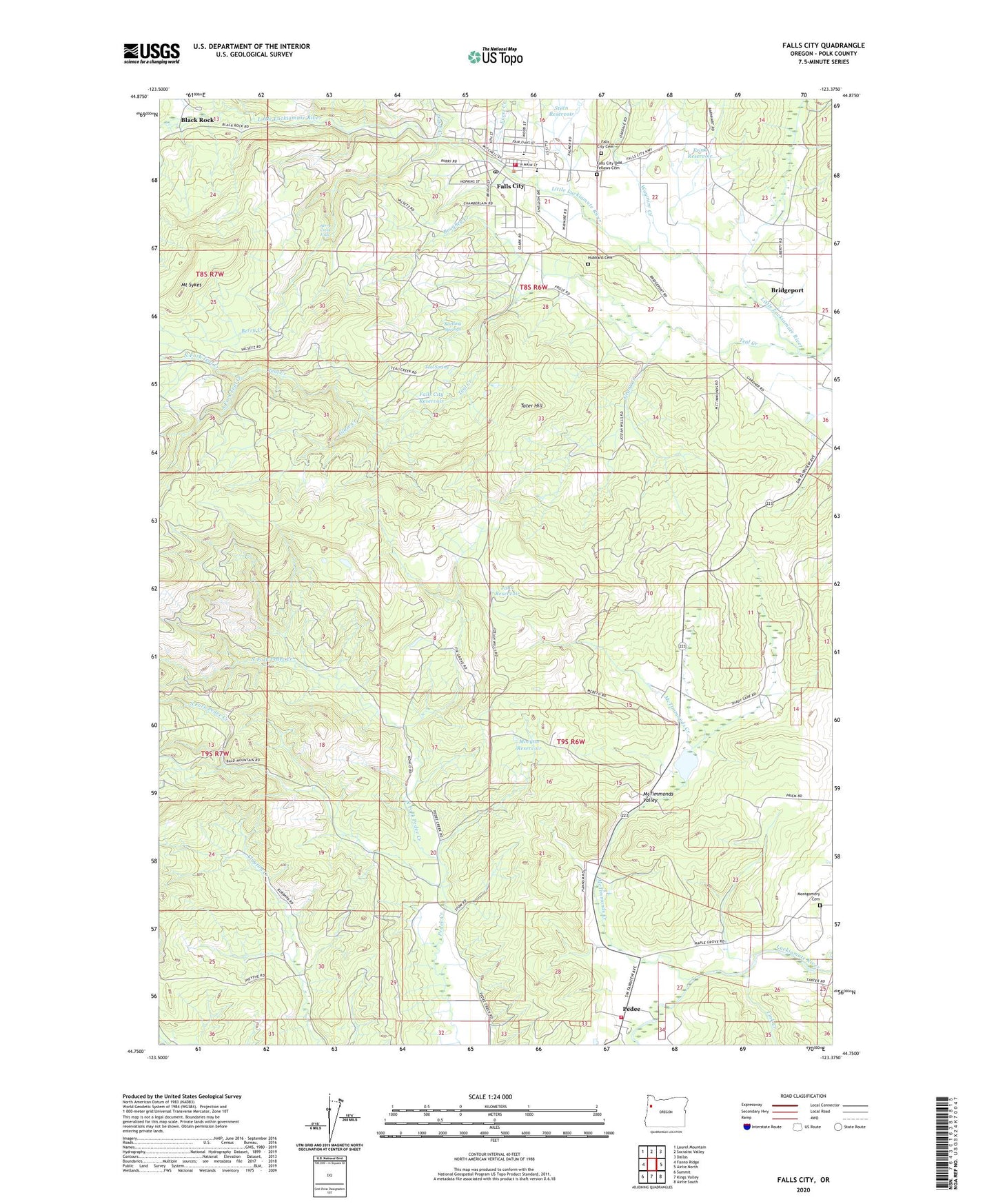
2020 topographic map quadrangle Falls City in the state of Oregon. Scale: 1:24000. Based on the newly updated USGS 7.5' US Topo map series, this map is in the following counties: Polk. The map contains contour data, water features, and other items you are used to seeing on USGS maps, but also has updated roads and other features. This is the next generation of topographic maps. Printed on high-quality waterproof paper with UV fade-resistant inks.
Quads adjacent to this one:
West: Fanno Ridge
Northwest: Laurel Mountain
North: Socialist Valley
Northeast: Dallas
East: Airlie North
Southeast: Airlie South
South: Kings Valley
Southwest: Summit
Contains the following named places: Berry Creek, Berry Creek Falls, Black Rock, Black Rock Post Office, Boughey Creek, Bridge Park, Bridgeport, Buman, Burns Corner, Camp 2, Camp Kilowan, Camp Tapawingo, Carey, City of Falls City, Dutch Creek, Everz Creek, Falls City, Falls City Cemetery, Falls City City Hall, Falls City Community Building and Municipal Courthouse, Falls City Elementary School, Falls City Fire Department, Falls City High School, Falls City Odd Fellows Cemetery, Falls City Post Office, Falls City Public Works, Falls City Reservoir, Falls City Wastewater Treatment Plant, Falls City Water Treatment Plant, Fir Grove School, Fran Wilson Riverside Park, Frink Reservoir, George Kitchen Upper Park, Gerlinger County Park, Glaze Creek, Grant Creek, Hubbard Cemetery, Jahn Reservoir, Link, Link Creek, Maddux Reservoir, McTimmonds Creek, McTimmonds Valley, Michael Harding Park, Montgomery Cemetery, Morgan Reservoir, Mount Sykes, North Fork Pedee Creek, North Fork Teal Creek, Oakhurst School, Pedee, Pedee Post Office, Polk County Fire District 1 Station 70 Pedee, Rattling Springs, Sams Creek, South Fork Pedee Creek, South Fork Teal Creek, Southwest Polk County Rural Fire Protection District Station 120, Steen Reservoir, Tater Hill, Teal Creek, Teal Spring, Wagner Community Library, Waymire Creek, Wye, ZIP Code: 97344