MyTopo
Indian Cove Oregon US Topo Map
Couldn't load pickup availability
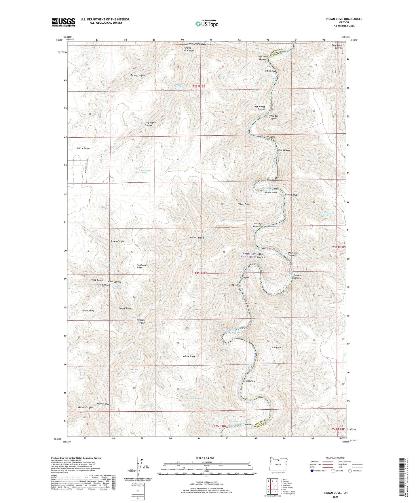
2020 topographic map quadrangle Indian Cove in the state of Oregon. Scale: 1:24000. Based on the newly updated USGS 7.5' US Topo map series, this map is in the following counties: Sherman, Gilliam. The map contains contour data, water features, and other items you are used to seeing on USGS maps, but also has updated roads and other features. This is the next generation of topographic maps. Printed on high-quality waterproof paper with UV fade-resistant inks.
Quads adjacent to this one:
West: Rosebush
Northwest: Moro
North: Harmony
Northeast: Esau Canyon
East: Indian Spring
Southeast: Shoestring Ridge
South: Horseshoe Bend
Southwest: Kent
Contains the following named places: Barnet Canyon, Brown Canyon, Bull Basin, Cottonwood Spring, Cow Canyon, Dipping Vat Canyon, Dipping Vat Spring, Dunlap Canyon, Fern Hollow, Gooseberry Spring, Grass Canyon, Hawkins Spring, Hayes Canyon, Indian Cove, Jackknife Canyon, Little Ferry Canyon, Lon Eakin Flat, Long Hollow, Lucy Payne Canyon, Lucy Payne Spring, Marlin Canyon, Marlin Spring, Minton Cove, Nat Wheat Canyon, North Canyon, Pearson Canyon, Peddicord Point, Penny Spring, Piano Box Canyon, Rutledge Canyon, S A Canyon, Shellrock Canyon, Sproul Canyon, Sproul Point, Steers Canyon, Turner Canyon, Warm Spring, Wilson Point, ZIP Code: 97033