MyTopo
Keno Oregon US Topo Map
Couldn't load pickup availability
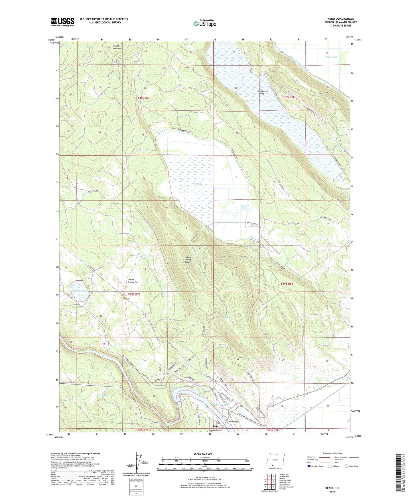
2020 topographic map quadrangle Keno in the state of Oregon. Scale: 1:24000. Based on the newly updated USGS 7.5' US Topo map series, this map is in the following counties: Klamath. The map contains contour data, water features, and other items you are used to seeing on USGS maps, but also has updated roads and other features. This is the next generation of topographic maps. Printed on high-quality waterproof paper with UV fade-resistant inks.
Quads adjacent to this one:
West: Spencer Creek
Northwest: Aspen Lake
North: Howard Bay
Northeast: Wocus
East: Klamath Falls
Southeast: Worden
South: Hamaker Mountain
Southwest: Chicken Hills
Contains the following named places: Home Creek, Indian Spring, Indian Spring Flat, Indian Spring Ridge, Keno, Keno Bridge, Keno Census Designated Place, Keno Dam, Keno Post Office, Keno Recreation Area Boat Ramp, Keno Reservoir, Keno Rural Fire Protection District Station 1Headquarters, Klamath County Library Keno Branch, Long Lake Valley, Millsite Creek, Oatman Junction, Oatman Lake, Paper Spring, Plevna, Plevna Post Office, Round Lake, Round Lake Hill, Round Lake Utilities Wastewater Treatment Lagoons, Sky Creek, Wocus Drainage Canal