MyTopo
Maklaks Crater Oregon US Topo Map
Couldn't load pickup availability
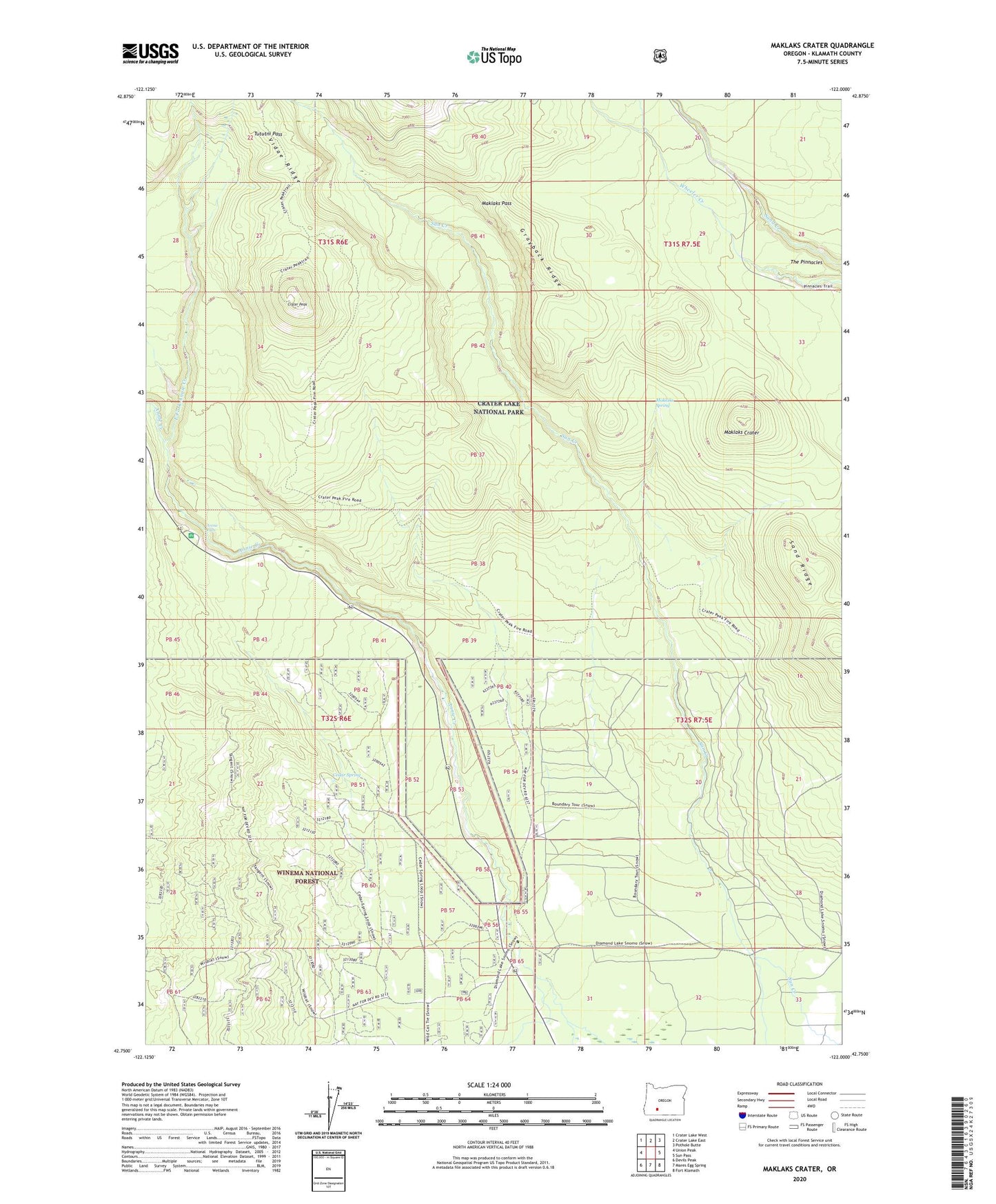
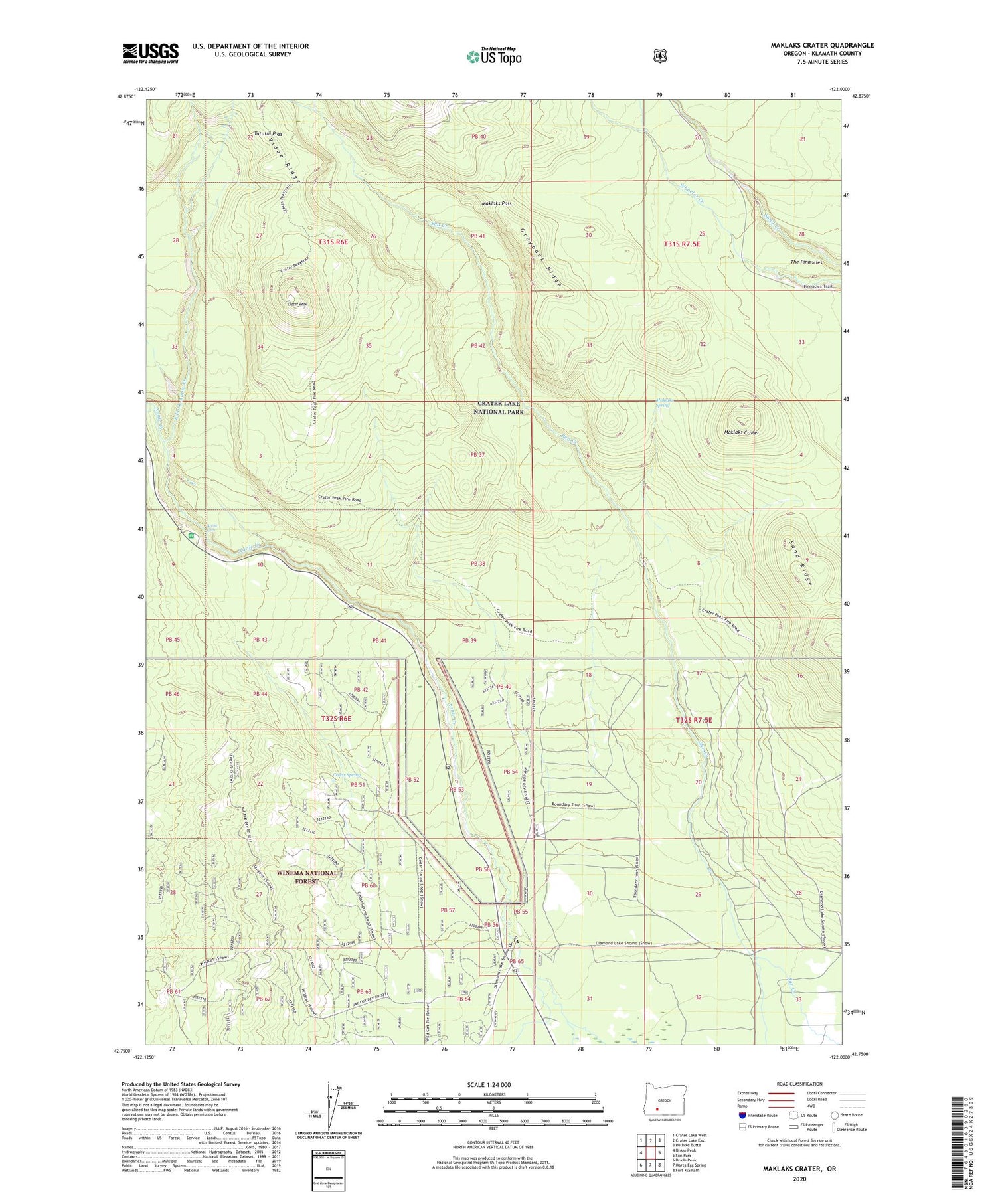
2020 topographic map quadrangle Maklaks Crater in the state of Oregon. Scale: 1:24000. Based on the newly updated USGS 7.5' US Topo map series, this map is in the following counties: Klamath. The map contains contour data, water features, and other items you are used to seeing on USGS maps, but also has updated roads and other features. This is the next generation of topographic maps. Printed on high-quality waterproof paper with UV fade-resistant inks.
Quads adjacent to this one:
West: Union Peak
Northwest: Crater Lake West
North: Crater Lake East
Northeast: Pothole Butte
East: Sun Pass
Southeast: Fort Klamath
South: Mares Egg Spring
Southwest: Devils Peak
Contains the following named places: Annie Creek Pit, Annie Creek Sno-Park, Annie Falls, Cedar Spring, Crater Peak, Crater Peak Trail, East Fork Annie Creek, Grayback Ridge, Lost Creek, Maklaks Crater, Maklaks Pass, Maklaks Spring, Picnic Area Number Two, Ponderosa Picnic Area, Sand Ridge, South Entrance Crater Lake National Park, The Pinnacles, Tututni Pass, Vidae Creek, Wildcat Camp