MyTopo
Mount Hagan Oregon US Topo Map
Couldn't load pickup availability
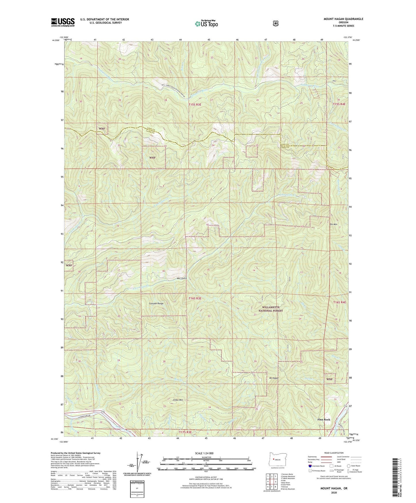
2020 topographic map quadrangle Mount Hagan in the state of Oregon. Scale: 1:24000. Based on the newly updated USGS 7.5' US Topo map series, this map is in the following counties: Lane, Linn. The map contains contour data, water features, and other items you are used to seeing on USGS maps, but also has updated roads and other features. This is the next generation of topographic maps. Printed on high-quality waterproof paper with UV fade-resistant inks.
Quads adjacent to this one:
West: Vida
Northwest: Farmers Butte
North: Swamp Mountain
Northeast: Tidbits Mountain
East: Blue River
Southeast: Harvey Mountain
South: Nimrod
Southwest: Goat Point
Contains the following named places: Bear Creek, Elk Mountain, Finn Rock, Finn Rock Landing Boat Ramp, Finn Rock Post Office, Finn Rock Safety Rest Area, H J Morton County Park, Hagan Block Research Natural Area, Jimbo Mountain, King Camp, King Creek, Little Bear Creek, Mount Hagan, North Fork Calapooia River, Rail Creek, Rough Creek, United States Creek, Wet Gulch, ZIP Code: 97488