MyTopo
Nortons Oregon US Topo Map
Couldn't load pickup availability
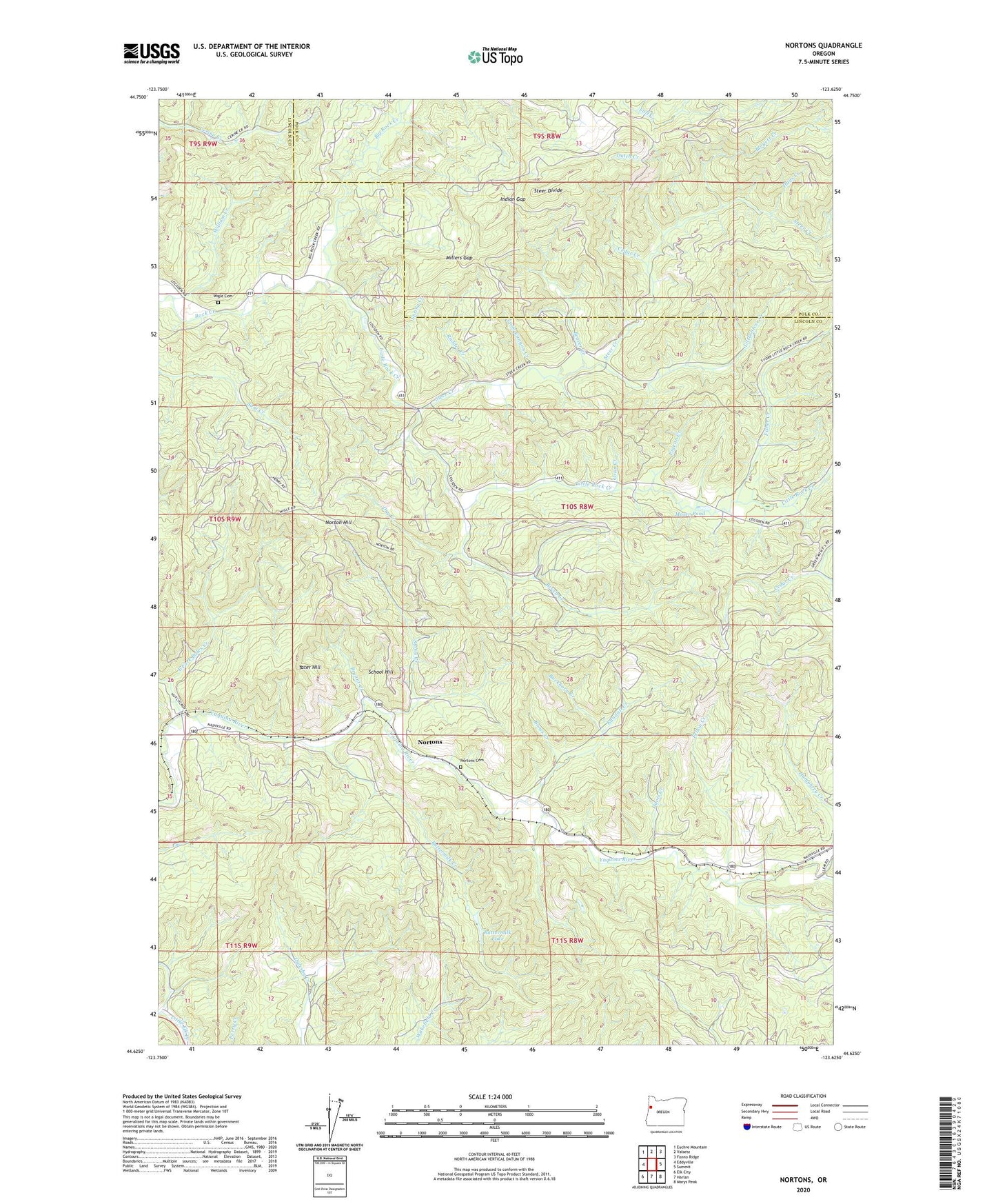
2020 topographic map quadrangle Nortons in the state of Oregon. Scale: 1:24000. Based on the newly updated USGS 7.5' US Topo map series, this map is in the following counties: Lincoln, Polk. The map contains contour data, water features, and other items you are used to seeing on USGS maps, but also has updated roads and other features. This is the next generation of topographic maps. Printed on high-quality waterproof paper with UV fade-resistant inks.
Quads adjacent to this one:
West: Eddyville
Northwest: Euchre Mountain
North: Valsetz
Northeast: Fanno Ridge
East: Summit
Southeast: Marys Peak
South: Harlan
Southwest: Elk City
Contains the following named places: Bahais of Lincoln County, Beaver Creek, Big Rock Creek, Blogett Creek, Bones Creek, Brush Creek, Bryant Creek, Buckhorn Creek, Buttermilk Creek, Buttermilk Lake, Cedar Creek, Coon Creek, Davis Creek, Dry Creek, Dutch Creek, East Fork Bales Creek, Fall Creek, Felton Creek, Fisher Creek, Hays Creek, Indian Gap, Little Rock Creek, Little Steer Creek, Long Canyon Creek, Millers Gap, Moser Pond, Norton Hill, Nortons, Nortons Cemetery, Nortons Post Office, Oregon State Fish Hatchery, Pigeon Creek, Randall Creek, Redfern, Rudder Creek, School Hill, Spring Creek, Steer Creek, Steer Divide, Stony Creek, Tater Hill, Wigle Cemetery, William Creek, Young Creek