
MyTopo
Salmon Fork Oregon US Topo Map
Couldn't load pickup availability
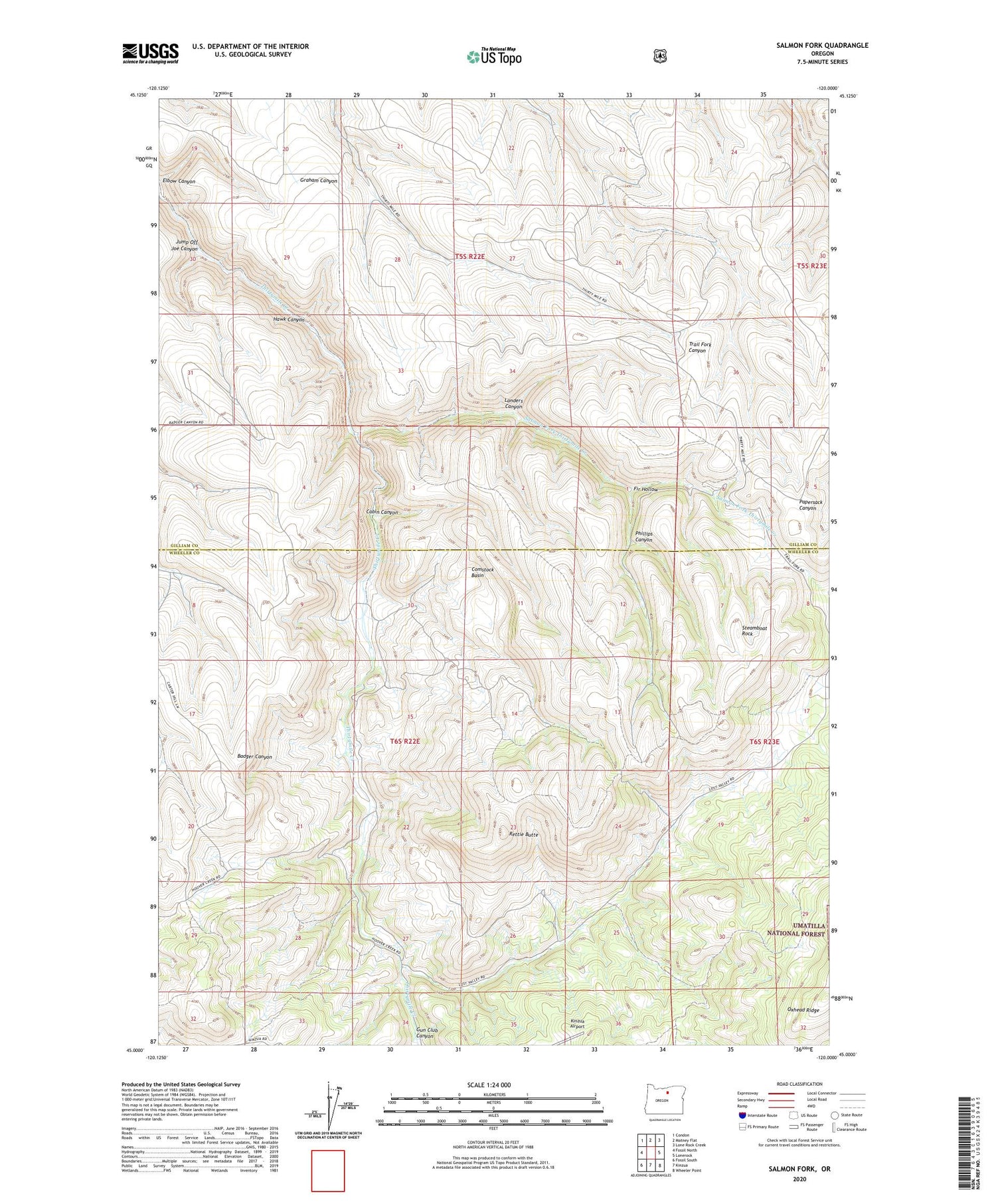
2020 topographic map quadrangle Salmon Fork in the state of Oregon. Scale: 1:24000. Based on the newly updated USGS 7.5' US Topo map series, this map is in the following counties: Gilliam, Wheeler. The map contains contour data, water features, and other items you are used to seeing on USGS maps, but also has updated roads and other features. This is the next generation of topographic maps. Printed on high-quality waterproof paper with UV fade-resistant inks.
Quads adjacent to this one:
West: Fossil North
Northwest: Condon
North: Matney Flat
Northeast: Lone Rock Creek
East: Lonerock
Southeast: Wheeler Point
South: Kinzua
Southwest: Fossil South
Contains the following named places: Cabin Canyon, Comstock Basin, Edwards, Elbow Canyon, Fir Hollow, Gun Club Canyon, Hawk Canyon, Jump Off Joe Canyon, Kinzua Airport, Kinzua Golf Course, Landers Canyon, Oxhead Ridge, Phillips Canyon, Rettie Butte, Salmon Fork Thirtymile Creek, Steamboat Rock, Stewarts, Trail Fork, Trail Fork School, Trailfork Post Office


