MyTopo
Snow Peak Oregon US Topo Map
Couldn't load pickup availability
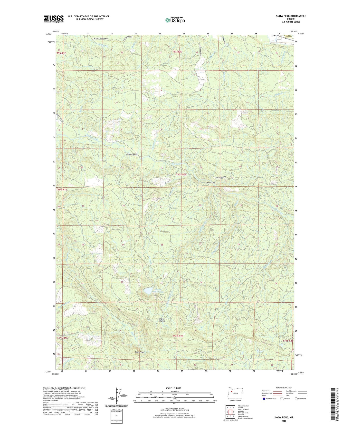
2020 topographic map quadrangle Snow Peak in the state of Oregon. Scale: 1:24000. Based on the newly updated USGS 7.5' US Topo map series, this map is in the following counties: Linn, Marion. The map contains contour data, water features, and other items you are used to seeing on USGS maps, but also has updated roads and other features. This is the next generation of topographic maps. Printed on high-quality waterproof paper with UV fade-resistant inks.
Quads adjacent to this one:
West: Jordan
Northwest: Stout Mountain
North: Lyons
Northeast: Mill City North
East: Mill City South
Southeast: Yellowstone Mountain
South: Keel Mountain
Southwest: Lacomb
Contains the following named places: Avery Creek, Bradshaw Creek, Crabtree Lake Trail, Criminal Creek, Devils Den, Ella Creek, Hortense Creek, Indian Prairie, Indian Prairie Creek, Indian Prairie Lake, Potter, Snow Peak, Snow Peak Mill City Trail, Thomas Cairn, West Fork Ella Creek