MyTopo
Tanner Butte Oregon US Topo Map
Couldn't load pickup availability
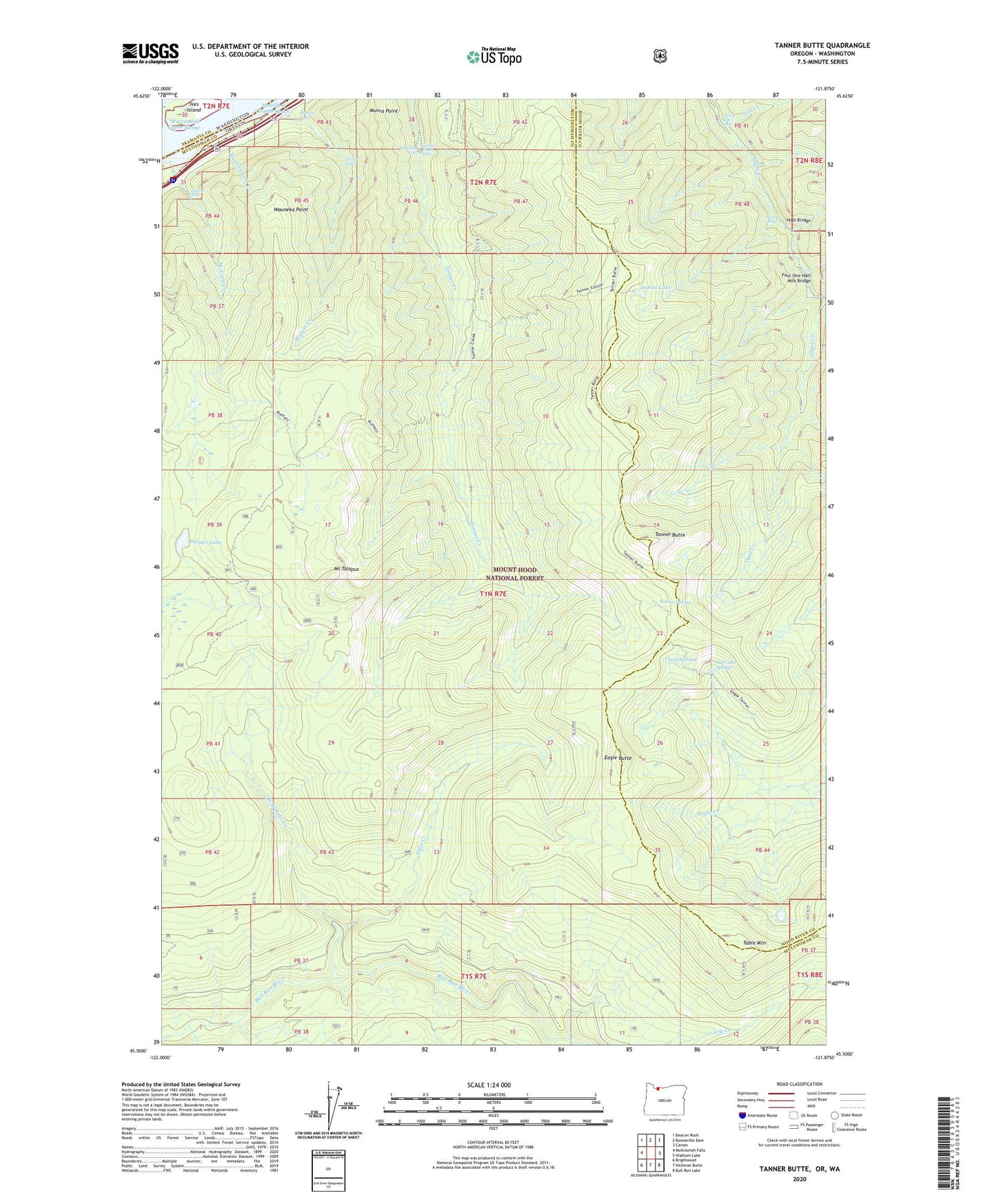
2020 topographic map quadrangle Tanner Butte in the states of Oregon, Washington. Scale: 1:24000. Based on the newly updated USGS 7.5' US Topo map series, this map is in the following counties: Multnomah, Hood River, Skamania. The map contains contour data, water features, and other items you are used to seeing on USGS maps, but also has updated roads and other features. This is the next generation of topographic maps. Printed on high-quality waterproof paper with UV fade-resistant inks.
Quads adjacent to this one:
West: Multnomah Falls
Northwest: Beacon Rock
North: Bonneville Dam
Northeast: Carson
East: Wahtum Lake
Southeast: Bull Run Lake
South: Hickman Butte
Southwest: Brightwood
Contains the following named places: Big Cedar Springs, Dublin Lake, Eagle Butte, Eagle Tanner Trail, Elowah Falls, Falls Creek, Four One Half Mile Bridge, Hamilton Island Reach, High Bridge, Ives Island, John B Yeon State Park, Log Creek, Loowit Falls, Metasequoia Creek, Moffett Creek, Moffett Falls, Mount Talapus, Munra Point, Nesmith Point Trail, Palmer Lake, Punch Bowl Falls, Stone, Table Mountain, Tanner Butte, Tanner Butte Trail, Tanner Creek Falls, Tanner Cutoff Trail, Tanner Spring, Tenas Camp, Thrush Pond, Tish Creek, Wahclella Falls, Wahe Falls, Warrendale Upper Range, Wauneka Point, West Branch Falls Creek