MyTopo
Tolo Mountain Oregon US Topo Map
Couldn't load pickup availability
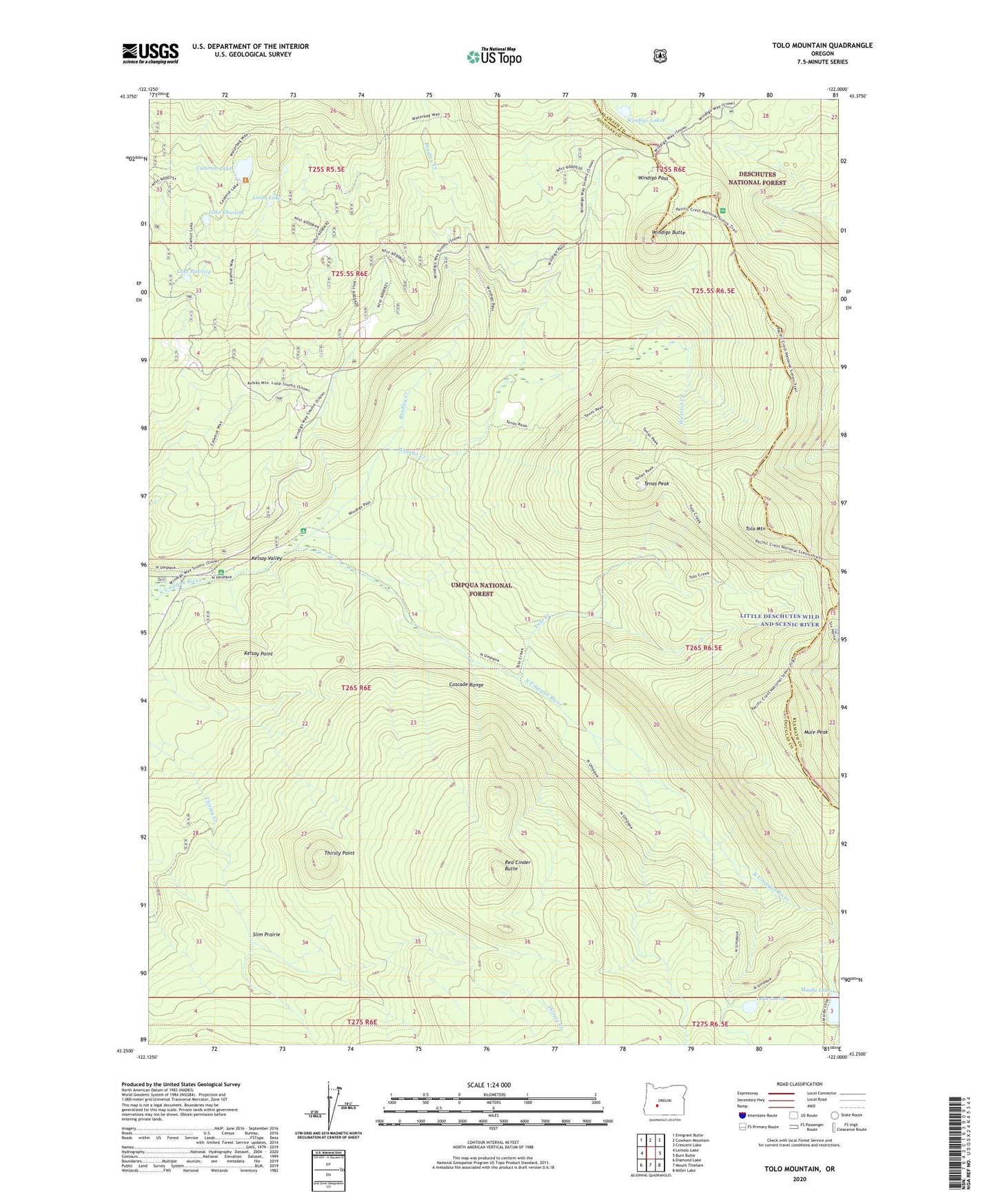
2020 topographic map quadrangle Tolo Mountain in the state of Oregon. Scale: 1:24000. Based on the newly updated USGS 7.5' US Topo map series, this map is in the following counties: Douglas, Klamath. The map contains contour data, water features, and other items you are used to seeing on USGS maps, but also has updated roads and other features. This is the next generation of topographic maps. Printed on high-quality waterproof paper with UV fade-resistant inks.
Quads adjacent to this one:
West: Lemolo Lake
Northwest: Emigrant Butte
North: Cowhorn Mountain
Northeast: Crescent Lake
East: Burn Butte
Southeast: Miller Lake
South: Mount Thielsen
Southwest: Diamond Lake
Contains the following named places: Bradley Creek, Calamut Lake, Calamut Way, Kelsay Point, Kelsay Valley Horse Camp, Kelsay VAlley Recreation Site, Kelsay Valley Trailhead, Kelsay Way, Lake Charline, Lake Lucile, Lake Lucile Campground, Lake Patricia, Linda Lake, Maidu Lake, Maidu Lake Way, Mule Peak, Red Cinder Butte, Slim Prairie, Tenas Peak, Tenas Peak Lookout Station, Thirsty Point, Tolo Creek, Tolo Mountain, Warrior Creek, Windigo Butte, Windigo Lakes, Windigo Pass, Windigo Pass Recreation Site