MyTopo
Waldo Mountain Oregon US Topo Map
Couldn't load pickup availability
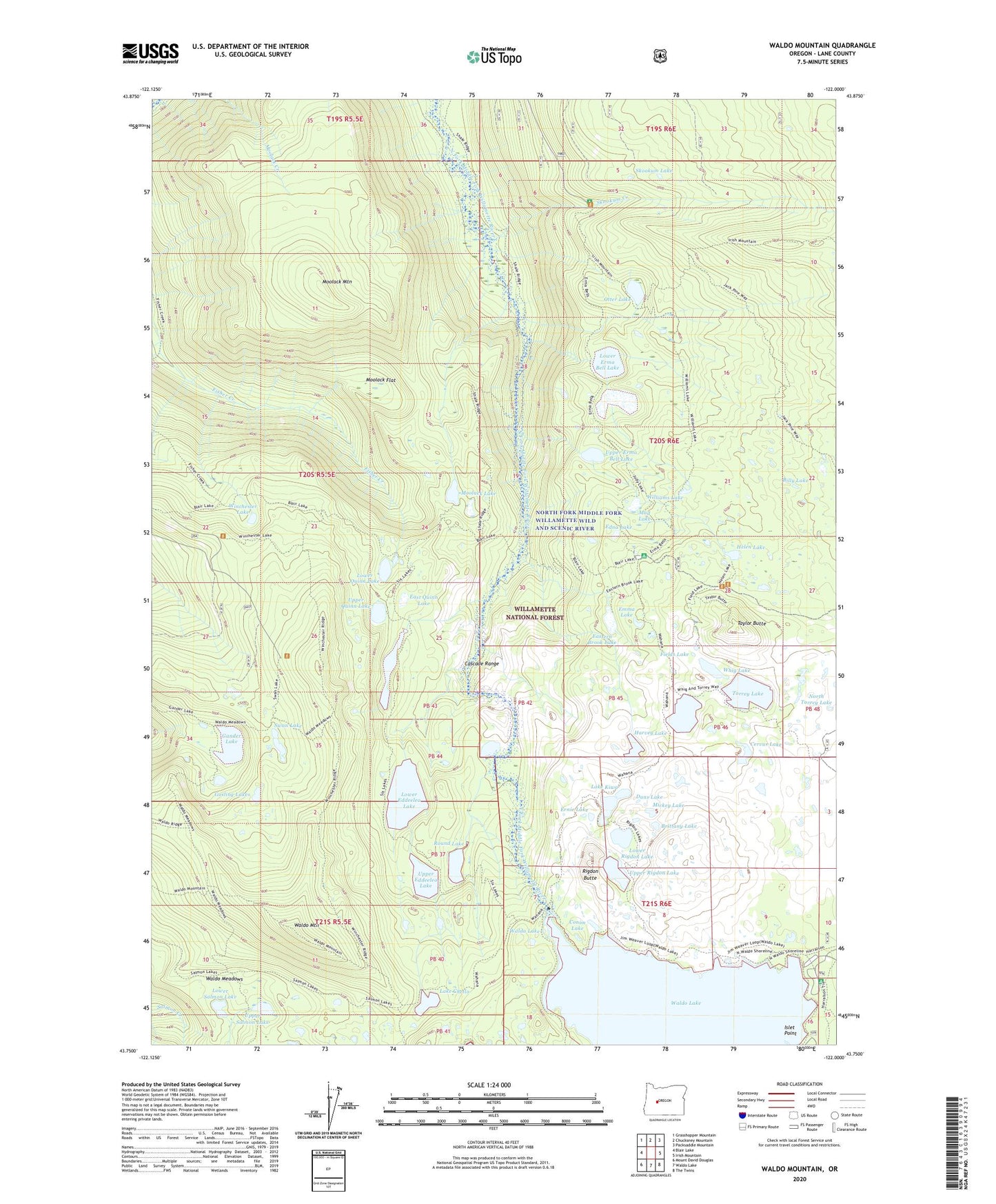
2020 topographic map quadrangle Waldo Mountain in the state of Oregon. Scale: 1:24000. Based on the newly updated USGS 7.5' US Topo map series, this map is in the following counties: Lane. The map contains contour data, water features, and other items you are used to seeing on USGS maps, but also has updated roads and other features. This is the next generation of topographic maps. Printed on high-quality waterproof paper with UV fade-resistant inks.
Quads adjacent to this one:
West: Blair Lake
Northwest: Grasshopper Mountain
North: Chucksney Mountain
Northeast: Packsaddle Mountain
East: Irish Mountain
Southeast: The Twins
South: Waldo Lake
Southwest: Mount David Douglas
Contains the following named places: Billy Lake, Brittany Lake, Cervus Lake, Conim Lake, Dans Lake, East Quinn Lake, Eastern Brook Lake, Eddeeleo Lakes, Edna Lake, Emma Lake, Erma Bell Lakes, Ernie Lake, Fields Lake, Gander Lake, Gosling Lakes, Harvey Lake, Helen Lake, Islet Point, Lake Chetlo, Lake Kiwa, Long Lake, Lower Eddeeleo Lake, Lower Erma Bell Lake, Lower Quinn Lake, Lower Rigdon Lake, Lower Salmon Lake, Mickey Lake, Middle Erma Bell Lake, Moolack Flat, Moolack Lake, Moolack Mountain, Mud Lake, North Torrey Lake, North Waldo Boat Ramp, North Waldo Recreation Site, Otter Lake, Quinn Lakes, Rigdon Butte, Round Lake, Salmon Lakes, Skookum Creek, Skookum Creek Recreation Site, Skookum Lake, Swan Lake, Taylor Burn, Taylor Burn Guard Station, Taylor Burn Recreation Site, Taylor Butte, Torrey Lake, Upper Eddeeleo Lake, Upper Erma Bell Lake, Upper Quinn Lake, Upper Rigdon Lake, Upper Salmon Lake, Wahanna Lake, Waldo Lake Wilderness, Waldo Meadows, Waldo Meadows Guard Station, Waldo Mountain, Whig Lake, Williams Lake, Winchester Forest Camp, Winchester Lake, Winchester Trail