MyTopo
Wanoga Butte Oregon US Topo Map
Couldn't load pickup availability
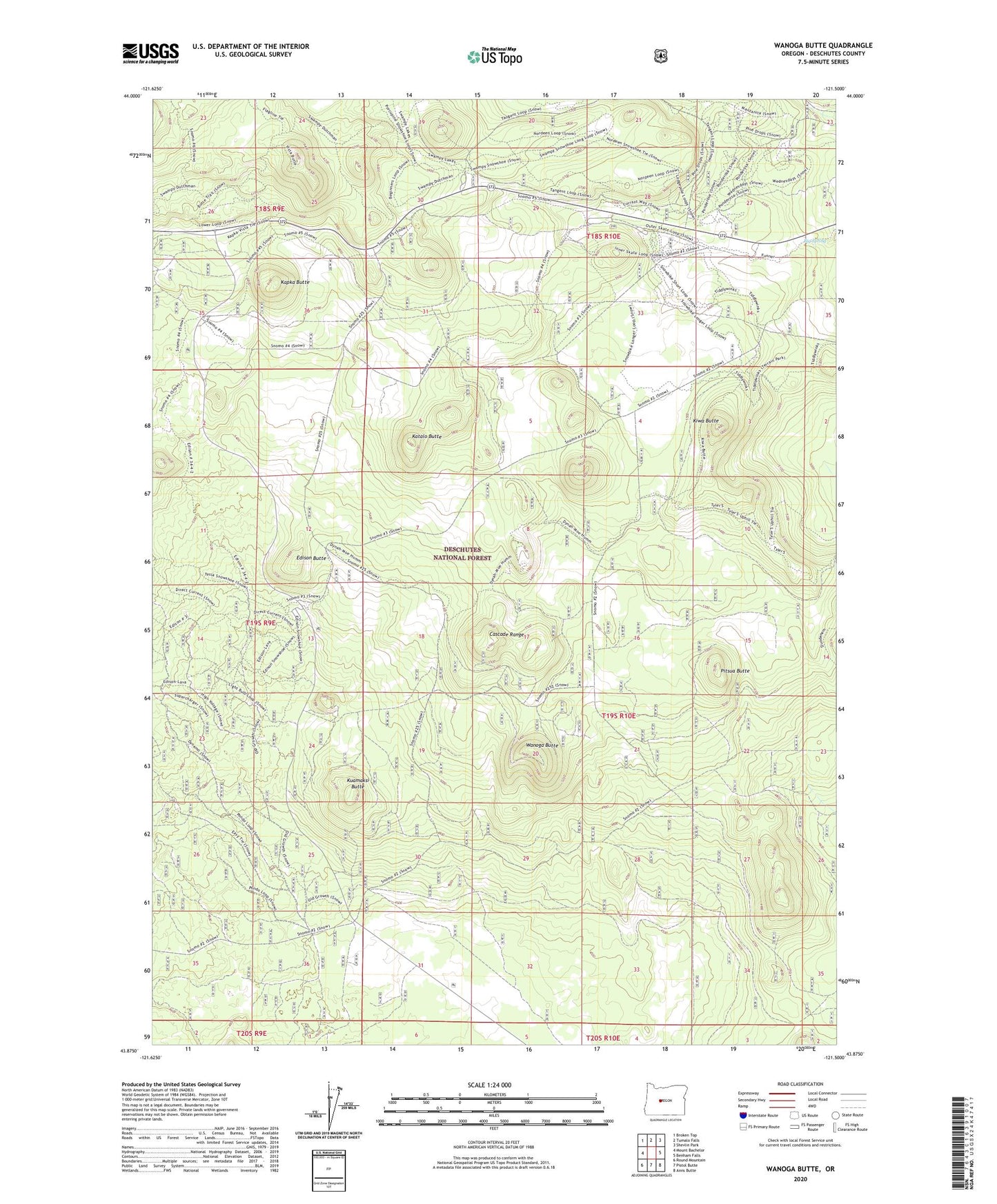
2020 topographic map quadrangle Wanoga Butte in the state of Oregon. Scale: 1:24000. Based on the newly updated USGS 7.5' US Topo map series, this map is in the following counties: Deschutes. The map contains contour data, water features, and other items you are used to seeing on USGS maps, but also has updated roads and other features. This is the next generation of topographic maps. Printed on high-quality waterproof paper with UV fade-resistant inks.
Quads adjacent to this one:
West: Mount Bachelor
Northwest: Broken Top
North: Tumalo Falls
Northeast: Shevlin Park
East: Benham Falls
Southeast: Anns Butte
South: Pistol Butte
Southwest: Round Mountain
Contains the following named places: Big Spring, Dutchman Creek, Edison Butte, Edison Butte Sno-Park, Kapka Butte, Katalo Butte, Kiwa Butte, Kuamaksi Butte, Meissner Shelter, Meissner Sno-Park, Nordeen Shelter, Pitsua Butte, Swampy Lakes Sno-Park, Swampy Lakes Trailhead, Vista Sno-Park, Wanoga Butte, Wanoga Butte Lookout Tower, Wanoga Sno-Park