MyTopo
Whitetail Butte Oregon US Topo Map
Couldn't load pickup availability
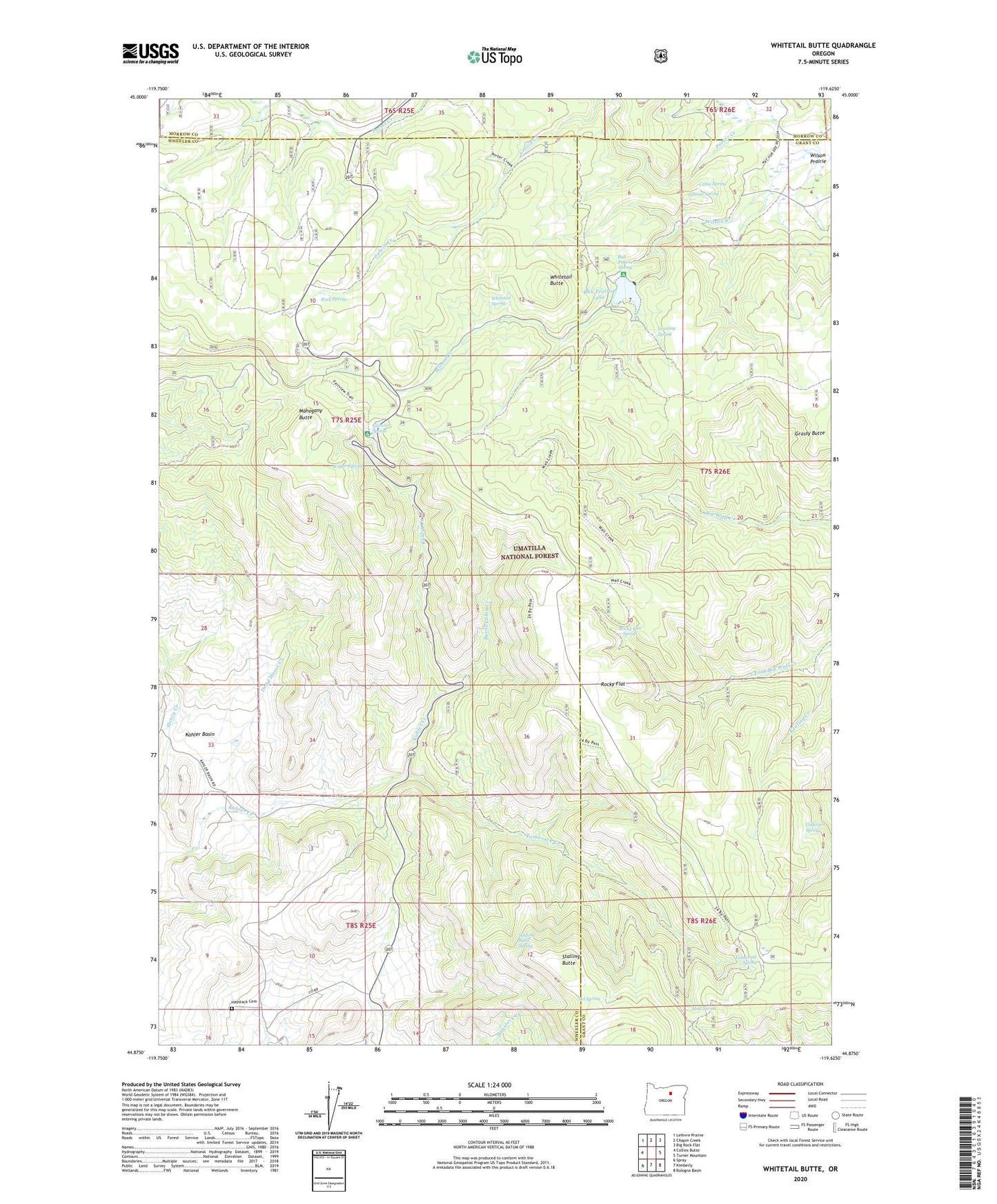
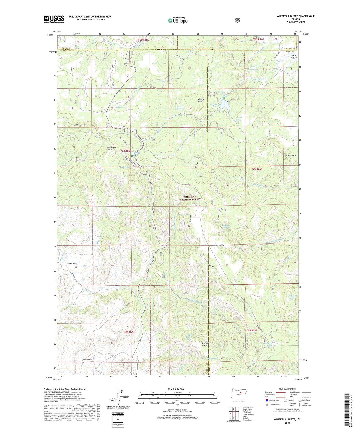
2020 topographic map quadrangle Whitetail Butte in the state of Oregon. Scale: 1:24000. Based on the newly updated USGS 7.5' US Topo map series, this map is in the following counties: Wheeler, Grant, Morrow. The map contains contour data, water features, and other items you are used to seeing on USGS maps, but also has updated roads and other features. This is the next generation of topographic maps. Printed on high-quality waterproof paper with UV fade-resistant inks.
Quads adjacent to this one:
West: Collins Butte
Northwest: Lefevre Prairie
North: Chapin Creek
Northeast: Big Rock Flat
East: Turner Mountain
Southeast: Bologna Basin
South: Kimberly
Southwest: Spray
Contains the following named places: Bull Prairie, Bull Prairie Campground Boat Ramp, Bull Prairie Dam, Bull Prairie Guard Station, Bull Prairie Lake, Bull Prairie Recreation Site, Bull Prairie Spring, Burnt Cabin Creek, Cabin Spring, Coffeepot Spring, Dead Horse Creek, Del Spring, Fairview Recreation Site, Fairview Spring, Gilman Spring, Haystack Cemetery, Johnson Creek, Kahler Basin, Keating Creek, Mahogany Butte, Morrow County OHV Park, Mud Spring, Porter Creek, Rock Spring, Rocky Flat, Rocky Flat Spring, Stalling Butte, Stalling Butte Spring, Tamarack Creek, Tamarack Spring, Wagner Post Office, Walker Spring, Wall Creek Trail, Whitetail Butte, Whitetail Spring, Wilson Prairie, Yearling Spring