
MyTopo
Auburn Center Pennsylvania US Topo Map
Couldn't load pickup availability
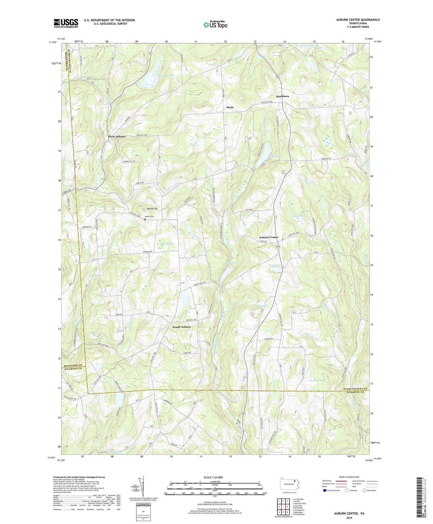
2019 topographic map quadrangle Auburn Center in the state of Pennsylvania. Scale: 1:24000. Based on the newly updated USGS 7.5' US Topo map series, this map is in the following counties: Susquehanna, Wyoming, Bradford. The map contains contour data, water features, and other items you are used to seeing on USGS maps, but also has updated roads and other features. This is the next generation of topographic maps. Printed on high-quality waterproof paper with UV fade-resistant inks.
Quads adjacent to this one:
West: Laceyville
Northwest: Le Raysville
North: Lawton
Northeast: Montrose West
East: Springville
Southeast: Tunkhannock
South: Meshoppen
Southwest: Jenningsville
Contains the following named places: Angle Corners, Auburn Center, Baker Creek, Beaver Meadow Creek, Benninger Creek, Bolles Cemetery, Bunnell Hill Church, Carlin Pond, Carter Corners, Carter Creek, Chase Corners, Crescent Lake Dam, Dority Creek, Green Corners, Harris Corners, Jersey Hill Church, Lott Pond, Malone Swamp, Mud Pond, Nick Creek, Nick Pond, Retta, Riley Creek, Robert Swamp, Round Top, Rushboro, Saint Bonaventure Church, Scranton Corners, Shannon Hill, South Auburn, Township of Auburn, Transue, Tuscarora Lake, Tuscarora Lake Dam, West Auburn, White Pond, ZIP Code: 18630


