MyTopo
Bakersville Pennsylvania US Topo Map
Couldn't load pickup availability
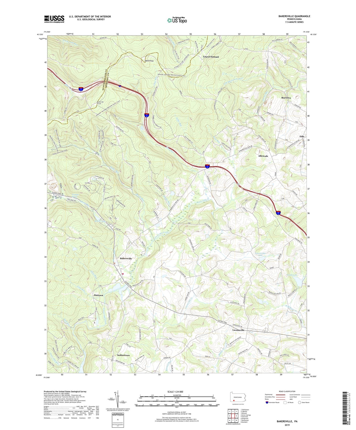
2019 topographic map quadrangle Bakersville in the state of Pennsylvania. Scale: 1:24000. Based on the newly updated USGS 7.5' US Topo map series, this map is in the following counties: Somerset, Westmoreland. The map contains contour data, water features, and other items you are used to seeing on USGS maps, but also has updated roads and other features. This is the next generation of topographic maps. Printed on high-quality waterproof paper with UV fade-resistant inks.
Quads adjacent to this one:
West: Seven Springs
Northwest: Stahlstown
North: Ligonier
Northeast: Boswell
East: Somerset
Southeast: Murdock
South: Rockwood
Southwest: Kingwood
Contains the following named places: Allenvale, Bakersville, Bakersville Volunteer Fire Company - Station 624, Bald Knob, Bethany Church, Buck Run, Buck Run Camp, Clear Run, Conestoga Camp, Crab Run, Crise Run, Edie, Edie Census Designated Place, Gillette, Gross Run, Horner Run, Indiantown, Jimtown, Jones Mill Run, Keller Run, Kesslerville, Klejka Dairy, Kooser Lake, Kooser Run, Kooser State Park, Laurel Hill Creek Dam, Laurel Hill Creek Reservoir, Laurel Hill Tunnel, Laurel Ridge Dam, Laurel Summit, Laurel Summit Picnic Area, Laurel Summit State Park, Laurelridge Lake, Lavansville, Miller School, Moore Run, Moore School, Mount Calvary Church, Mountain Lake Dam, New Fountain School, Pike Run Church, Plateau De Mount Ski Area, Quemahoning Tunnel, Ridge School, Roytown, Saint Peters Church, Salem Church, Samuels Church, Samuels School, Shafer Run, Shanks Run, Stahls, Temple School, Township of Jefferson, Trolls Lake, VanDyke Spring, Zufall, ZIP Codes: 15501, 15502