MyTopo
Bentley Creek Pennsylvania US Topo Map
Couldn't load pickup availability
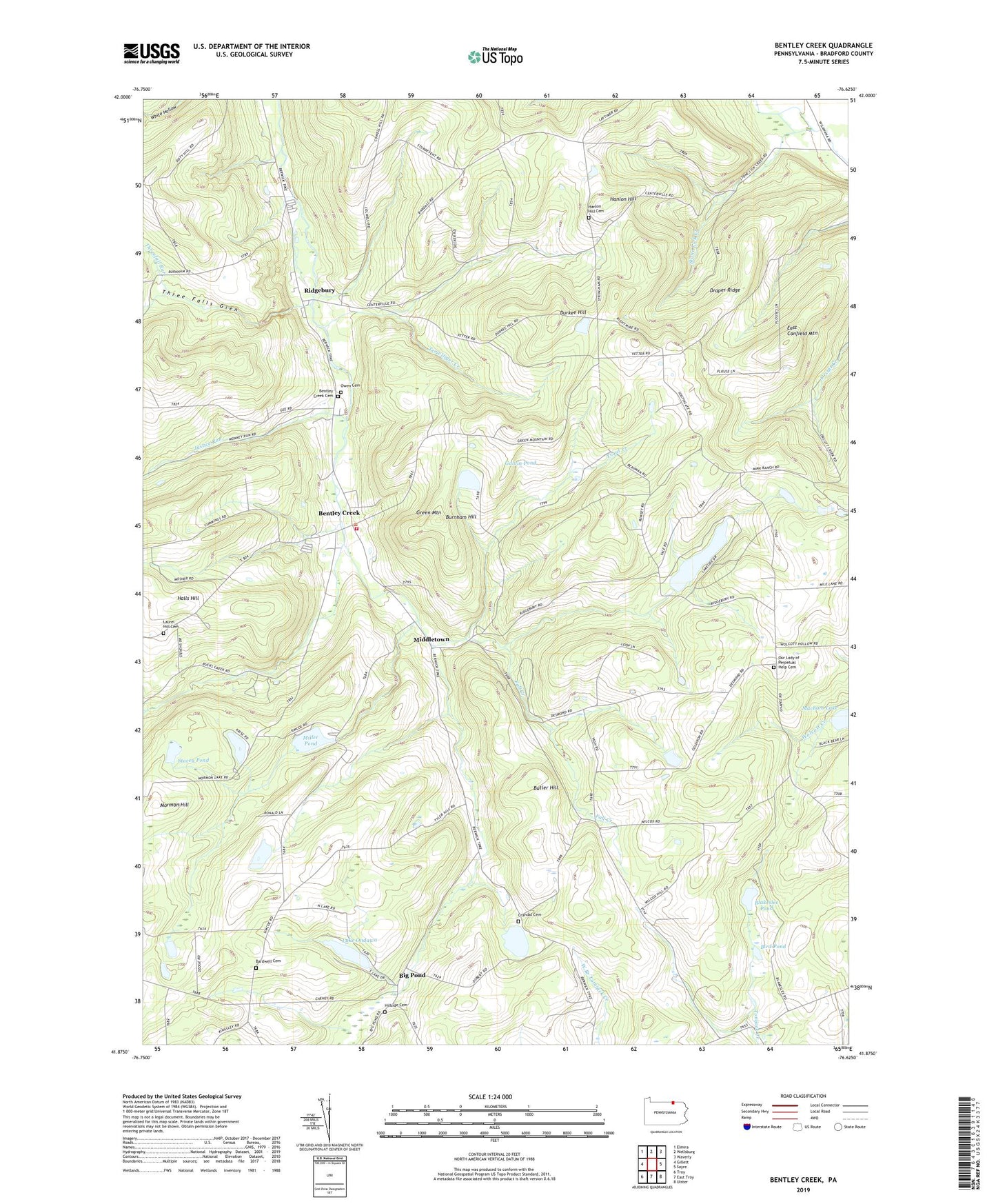
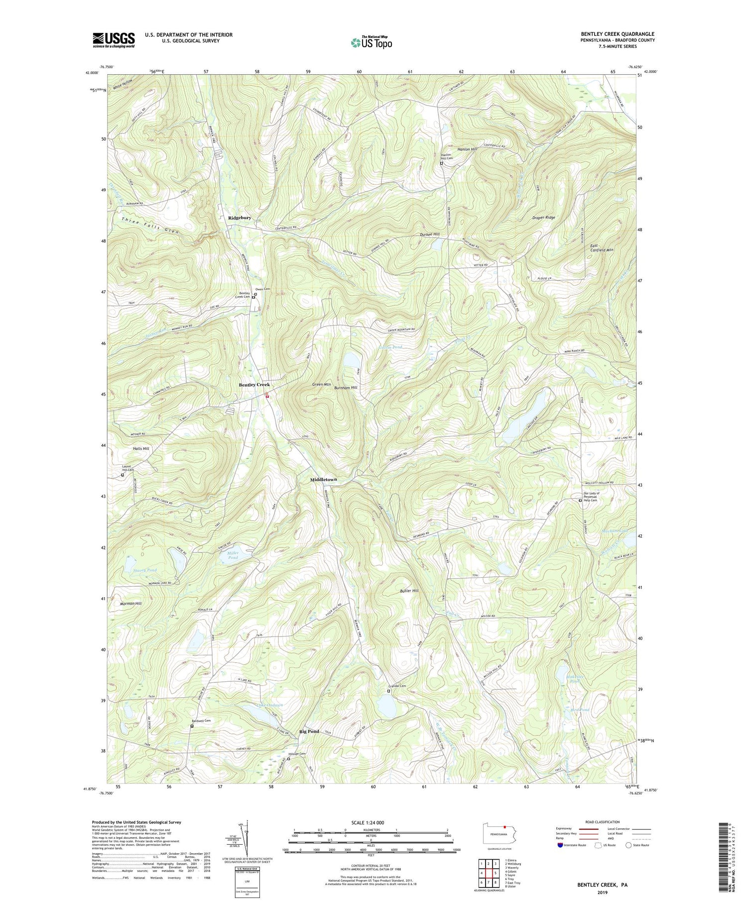
2019 topographic map quadrangle Bentley Creek in the state of Pennsylvania. Scale: 1:24000. Based on the newly updated USGS 7.5' US Topo map series, this map is in the following counties: Bradford. The map contains contour data, water features, and other items you are used to seeing on USGS maps, but also has updated roads and other features. This is the next generation of topographic maps. Printed on high-quality waterproof paper with UV fade-resistant inks.
Quads adjacent to this one:
West: Gillett
Northwest: Elmira
North: Wellsburg
Northeast: Waverly
East: Sayre
Southeast: Ulster
South: East Troy
Southwest: Troy
Contains the following named places: Bardwell Cemetery, Bentley Creek, Bentley Creek Cemetery, Big Pond, Bird Pond, Blakeslee Pond, Buck Creek, Burnham Hill, Butler Hill, Cole Airport, Crandal Cemetery, Doty Hill School, Draper Ridge, Durkee Hill, East Canfield Mountain, Fall Creek, Farrell Run, Galvin Pond, Galvin Pond Dam, Green Mountain, Halls Hill, Hanlon Hill, Hanlon Hill Cemetery, Hanlon Hill School, Hillside Cemetery, Justice Run, Lake Ondawa, Lake Ondawa Dam, Laurel Hill Cemetery, Middletown, Miller Pond, Miller Run, Millers Pond Dam, Mormon Hill, Our Lady of Perpetual Help Cemetery, Owen Cemetery, Paker Run, Ridgebury, Ridgebury Chapel, Ridgebury Lake Dam, Ridgebury Volunteer Fire Company, Smithfield Summit, South Grove School, Stacey Pond, State Game Lands Number 123, Terwiliger Creek, Three Falls Glen, Threefall Run, Township of Ridgebury, Tri - Township Ambulance, Trout Creek