MyTopo
Bessemer Pennsylvania US Topo Map
Couldn't load pickup availability
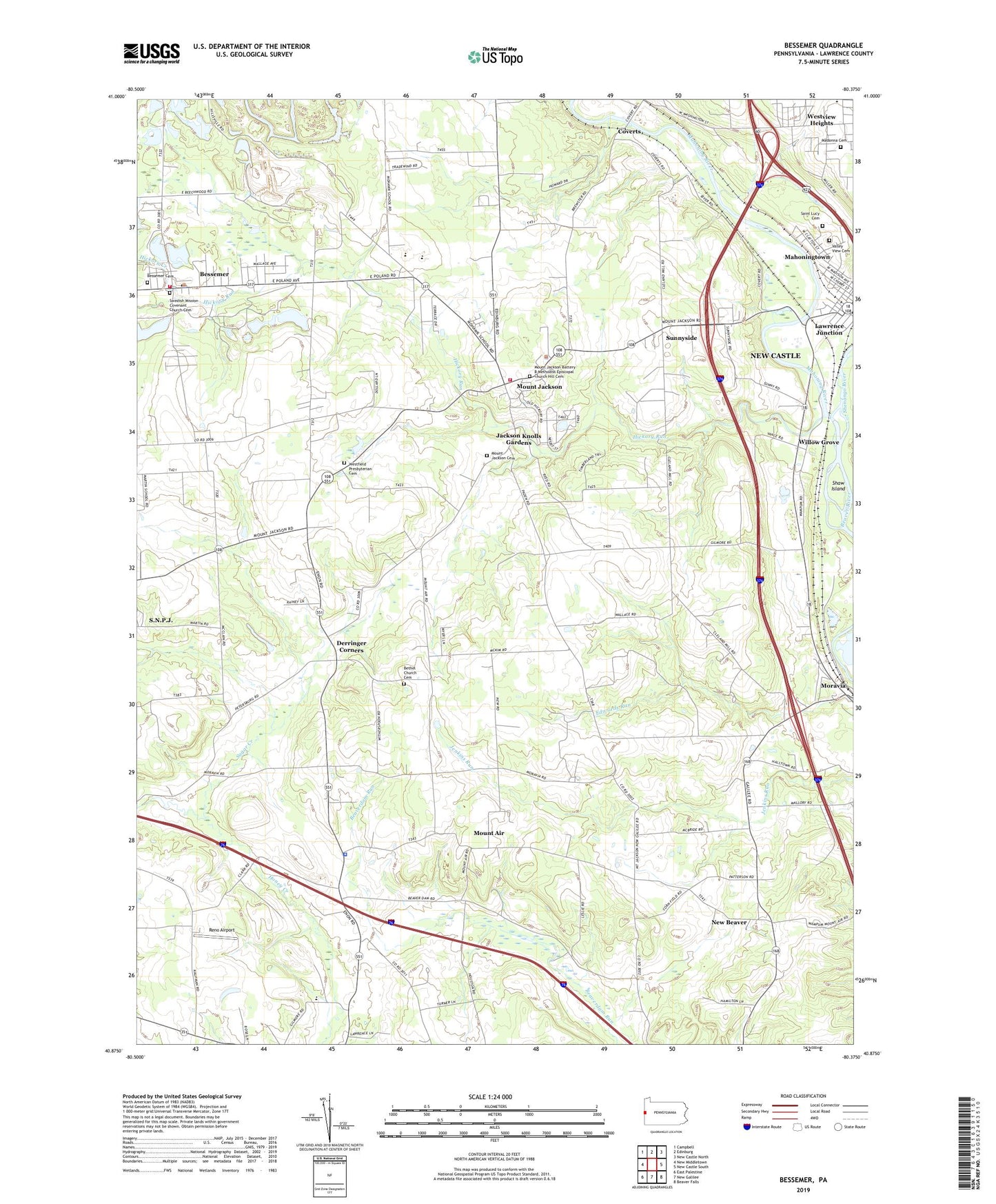
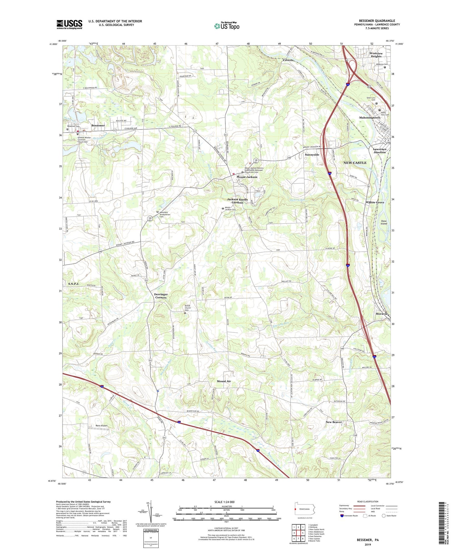
2019 topographic map quadrangle Bessemer in the state of Pennsylvania. Scale: 1:24000. Based on the newly updated USGS 7.5' US Topo map series, this map is in the following counties: Lawrence. The map contains contour data, water features, and other items you are used to seeing on USGS maps, but also has updated roads and other features. This is the next generation of topographic maps. Printed on high-quality waterproof paper with UV fade-resistant inks.
Quads adjacent to this one:
West: New Middletown
Northwest: Campbell
North: Edinburg
Northeast: New Castle North
East: New Castle South
Southeast: Beaver Falls
South: New Galilee
Southwest: East Palestine
Contains the following named places: Bessemer, Bessemer Boro Police Department, Bessemer Cemetery, Bessemer Post Office, Bessemer Volunteer Fire Company Station 400, Bethel Church Cemetery, Borough of Bessemer, Borough of S.N.P.J., Coverts, Derringer Corners, Evans Airport, Gwin Airport, Hickory Creek, Hickory Run, Jackson Knolls Gardens, Kimmel Airport, Lawrence Junction, Little Beaver Police Department, Madonna Cemetery, Mahoning River, Moravia, Mount Air, Mount Jackson, Mount Jackson Battery B Methodist Episcopal Church Hill Cemetery, Mount Jackson Cemetery, North Beaver Township Police Department, North Beaver Township Volunteer Fire Department Station 700, Reno Airport, Saint Lucy Cemetery, Shaw Island, Shenango River, Sugar Creek, Sunnyside, Swedish Mission Covenant Church Cemetery, Township of Little Beaver, Township of North Beaver, Turner Poultry Farm, Union Area High School, Union Area Middle School, Union Memorial Elementary School, Valley View Cemetery, WBZY-AM (New Castle), Westfield Presbyterian Cemetery, Westview Heights, Willow Grove, ZIP Codes: 16102, 16112, 16120