MyTopo
Claysville Pennsylvania US Topo Map
Couldn't load pickup availability
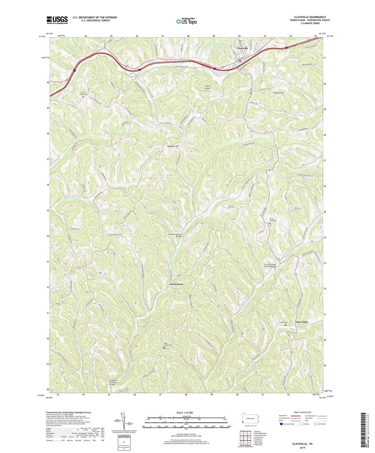
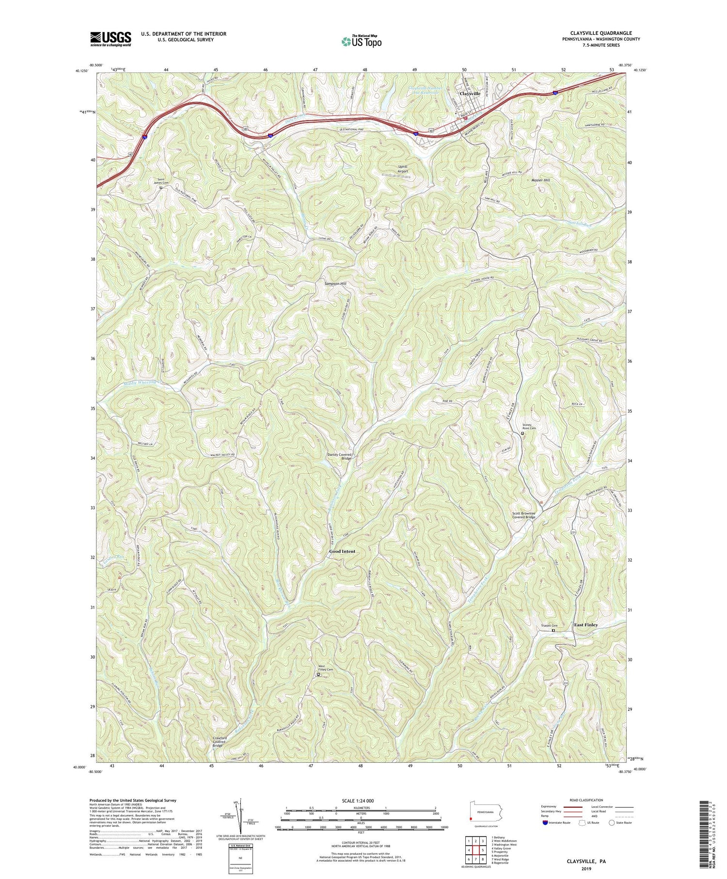
2019 topographic map quadrangle Claysville in the state of Pennsylvania. Scale: 1:24000. Based on the newly updated USGS 7.5' US Topo map series, this map is in the following counties: Washington. The map contains contour data, water features, and other items you are used to seeing on USGS maps, but also has updated roads and other features. This is the next generation of topographic maps. Printed on high-quality waterproof paper with UV fade-resistant inks.
Quads adjacent to this one:
West: Valley Grove
Northwest: Bethany
North: West Middletown
Northeast: Washington West
East: Prosperity
Southeast: Rogersville
South: Wind Ridge
Southwest: Majorsville
Contains the following named places: Blockhouse Run, Bonar Creek, Borough of Claysville, Claysville, Claysville Fire Rescue Station 31, Claysville Number One Dam, Claysville Number One Reservoir, Claysville Post Office, Coon Island, Coon Island Post Office, Crawford Covered Bridge, Danley Covered Bridge, Double Dam Golf Course, East Finley, East-West Finley School, Fairmount Church, Good Intent, Hair Schoolhouse, Jordan School, Kimmins Schoolhouse, Mosier Hill, Pa-661 Dam, Saint James Cemetery, Sampson Hill, Sawhill Schoolhouse, Scott Brownlee Covered Bridge, State Game Lands Number 245, Stoney Point Cemetery, Stony Point Schoolhouse, Township of East Finley, Township of West Finley, Trussell Cemetery, Uphill Airport, West Finley Cemetery, Wheeling Hill Church, Windy Gap Church, ZIP Codes: 15323, 15376