MyTopo
Damascus Pennsylvania US Topo Map
Couldn't load pickup availability
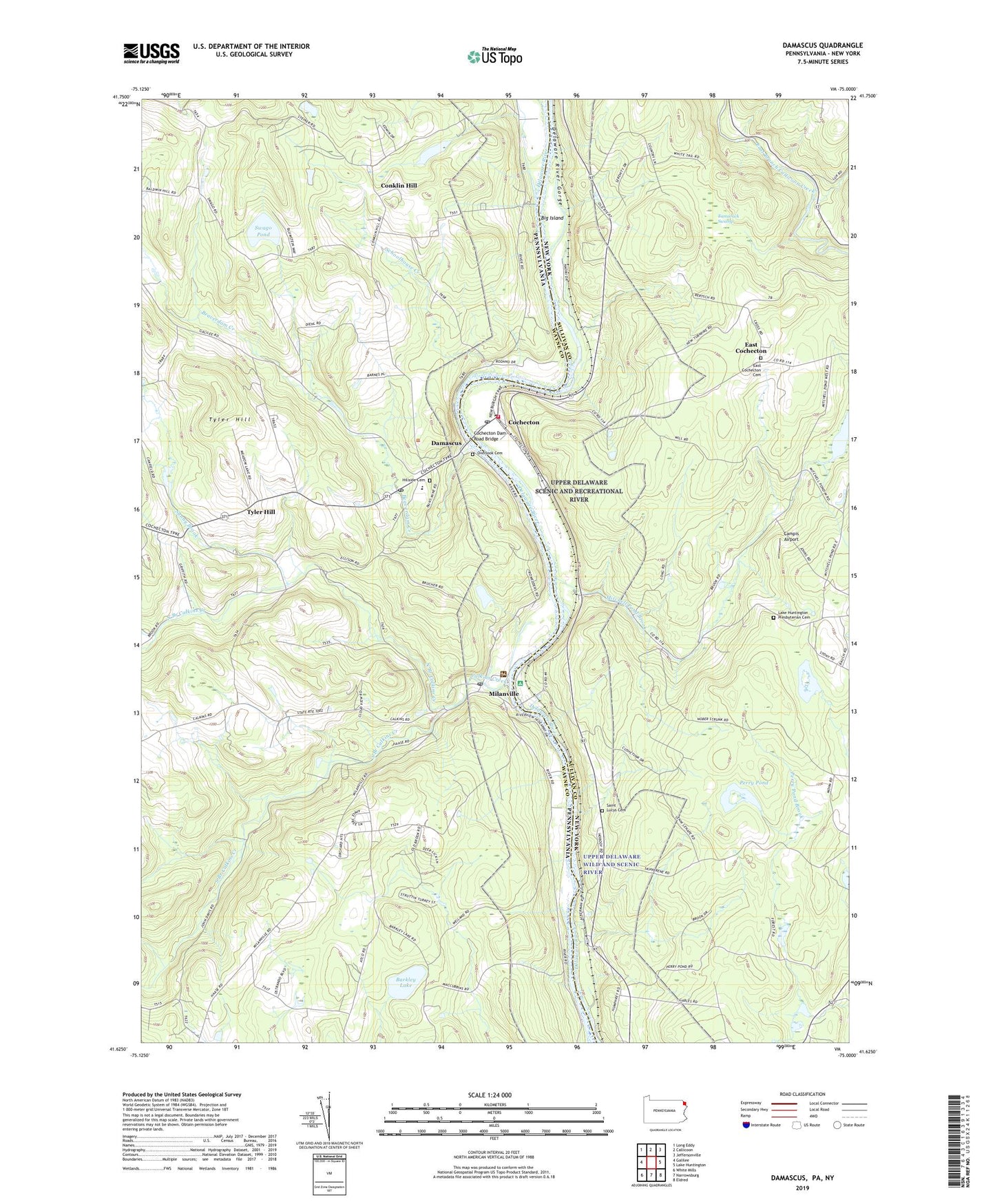
2019 topographic map quadrangle Damascus in the states of Pennsylvania, New York. Scale: 1:24000. Based on the newly updated USGS 7.5' US Topo map series, this map is in the following counties: Wayne, Sullivan. The map contains contour data, water features, and other items you are used to seeing on USGS maps, but also has updated roads and other features. This is the next generation of topographic maps. Printed on high-quality waterproof paper with UV fade-resistant inks.
Quads adjacent to this one:
West: Galilee
Northwest: Long Eddy
North: Callicoon
Northeast: Jeffersonville
East: Lake Huntington
Southeast: Eldred
South: Narrowsburg
Southwest: White Mills
Contains the following named places: Barkley Lake, Beaverdam Creek, Big Island, Calkins Creek, Campis Airport, Cochecton, Cochecton Dam Road Bridge, Cochecton Post Office, Conklin Hill, Damascus, Damascus Post Office, Damascus Township Volunteer Ambulance Corps, East Cochecton, East Cochecton Cemetery, Hillside Cemetery, Lake Huntington Presbyterian Cemetery, Lake Huntington Volunteer Fire Company Station 3, Milanville, Milanville Post Office, Mitchell Pond, Mitchell Pond Brook, Nobody Station, North Branch Calkins Creek, Overlook Cemetery, Perry Pond, Riverside School, Saint Lucys Cemetery, Saint Lucys Church, Schoolhouse Creek, Skinners Falls, Smith Switch, South Branch Calkins Creek, Stanton Corner, Sunny Brook, Swago Pond, Tamarack Swamp, Tyler Hill, Upper Delaware Wild and Scenic River, Upper Tyler Hill Dam, ZIP Codes: 12726, 18415, 18443