MyTopo
Hickory Run Pennsylvania US Topo Map
Couldn't load pickup availability
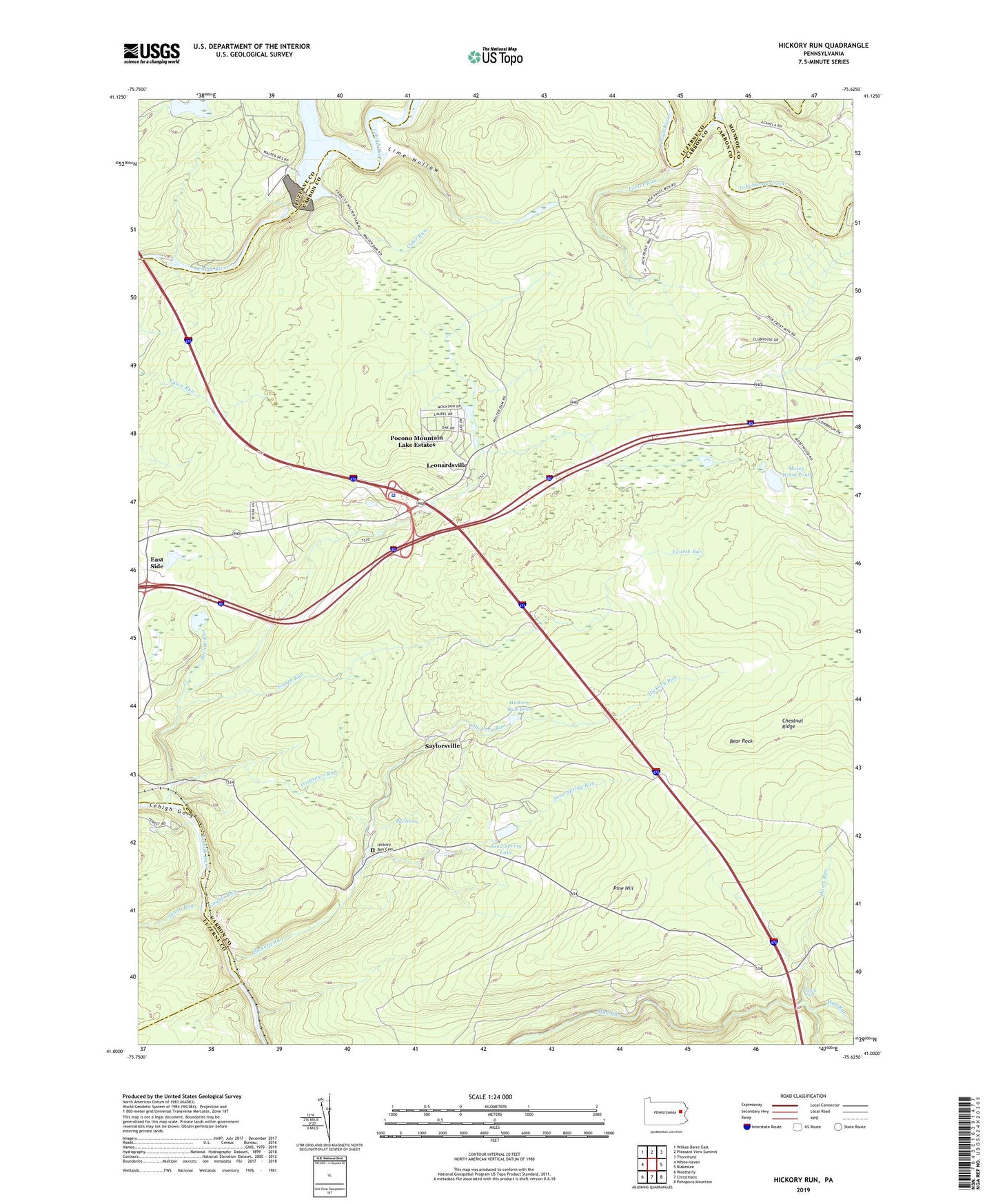
2019 topographic map quadrangle Hickory Run in the state of Pennsylvania. Scale: 1:24000. Based on the newly updated USGS 7.5' US Topo map series, this map is in the following counties: Carbon, Luzerne, Monroe. The map contains contour data, water features, and other items you are used to seeing on USGS maps, but also has updated roads and other features. This is the next generation of topographic maps. Printed on high-quality waterproof paper with UV fade-resistant inks.
Quads adjacent to this one:
West: White Haven
Northwest: Wilkes-Barre East
North: Pleasant View Summit
Northeast: Thornhurst
East: Blakeslee
Southeast: Pohopoco Mountain
South: Christmans
Southwest: Weatherly
Contains the following named places: Bear Creek, Bear Rock, Big Spring, Black Creek, Boulder Field, Boulder Field Trail, Camp Acahela, CCC Dam, Chestnut Ridge, Cider Run, Fishery School, Fourth Run, Francis E Walter Dam, Francis E Walter Reservoir, Goulds Run, Hawk Falls, Hawk Run, Hickory Run, Hickory Run Cemetery, Hickory Run Dam, Hickory Run Lake, Hickory Run Park Dam, Hickory Run School, Hickory Run State Park, Irishtown Run, Jack Frost Mountain Ski Area, Leonardsville, Lime Hollow, Mosey Wood Pond, Panther Creek, Pennsylvania State Police Troop T Pocono Station, Pine Hill, Pine View Dam, Pocono Mountain Lake Estates, Porter Run, Sand Spring Lake, Sand Spring Run, Sandy Run, Saylorsville, Saylorsville Dam, Shanty Run, Stametz Dam, State Game Lands Number 149, State Game Lands Number 40, Stony Point Tower, Tobyhanna Creek, Township of Kidder, ZIP Codes: 18624, 18661