MyTopo
New Baltimore Pennsylvania US Topo Map
Couldn't load pickup availability
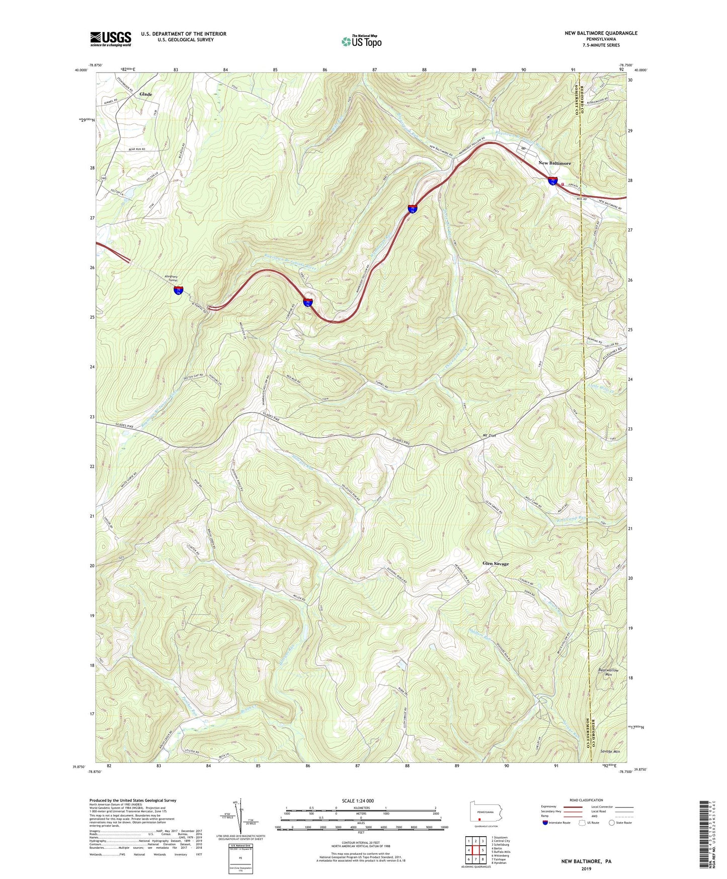
2019 topographic map quadrangle New Baltimore in the state of Pennsylvania. Scale: 1:24000. Based on the newly updated USGS 7.5' US Topo map series, this map is in the following counties: Somerset, Bedford. The map contains contour data, water features, and other items you are used to seeing on USGS maps, but also has updated roads and other features. This is the next generation of topographic maps. Printed on high-quality waterproof paper with UV fade-resistant inks.
Quads adjacent to this one:
West: Berlin
Northwest: Stoystown
North: Central City
Northeast: Schellsburg
East: Buffalo Mills
Southeast: Hyndman
South: Fairhope
Southwest: Wittenberg
Contains the following named places: Allegheny Tunnel, Bearwallow Mountain, Borough of New Baltimore, Breastwork Run, Bruck Run, Deeters Gap, Dividing Ridge, Emrick School, Glade, Glen Savage, Herman School, Hillegas Run, Mount Healthy Post Office, Mount Olive Church, Mount Zion, New Baltimore, New Baltimore and Area Volunteer Fire Department - Station 629, New Baltimore Post Office, Panther Run, Pine School, Saint Johns Church, Saint Lukes Church, Sarver Church, Savage Run, State Game Lands Number 104, Suhrie School, Three Lick Run, Township of Allegheny, Wambaugh Run, Warner School, Wills Run, Wills School