MyTopo
Overton Pennsylvania US Topo Map
Couldn't load pickup availability
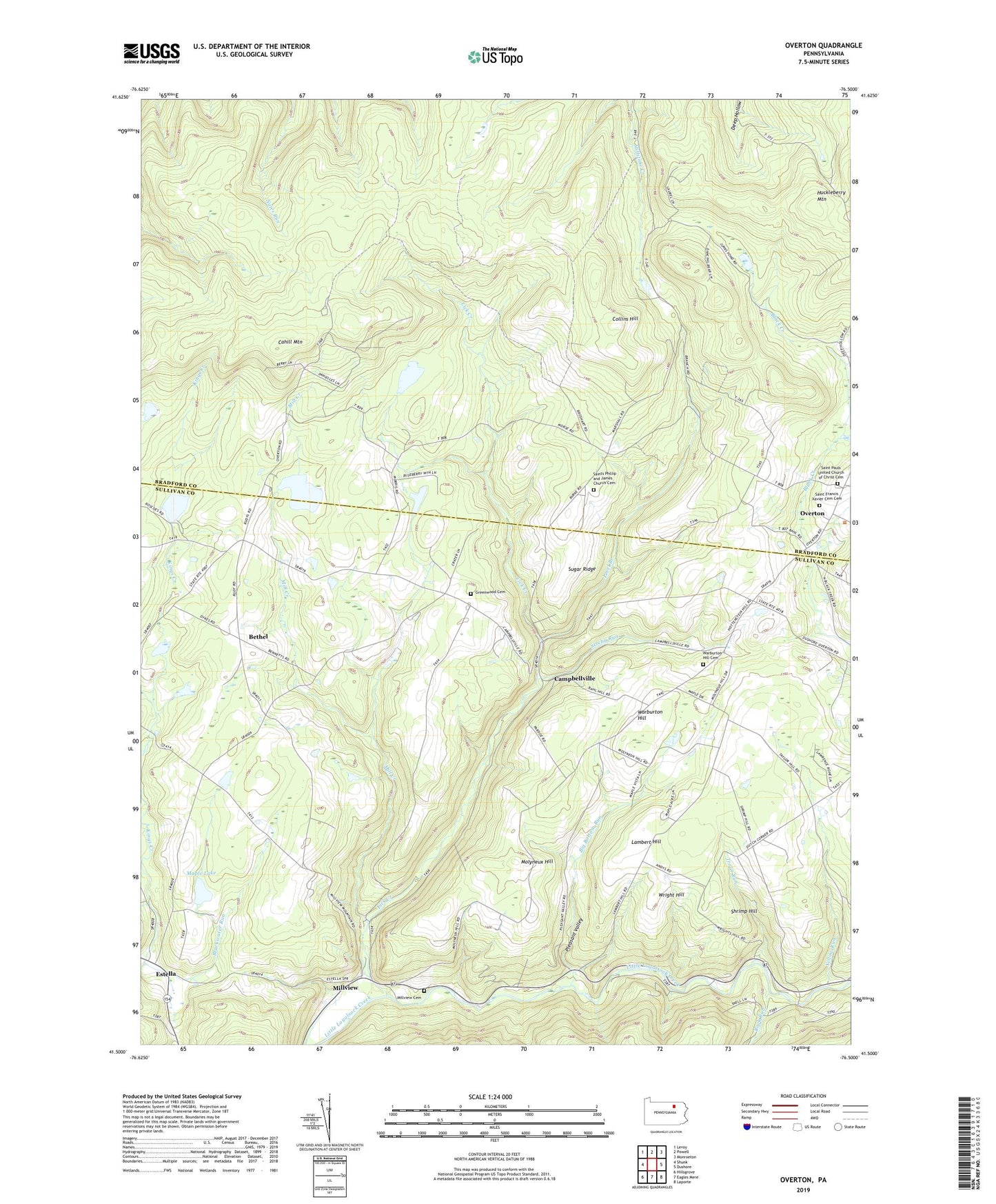
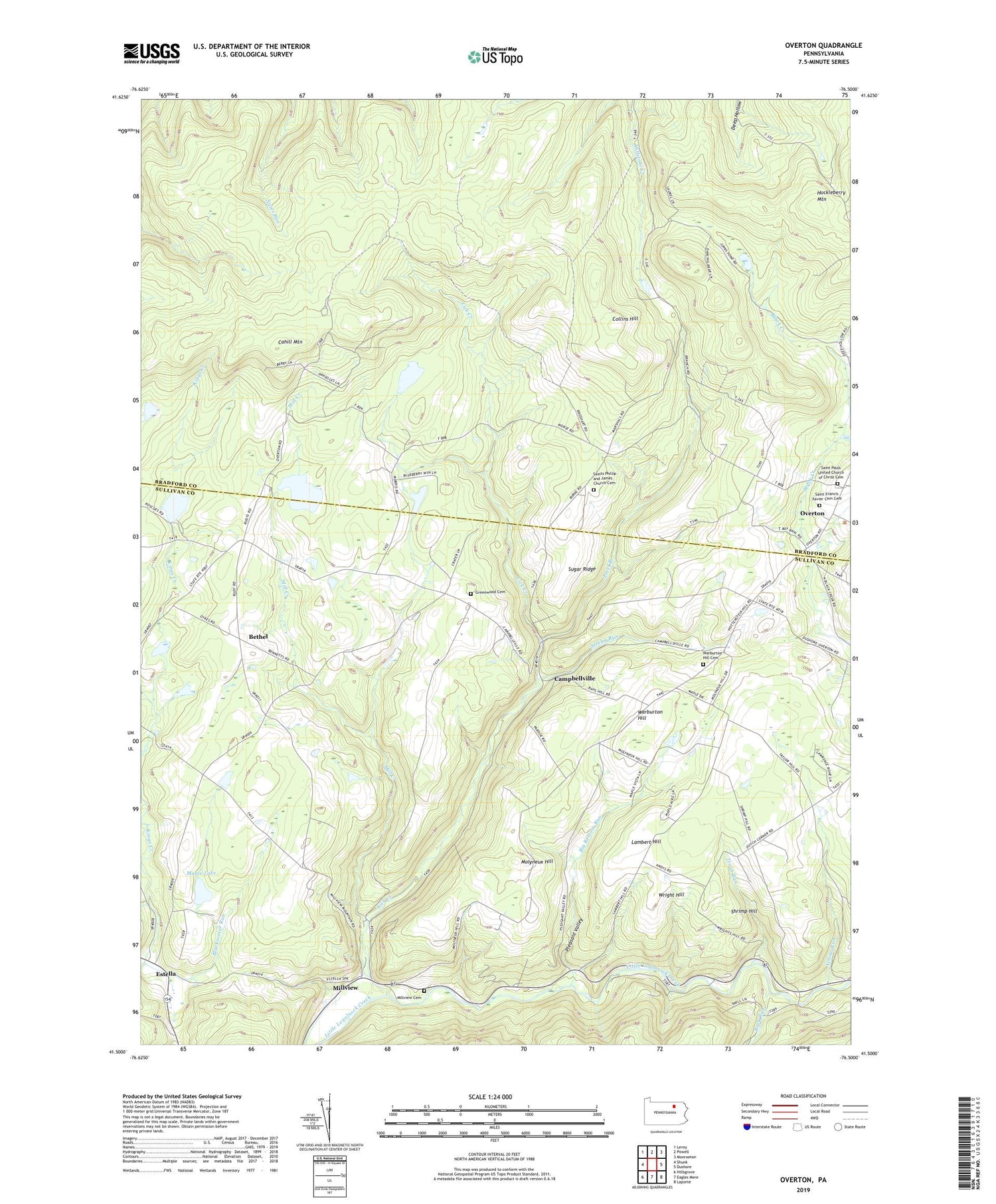
2019 topographic map quadrangle Overton in the state of Pennsylvania. Scale: 1:24000. Based on the newly updated USGS 7.5' US Topo map series, this map is in the following counties: Sullivan, Bradford. The map contains contour data, water features, and other items you are used to seeing on USGS maps, but also has updated roads and other features. This is the next generation of topographic maps. Printed on high-quality waterproof paper with UV fade-resistant inks.
Quads adjacent to this one:
West: Shunk
Northwest: Leroy
North: Powell
Northeast: Monroeton
East: Dushore
Southeast: Laporte
South: Eagles Mere
Southwest: Hillsgrove
Contains the following named places: Bedford Corners, Bethel, Big Bottom Run, Blackwater Run, Burgess Pond, Cahill Mountain, Campbellville, Collins Hill, East Forks Union Cemetery, Elkland School, Estella, Greenwood Cemetery, Huckleberry Mountain, Hugos Corners, Kahill Fire Tower, Kings Creek, Lambert Hill, Level Branch, Lick Creek, Maple Lake, Maple Lake Dam, Mill Creek, Millview, Millview Cemetery, Molyneux Hill, Overton, Pleasant Valley, Pleasant Valley School, Rock Run, Roscoe Burgess Dam, Saint Francis Xavier Cemetery, Saint Pauls Church, Saint Pauls United Church of Christ Cemetery, Saint Peters Church, Saints Phillip and James Church Cemetery, Shrimp Hill, Streby Run, Sugar Ridge, Sugar Ridge Church, Township of Forks, Township of Overton, Trout Run, Vought Corners, Warburton Hill, Warburton Hill School, Wright Hill, Yellow Run