MyTopo
Springville Pennsylvania US Topo Map
Couldn't load pickup availability
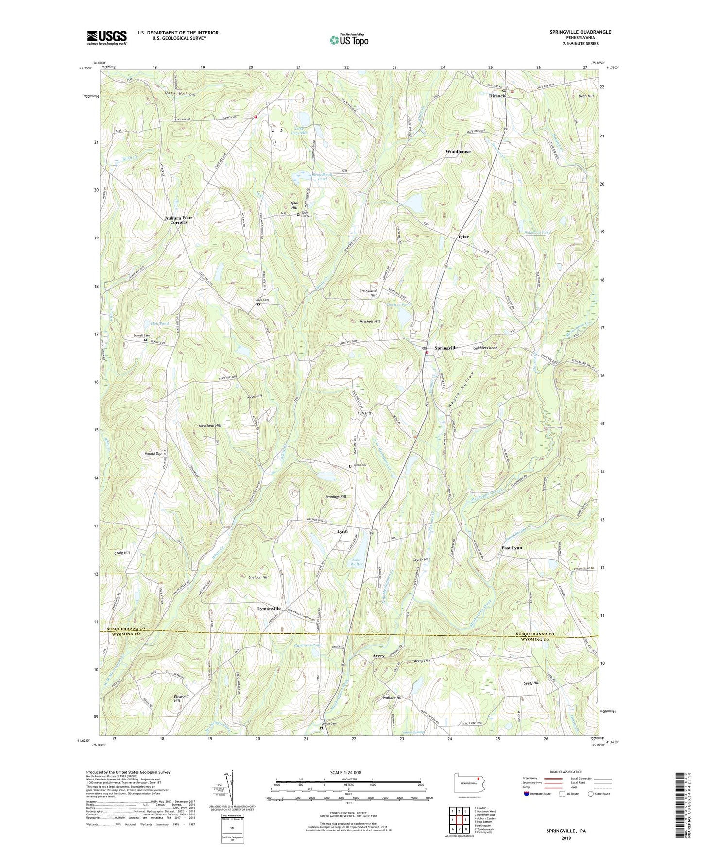
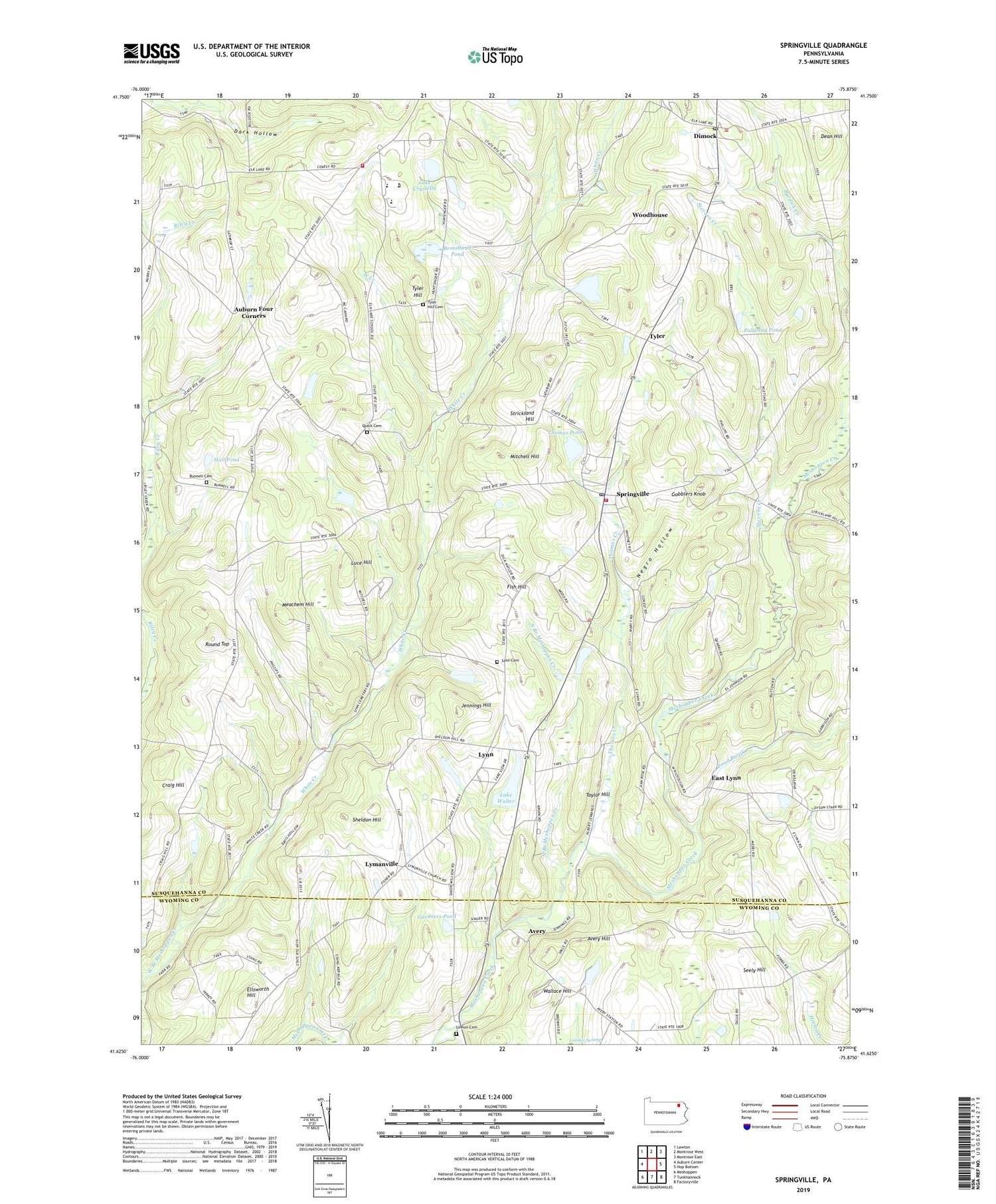
2019 topographic map quadrangle Springville in the state of Pennsylvania. Scale: 1:24000. Based on the newly updated USGS 7.5' US Topo map series, this map is in the following counties: Susquehanna, Wyoming. The map contains contour data, water features, and other items you are used to seeing on USGS maps, but also has updated roads and other features. This is the next generation of topographic maps. Printed on high-quality waterproof paper with UV fade-resistant inks.
Quads adjacent to this one:
West: Auburn Center
Northwest: Lawton
North: Montrose West
Northeast: Montrose East
East: Hop Bottom
Southeast: Factoryville
South: Tunkhannock
Southwest: Meshoppen
Contains the following named places: Auburn Four Corners, Avery, Avery Hill, Bennett Corners, Broadhead Pond, Bunnell Cemetery, Clark Cemetery, Craig Hill, Dark Hollow, Dean Hill, Dimock, Dimock Post Office, Dimock Station, East Lynn, Elk Lake Volunteer Fire Company, Ellsworth Hill, Fish Hill, Gardners Pond, Gobblers Knob, Hall Pond, Jennings Hill, Kasson Corners, Lake Crystella, Lake Walter, Lake Walter Dam, Loomis Swamp, Luce Hill, Lymanville, Lynn, Lynn Cemetery, Lynn Station, Meachem Hill, Mitchell Hill, Negro Hollow, North Branch Meshoppen Creek, Pa-Rc and D-105 Dam, Pollywog Pond, Pond Brook, Quick Cemetery, Round Top, Schlessers Corners, Seely Hill, Sheldon Hill, Springville, Springville Post Office, Springville Volunteer Fire Company, States Mill Pond, Stevens Creek, Strickland Hill, Taylor Hill, Thomas Creek, Thomas Pond, Township of Dimock, Township of Springville, Tyler, Tyler Hill, Tyler Hill Cemetery, Wallace Hill, Wallace Hill School, West Creek, White Creek, Woodhouse, ZIP Code: 18844