MyTopo
Sugar Lake Pennsylvania US Topo Map
Couldn't load pickup availability
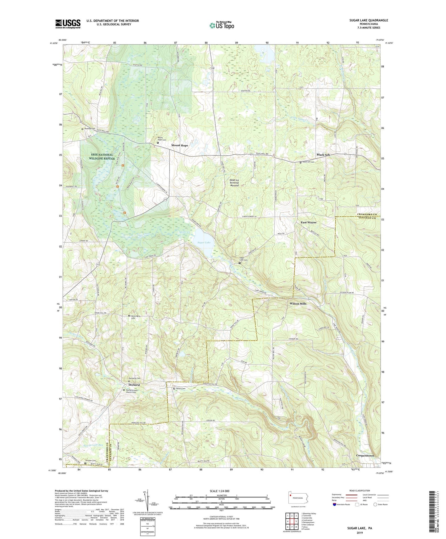
2019 topographic map quadrangle Sugar Lake in the state of Pennsylvania. Scale: 1:24000. Based on the newly updated USGS 7.5' US Topo map series, this map is in the following counties: Crawford, Venango. The map contains contour data, water features, and other items you are used to seeing on USGS maps, but also has updated roads and other features. This is the next generation of topographic maps. Printed on high-quality waterproof paper with UV fade-resistant inks.
Quads adjacent to this one:
West: Cochranton
Northwest: Blooming Valley
North: Townville
Northeast: Centerville
East: Dempseytown
Southeast: Franklin
South: Utica
Southwest: New Lebanon
Contains the following named places: Black Ash, Black Ash Cemetery, Black Ash Church, Brawley Cemetery, Brawley Run, Dead-Ice Terminal Moraine, Deckard, Deckards Cemetery, Dennington Cemetery, Donation Hill Church, Donation School, Drake School, East Wayne, Erie National Wildlife Refuge, Erie NWR Pool Number Nine, Erie NWR Pool Number Seven, Little Sugar Creek, Little Sugar Creek Dam, Maple Cave Park Airport, McCauley Run, McDaniel Church, McDaniels School, Mount Hope, Mount Hope Cemetery, Mount Hope Church, Mount Joy Church, Mount Joy School, Mount Pleasant Church, Mount Pleasant School, Oakes School, Old Reformed Church Cemetery, Peters Cemetery, Peters School, Raughs Corners, Saint Johns Church, Seceder Cemetery, Sugar Grove School, Sugar Lake, Sugar Lake Cemetery, Sugar Lake Church, Sugar Lake School, Township of Jackson, Township of Wayne, Trout Run, Trout Run School, Wilson Mills