
MyTopo
The Knobs Pennsylvania US Topo Map
Couldn't load pickup availability
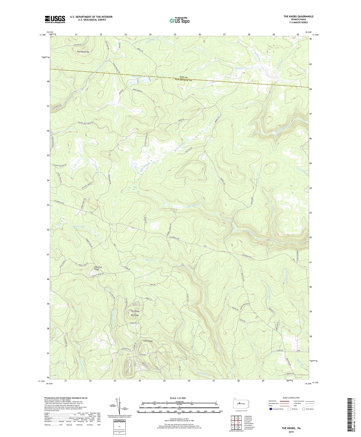
2019 topographic map quadrangle The Knobs in the state of Pennsylvania. Scale: 1:24000. Based on the newly updated USGS 7.5' US Topo map series, this map is in the following counties: Clearfield, Elk. The map contains contour data, water features, and other items you are used to seeing on USGS maps, but also has updated roads and other features. This is the next generation of topographic maps. Printed on high-quality waterproof paper with UV fade-resistant inks.
Quads adjacent to this one:
West: Huntley
Northwest: Weedville
North: Dents Run
Northeast: Driftwood
East: Devils Elbow
Southeast: Frenchville
South: Lecontes Mills
Southwest: Clearfield
Contains the following named places: Beaver Run, Big Knob, Chestnut Ridge, Deserter Run, Duck Marshes, Gifford Dam, Little Knob, Little Sandy Run, McNerney Dam, McNerney Run, Old Round Top, Pebble Run, State Game Lands Number 34, The Knobs, The Knobs Fire Tower, Township of Girard, ZIP Code: 16836


