MyTopo
Tidioute Pennsylvania US Topo Map
Couldn't load pickup availability
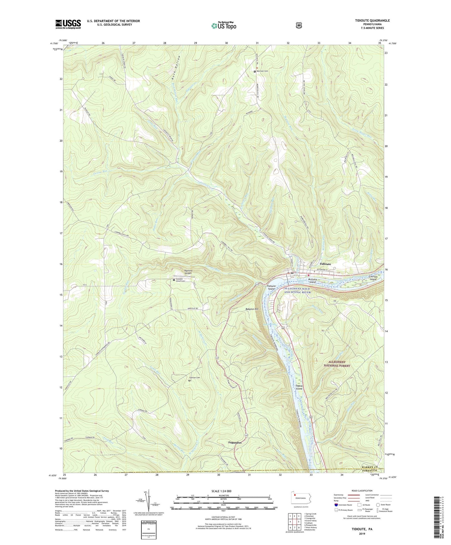
2019 topographic map quadrangle Tidioute in the state of Pennsylvania. Scale: 1:24000. Based on the newly updated USGS 7.5' US Topo map series, this map is in the following counties: Warren, Forest. The map contains contour data, water features, and other items you are used to seeing on USGS maps, but also has updated roads and other features. This is the next generation of topographic maps. Printed on high-quality waterproof paper with UV fade-resistant inks.
Quads adjacent to this one:
West: Grand Valley
Northwest: Spring Creek
North: Pittsfield
Northeast: Youngsville
East: Cobham
Southeast: Kellettville
South: West Hickory
Southwest: Pleasantville
Contains the following named places: Babylon, Babylon Hill, Borough of Tidioute, Cochener Run, Courson Eddy, Courson Island, Dale Run, Dennis Run, Dunn Run, Eagle, Economite Hill, Excelsior Corner, Fagundus, Fuellhart Run, Funkville, George Run, Gilmore Run, Gordon Run, Gorman Cemetery, Gorman School, Grandin, Grove Run, Hemlock, Jones Run, Lamb Run, Lower Eddy, Martin Run, McGraw Corners, McGraw School, McGuire Island, McGuire Run, McGuire School, Morrison Hill School, Myers Run, Pedler Run, Pleasant Grove School, Potter Run, Rigrtona Airport, Rock Hollow, Rock Hollow Run, Russian Houses, Siggias Island, Sutton Corners, Sutton Hill Cemetery, Sutton Hill School, Tidioute, Tidioute Area Volunteer Fire Department Station 71, Tidioute Borough Police Department, Tidioute Creek, Tidioute Eddy, Tidioute Elementary School, Tidioute High School, Tidioute Island, Tidioute Overlook, Tidioute Post Office, Township of Deerfield, Township of Triumph, Triumph, Triumph School, Triumph Swedish Union Church Cemetery, White School, Whitehead Corners