MyTopo
Waterford Pennsylvania US Topo Map
Couldn't load pickup availability
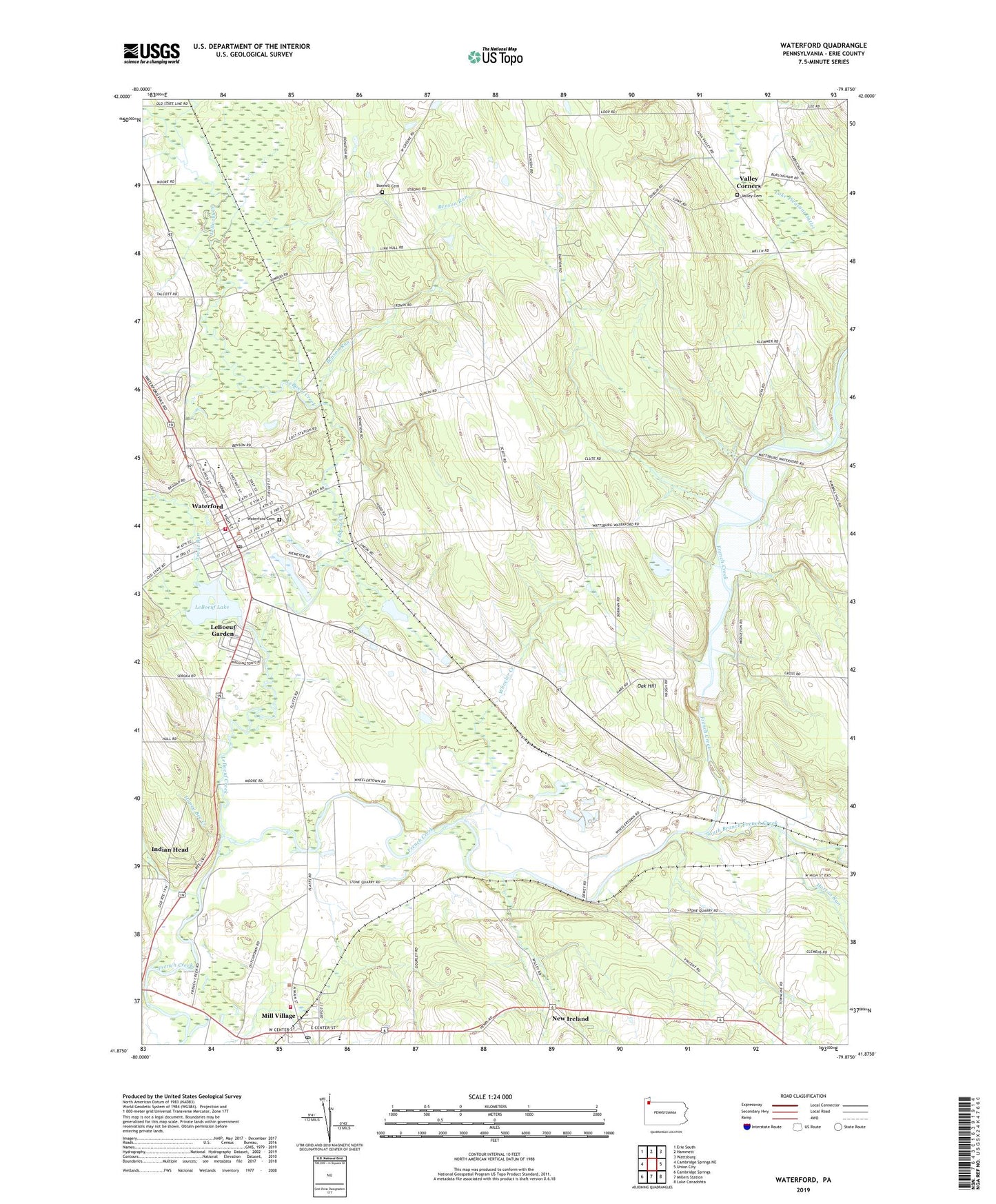
2019 topographic map quadrangle Waterford in the state of Pennsylvania. Scale: 1:24000. Based on the newly updated USGS 7.5' US Topo map series, this map is in the following counties: Erie. The map contains contour data, water features, and other items you are used to seeing on USGS maps, but also has updated roads and other features. This is the next generation of topographic maps. Printed on high-quality waterproof paper with UV fade-resistant inks.
Quads adjacent to this one:
West: Cambridge Springs NE
Northwest: Erie South
North: Hammett
Northeast: Wattsburg
East: Union City
Southeast: Lake Canadohta
South: Millers Station
Southwest: Cambridge Springs
Contains the following named places: Barton School, Benson Run, Bonnell Cemetery, Bonnell School, Borough of Mill Village, Borough of Waterford, East Branch LeBoeuf Creek, Fort LeBoeuf Senior High School, Glover Farms, Hartner Farm, Honey Bee Creek, Hoover School, Horton Run, Indian Head, Kibbe Farms, LeBoeuf, LeBoeuf Creek, LeBoeuf Garden, LeBoeuf Lake, Maham School, Middleton School, Mill Village, Mill Village Post Office, Mill Village Volunteer Fire Company Department 37, New Ireland, Oak Grove School, Oak Hill, Port Farms, Risjan Dairy Farm, Saint Cyprians Church, South Branch French Creek, Stancliff Hose Company Station 14, State Game Lands Number 109, State Game Lands Number 190, Townline School, Township of LeBoeuf, Township of Waterford, Trout Run, Troyer Pit Number 1, Union City Dam, Union City Lake, Valley Cemetery, Valley Corners, Waterford, Waterford Cemetery, Waterford Post Office, Waterford Public Library, Waterford Station, Wheeler Creek, ZIP Codes: 16427, 16441