MyTopo
Westline Pennsylvania US Topo Map
Couldn't load pickup availability
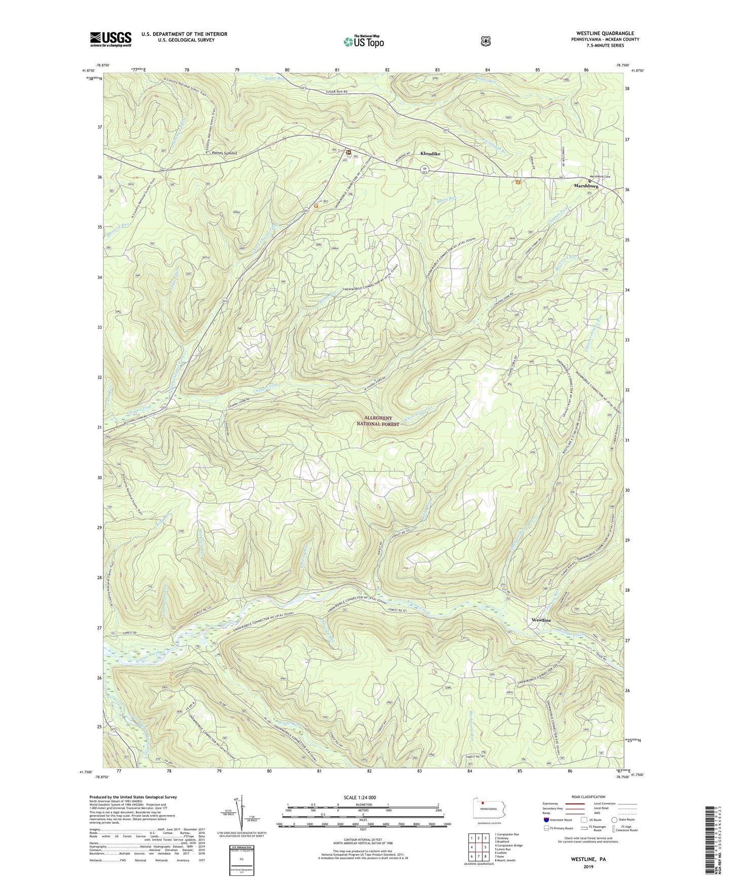
2019 topographic map quadrangle Westline in the state of Pennsylvania. Scale: 1:24000. Based on the newly updated USGS 7.5' US Topo map series, this map is in the following counties: McKean. The map contains contour data, water features, and other items you are used to seeing on USGS maps, but also has updated roads and other features. This is the next generation of topographic maps. Printed on high-quality waterproof paper with UV fade-resistant inks.
Quads adjacent to this one:
West: Cornplanter Bridge
Northwest: Cornplanter Run
North: Stickney
Northeast: Bradford
East: Lewis Run
Southeast: Mount Jewett
South: Kane
Southwest: Ludlow
Contains the following named places: Big Rock Overflow Area Recreation Site, Bradford Ranger Station, Buck Lick Run, Bump Run, Camp Run, Coon Run, Crary Run, Gunning Run, Hemlock Trail, Indian Run, Kavanaugh Branch, Klondike, Libby Run, Linn Brook, Little Meade Run, Markham Run, Marshburg, Marshburg Cemetery, Meade Run, North Fork Chappel Fork, Paines Summit, Root Run, Thundershower Run, Turnup Run, Westline, White Gravel Creek, Whiting Run, Windfall Run