MyTopo
Furman South Carolina US Topo Map
Couldn't load pickup availability
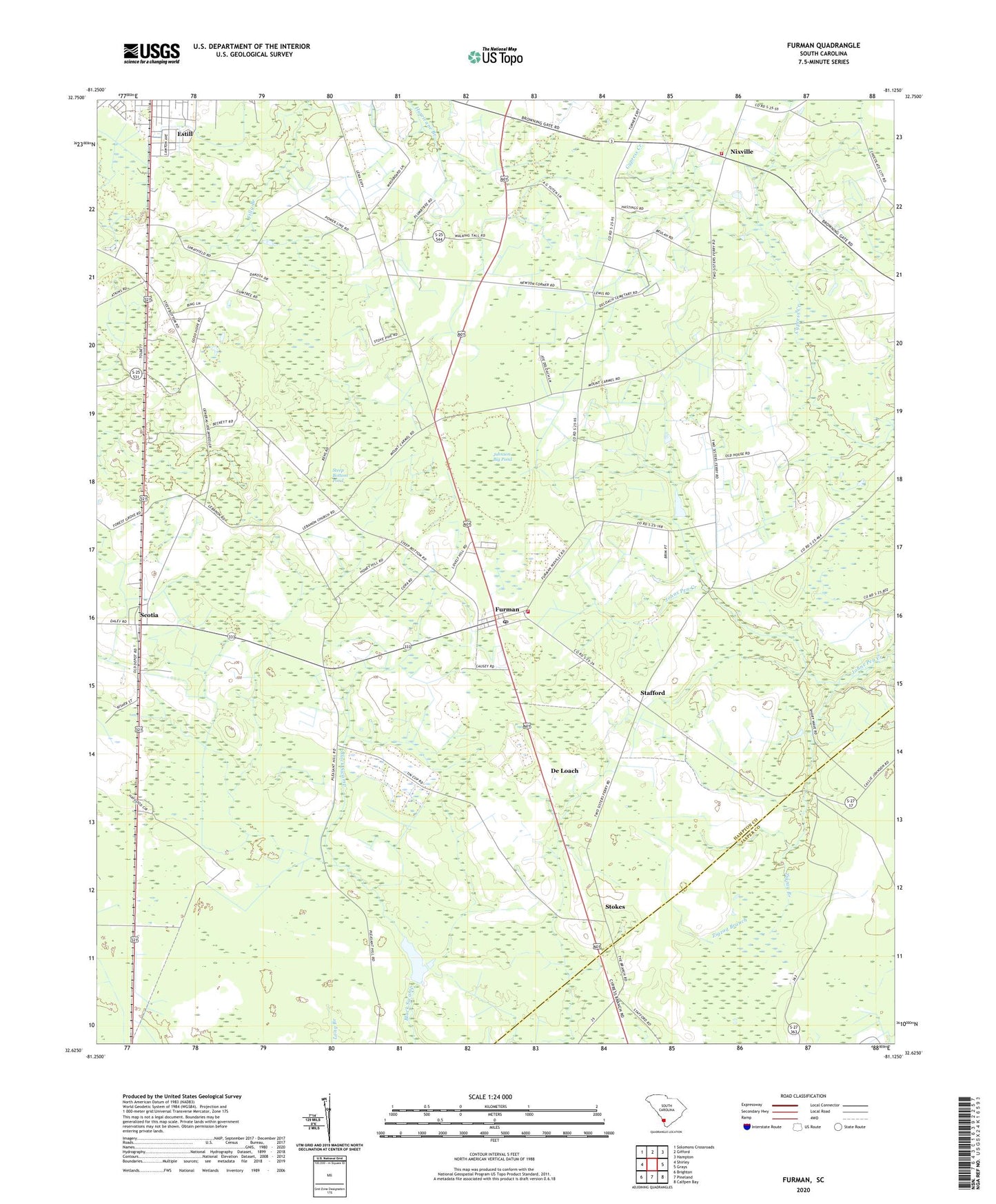
2020 topographic map quadrangle Furman in the state of South Carolina. Scale: 1:24000. Based on the newly updated USGS 7.5' US Topo map series, this map is in the following counties: Hampton, Jasper. The map contains contour data, water features, and other items you are used to seeing on USGS maps, but also has updated roads and other features. This is the next generation of topographic maps. Printed on high-quality waterproof paper with UV fade-resistant inks.
Quads adjacent to this one:
West: Shirley
Northwest: Solomons Crossroads
North: Gifford
Northeast: Hampton
East: Grays
Southeast: Calfpen Bay
South: Pineland
Southwest: Brighton
Contains the following named places: Bishop Grace Church, Buckner School, Crapsedale School, De Loach, Dixon Elementary School, First Estill Baptist Church, Furman, Furman Fire Department Station 30, Furman Post Office, Good Hope Church, Hampton Fire Department Station 80, Horse Pond School, Johnson Big Pond, Jones Pond, Lebanon Church, Nixville, Nixville Church, Nixville School, Pine Savannah School, Russel School, Sanctified Church, Sandy Drain Church, Sandy Drain School, Scotia, Scotia School, Smith Store, South Carolina Noname 25011 D-2604 Dam, South Carolina Noname 25013 D-2612 Dam, Stafford, Stafford Church, Steep Bottom, Steep Bottom Church, Steep Bottom Pond, Stokes, Thankful Church, Town of Furman, Town of Scotia, Zigzag Branch, ZIP Codes: 29918, 29921, 29939