MyTopo
Hartsville South South Carolina US Topo Map
Couldn't load pickup availability
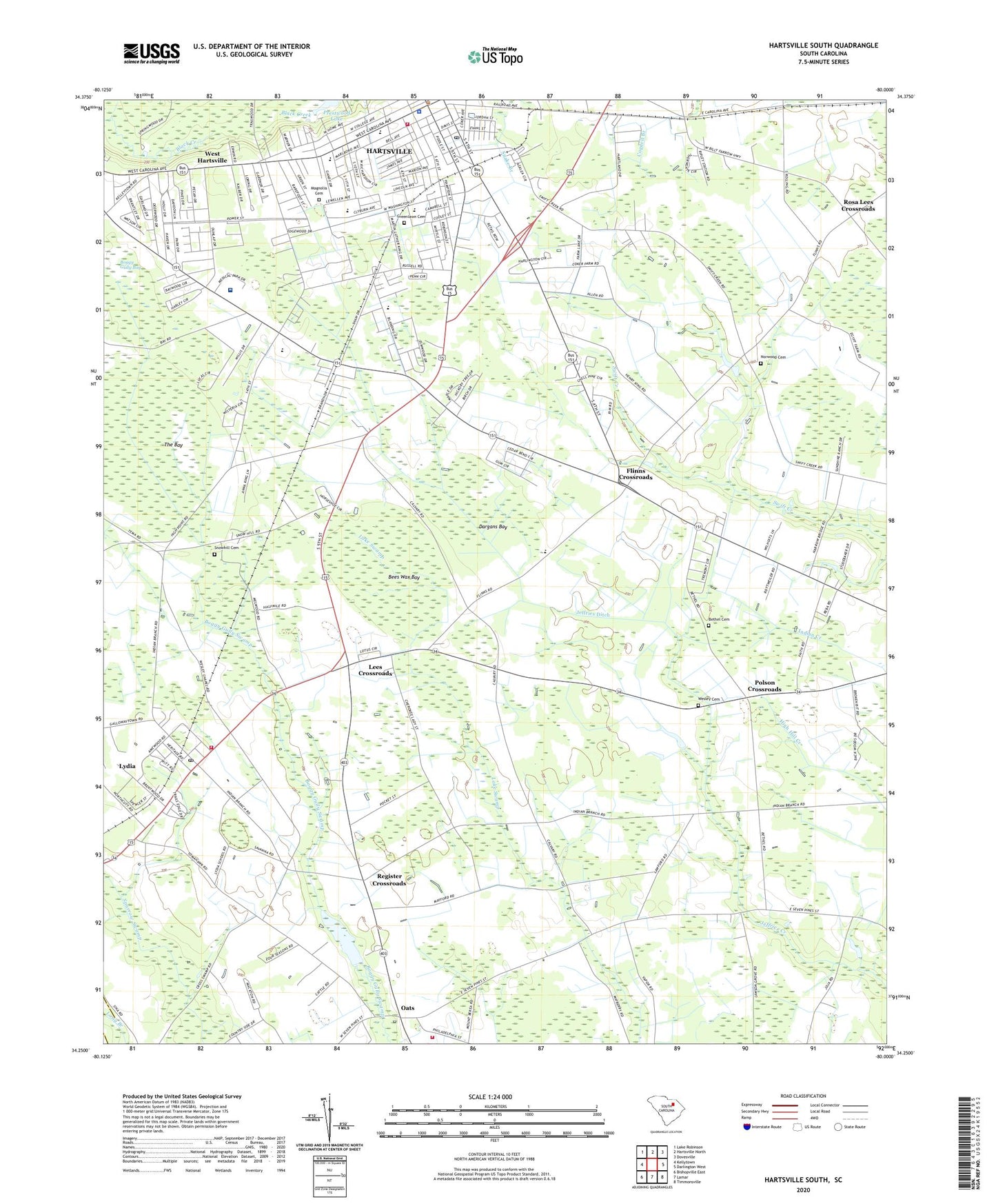
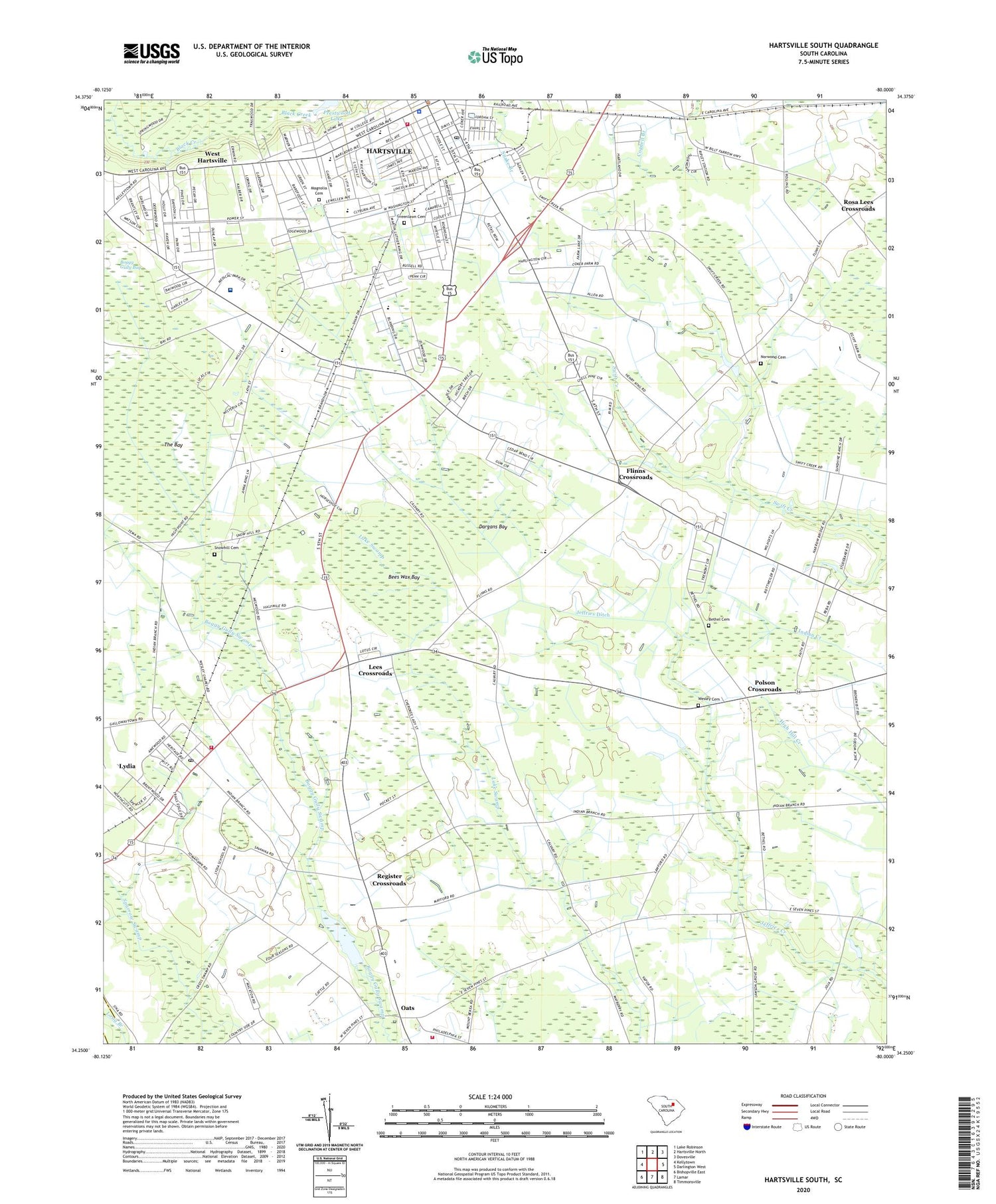
2020 topographic map quadrangle Hartsville South in the state of South Carolina. Scale: 1:24000. Based on the newly updated USGS 7.5' US Topo map series, this map is in the following counties: Darlington, Lee. The map contains contour data, water features, and other items you are used to seeing on USGS maps, but also has updated roads and other features. This is the next generation of topographic maps. Printed on high-quality waterproof paper with UV fade-resistant inks.
Quads adjacent to this one:
West: Kellytown
Northwest: Lake Robinson
North: Hartsville North
Northeast: Dovesville
East: Darlington West
Southeast: Timmonsville
South: Lamar
Southwest: Bishopville East
Contains the following named places: Advent Christian Church, Bees Wax Bay, Berea Church, Bethel Cemetery, Bethel Church, Bethel School, Bladen, Boggy Gully Bay, Butler School, Calvary Church, Carolina Pines Regional Medical Center, Carolina School, Centenary United Methodist Church, Church of God, City of Hartsville, Dargans Bay, Darlington County Fire Department Station 14, Darlington County Fire Department Station 9, Erwin Park, Faith Baptist Church, Fath Church, First Church, First Presbyterian Church, Flinns Crossroads, Forest Acres, Fourth Street Baptist Church, Georgia Estates, Glen Acres, Greenlawn Cemetery, Harolds Millpond, Harrolds Mill, Hartsville, Hartsville Career Center, Hartsville City Hall, Hartsville Division, Hartsville Fire Department, Hartsville Junior High School, Hartsville Mall Shopping Center, Hartsville Police Department, Hartsville Post Office, Hartsville Rescue Squad, Hartsville Senior High School, Holiness Church, Jeffries Ditch, Jerusalem Baptist Church, Kalmia Gardens, Kalmia Place, Kingsville Church, Kingsville Heights, Lakefield Circle, Lakeview Club, Lawson Grove Church, Lees Crossroads, Lydia, Lydia Census Designated Place, Lydia School, Magnolia Cemetery, Meadow Oaks, Mount Calvary Church, Mount Pisgah School, Norwood Cemetery, Oats, Oats School, Philadelphia Lookout Tower, Pine Acres, Polson Crossroads, Register Crossroads, Rosa Lees Crossroads, Saint John School, Saint Johns Church, Saint Lukes Church, Saint Pauls Community Church, Sanctified Holiness Church, Snowhill Cemetery, South Carolina Noname 16015 D-3523 Dam, South Hartsville Church, South Park, Southside Church, Southside School, The Bay, Thomas Hart Academy, Tremont, Trinity Chapel Methodist Episcopal Church, Washington Street Elementary School, Wesley Cemetery, Wesley Chapel, Wesley Chapel Church, Wesley Chapel School, West Hartsville, WHSC-AM (Hartsville), Wildes Pond Dam D-3524, Wilds Pond Dam D-3522, WTNI-AM (Hartsville), ZIP Code: 29079