
MyTopo
Saylors Lake South Carolina US Topo Map
Couldn't load pickup availability
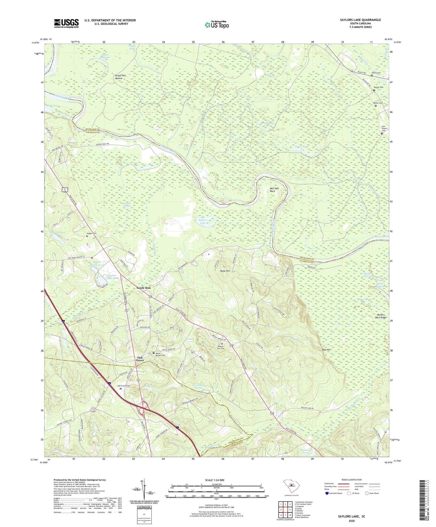
2020 topographic map quadrangle Saylors Lake in the state of South Carolina. Scale: 1:24000. Based on the newly updated USGS 7.5' US Topo map series, this map is in the following counties: Calhoun, Richland, Lexington. The map contains contour data, water features, and other items you are used to seeing on USGS maps, but also has updated roads and other features. This is the next generation of topographic maps. Printed on high-quality waterproof paper with UV fade-resistant inks.
Quads adjacent to this one:
West: Gaston
Northwest: Southwest Columbia
North: Fort Jackson South
Northeast: Congaree
East: Gadsden
Southeast: Saint Matthews
South: Staley Crossroads
Southwest: Swansea
Contains the following named places: Bell Hall Neck, Bethel Cemetery, Beulah Church, Boggy Gully, Branham Branch, Cabin Branch, Culler School, Dead River, Denny Memorial Church, Devils Orchard, Goose Pond, Green Hill Lake, Green Hill Mound, Hagood Church, Haigs Hill, Heyward Church, Heyward School, Jamison Pond, Kaigler Cemetery, Little Beaver Creek, Mill Creek, Mount Moriah Cemetery, Mount Moriah Church, Mount Moriah School, Mount Zion Cemetery, Mount Zion Church, Mullers Barn Ridge, Mullers Little Lake, Mullers Swamp, Myers Cemetery, New Bethel Church, Oak Grove, Oak Grove Cemetery, Oak Grove Church, Red Hill, Roundabout Lake, Ruckers Pond, Sandy Run, Sandy Run Calhoun Fire Department, Sandy Run Lutheran Church, Sandy Run School, Savany Hunt Creek, Saylors Lake, South Carolina Noname 09034 D-2649 Dam, South Carolina Noname 09035 D-2650 Dam, South Carolina Noname 09036 D-2651 Dam, South Carolina Noname 09037 D-2652 Dam, Struckman Pond, Struckman Pond Dam D-2926, Taylors House Pond, Taylors Upper Pond, Weeping Mary Church, Wolf Lake, WRLX-FM (Orangeburg), Zion Church, Zion Pilgrim Cemetery


