MyTopo
Snelling South Carolina US Topo Map
Couldn't load pickup availability
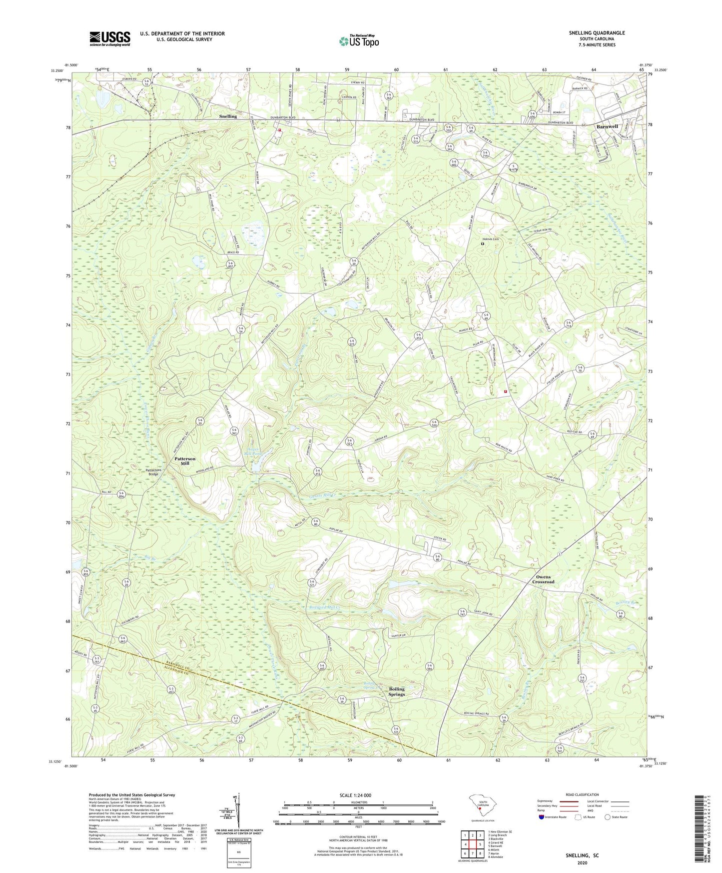
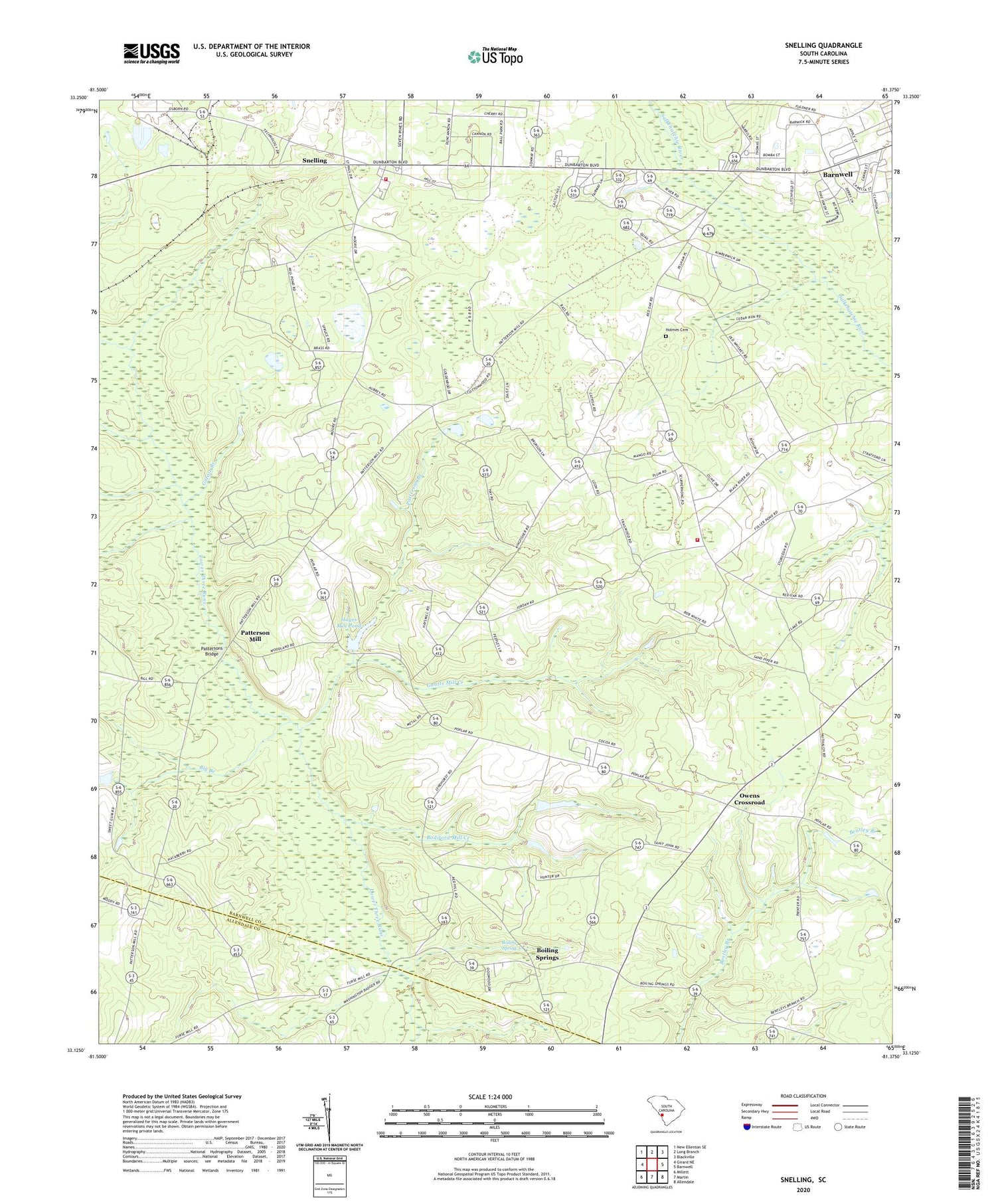
2020 topographic map quadrangle Snelling in the state of South Carolina. Scale: 1:24000. Based on the newly updated USGS 7.5' US Topo map series, this map is in the following counties: Barnwell, Allendale. The map contains contour data, water features, and other items you are used to seeing on USGS maps, but also has updated roads and other features. This is the next generation of topographic maps. Printed on high-quality waterproof paper with UV fade-resistant inks.
Quads adjacent to this one:
West: Girard NE
Northwest: New Ellenton SE
North: Long Branch
Northeast: Blackville
East: Barnwell
Southeast: Allendale
South: Martin
Southwest: Millett
Contains the following named places: Big Branch, Bodiford Mill Creek, Boiling Spring, Boiling Spring School, Boiling Springs, Boiling Springs Presbyterian Church, Diamond School, Ellis Store, Gantts Mill Creek, Gideon Branch, Handberry Pond Dam D-3066, Hayes Mill Pond, Holmes Cemetery, Jordan Baptist Church, Jordan School, New Home Baptist Church, Owens Crossroad, Owens Pond D-3067 Dam, Patterson Branch, Patterson Mill, Patterson Mill School, Pattersons Bridge, Pleasant Mountain Church, Red Branch Baptist Church, Red Oak Fire Department, Saint John School, Saint Johns Baptist Church, Saint Paul Baptist Church, Salem School, Seven Pines Baptist Church, Siloam Church, Snelling, Snelling Volunteer Fire Department, Stinson Bridge, Sweetwater Grove Church, Town of Snelling, Tri-County Shopping Center, Union Church, WEBA-TV (Allendale), ZIP Code: 29812