MyTopo
Snow Island South Carolina US Topo Map
Couldn't load pickup availability
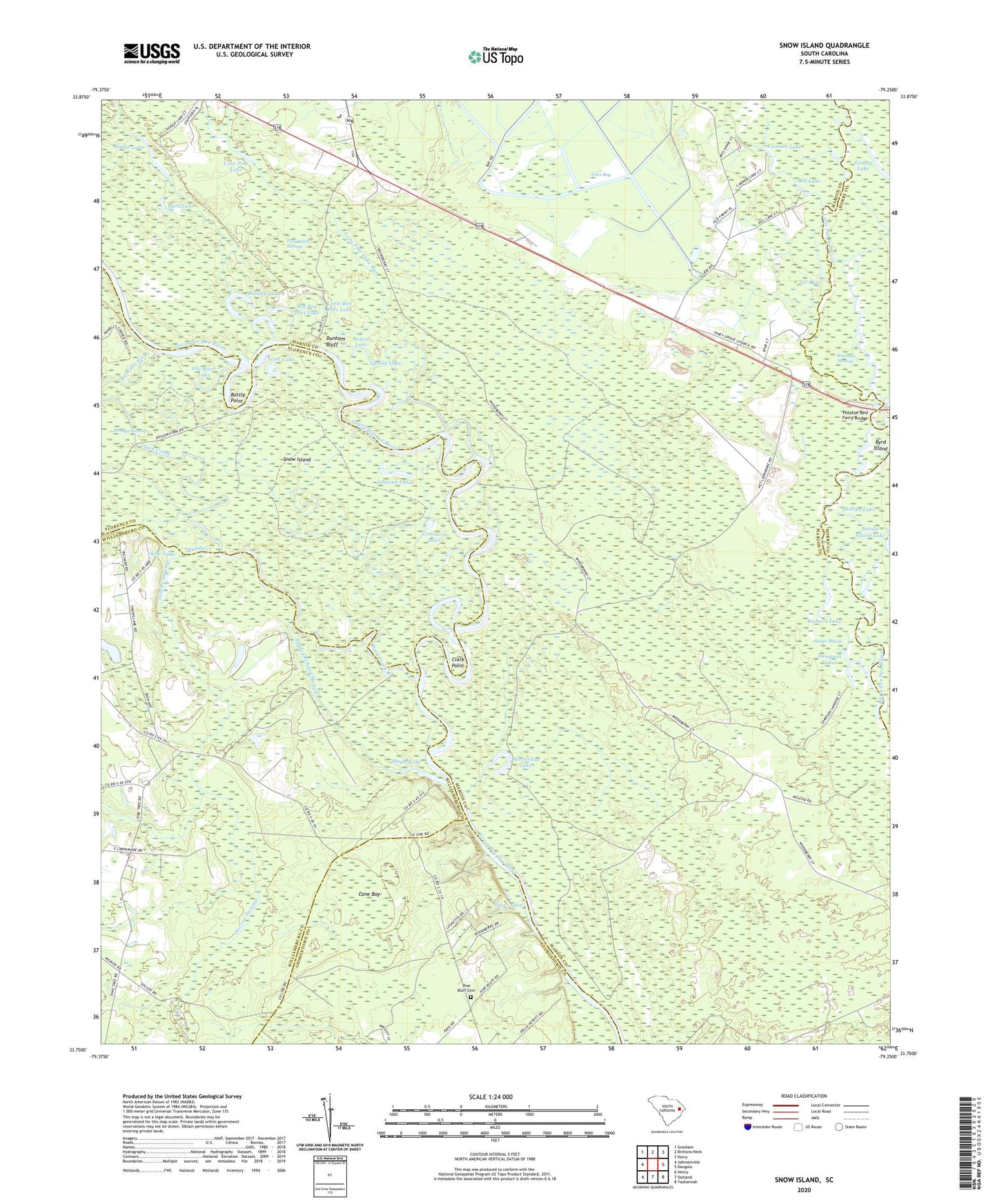
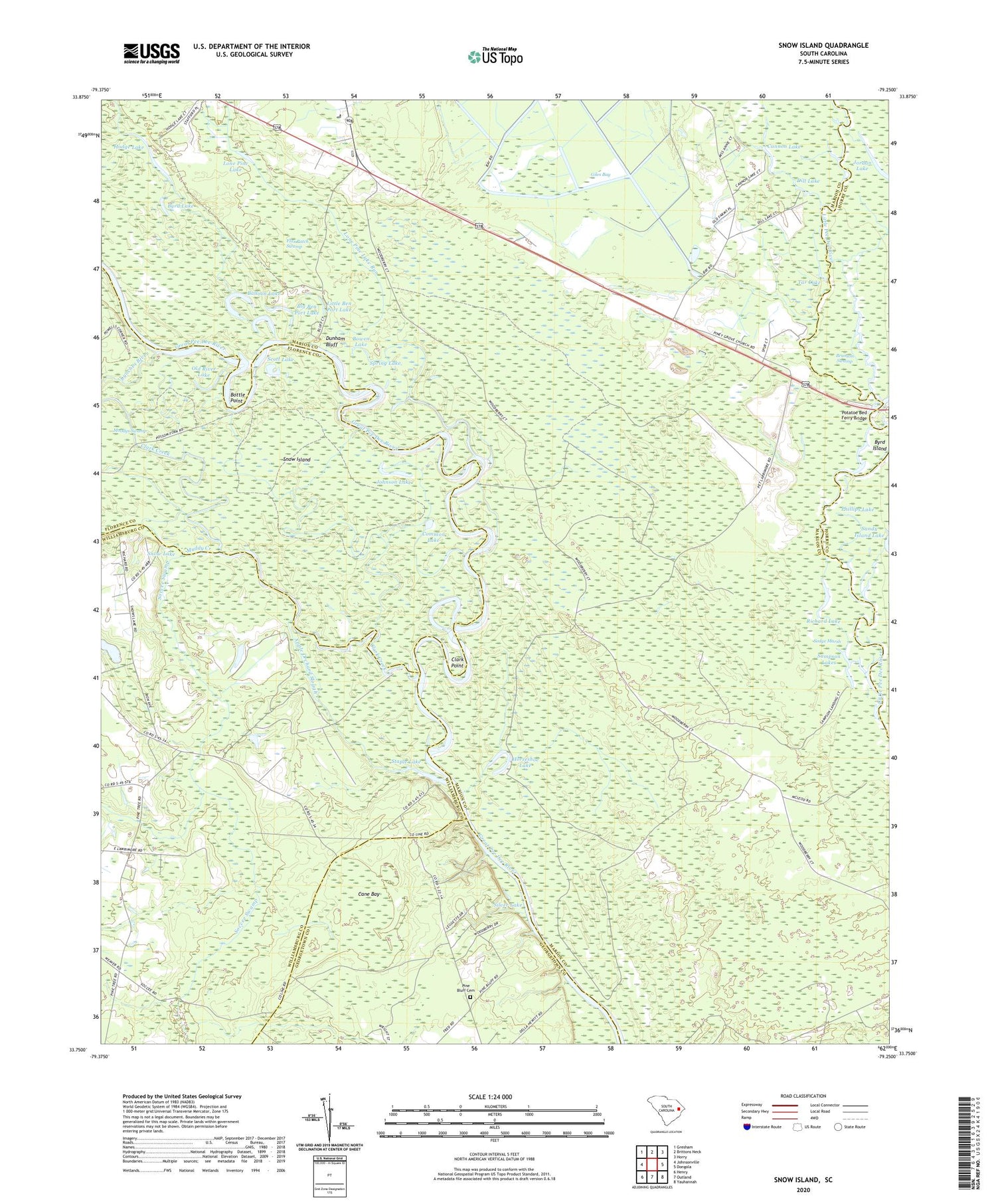
2020 topographic map quadrangle Snow Island in the state of South Carolina. Scale: 1:24000. Based on the newly updated USGS 7.5' US Topo map series, this map is in the following counties: Marion, Williamsburg, Florence, Georgetown, Horry. The map contains contour data, water features, and other items you are used to seeing on USGS maps, but also has updated roads and other features. This is the next generation of topographic maps. Printed on high-quality waterproof paper with UV fade-resistant inks.
Quads adjacent to this one:
West: Johnsonville
Northwest: Gresham
North: Brittons Neck
Northeast: Horry
East: Dongola
Southeast: Yauhannah
South: Outland
Southwest: Henry
Contains the following named places: Apple Orchard Slough, Balloon Lake, Big Ben Port Lake, Bottle Point, Bowen Lake, Bradley and Britton Ferry, Brittons Neck Division, Brittons Neck Lookout Tower, Byrd Island, Byrd Lake, Cane Bay, Cane Bay School, Cannon Lake, Clark Creek, Clark Point, Common Lake, Dill Lake, Dunham Bluff, Flax Patch Swamp, Hodge Lake, Horseshoe Lake, Johnson Lake, Jordan Lake, Little Ben Port Lake, Lone Pine Lake, Lone Pine Lake Run, Lynches River, Muddy Creek, Nurse Chapel, Old Ark Church, Old River Lake, Palmetto Swamp, Phillips Lake, Pine Bluff Cemetery, Pine Bluff Church, Piney Grove Baptist Church, Pitch Landing, Potatoe Bed Ferry Bridge, Richard Lake, Sampson Lakes, Sampson Landing, Scott Lake, Silver Lake, Snow Island, Snow Lake, Soccee Swamp, Spring Lake, Staple Lake, Tar Lake, Thomas Lake, Wildhorse Lake, Woodbury Rod and Gun Club